
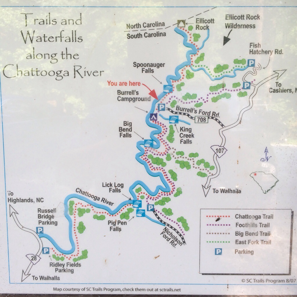
Big Bend Trail & Falls is part of the Oconee District of Sumter National Forest near the intersection of GA, NC, and SC. It is around 2.7 miles from the trailhead to the Chattooga River (~5.5 mile out-and-back). This hike mostly follows the same contour of the mountain, meaning your elevation change is minimal. In fact, the short section from the road to level ground is the steepest part of the entire hike.
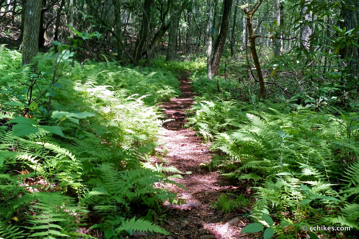
Like most trails in this area, the pathway is not heavily trafficked. That means you’ll be kicking plants out of your way and feasting on spiderwebs for hours. It features a very dense canopy, so the ground stays moist. The result is a very hot and humid hike filled with annoying flies that find your ears to be their Eden. Spray down with some Bens 100: Insect Repellent Spray before heading out and take lots of water.
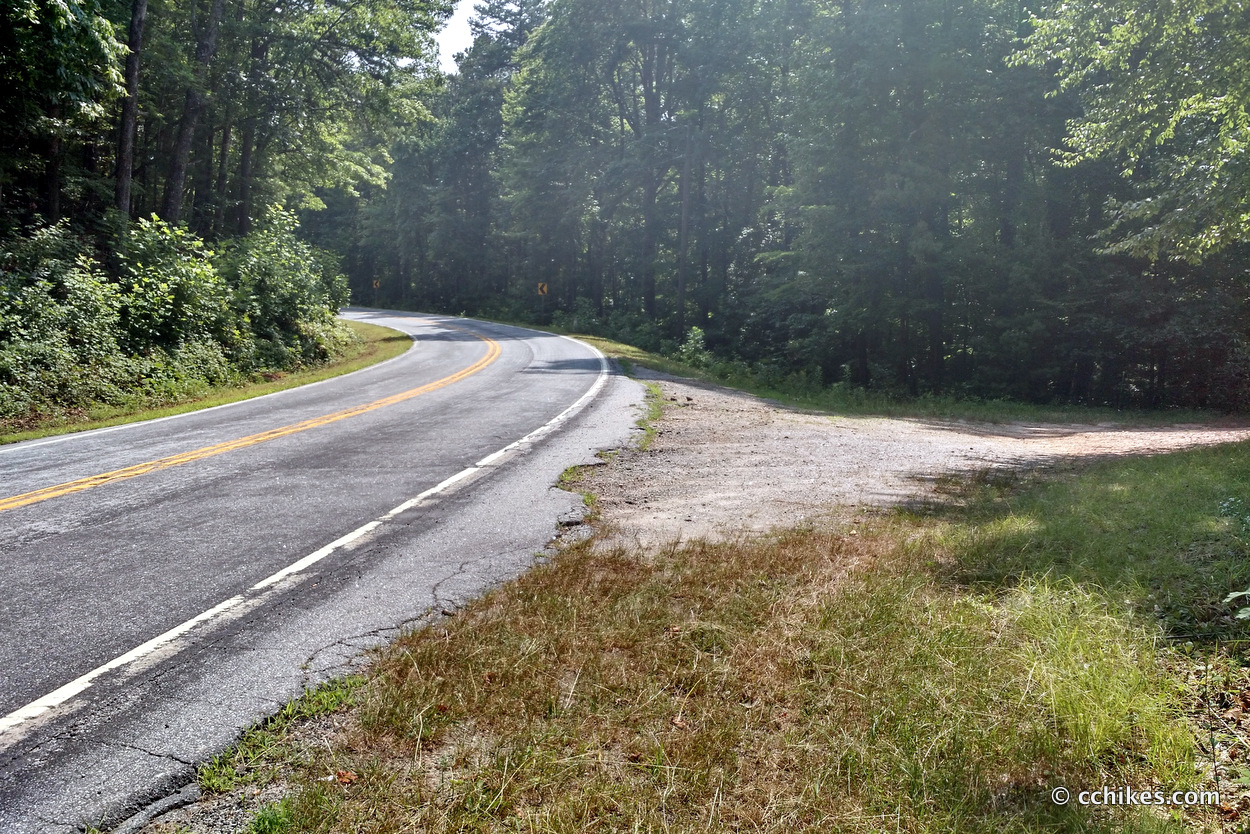
Park at the small gravel pull-off on the map below. It’s just south of the entrance to the Cherry Hill Campground. This is actually the trailhead for Winding Stairs Trail, but that’s a hike for another day. I should add that there are showers and bathrooms at the campground and it’s only $10 to claim a spot if you feel like spending the night (first come, first served).
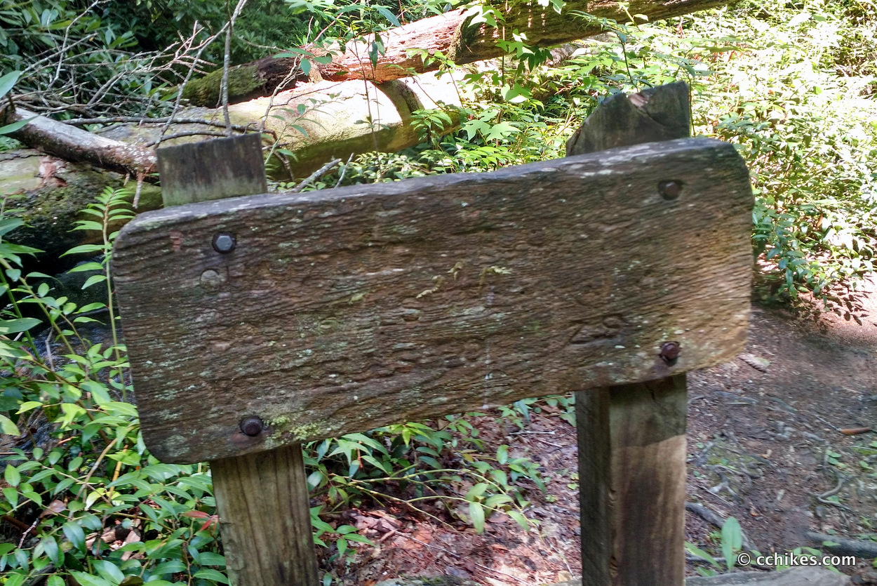
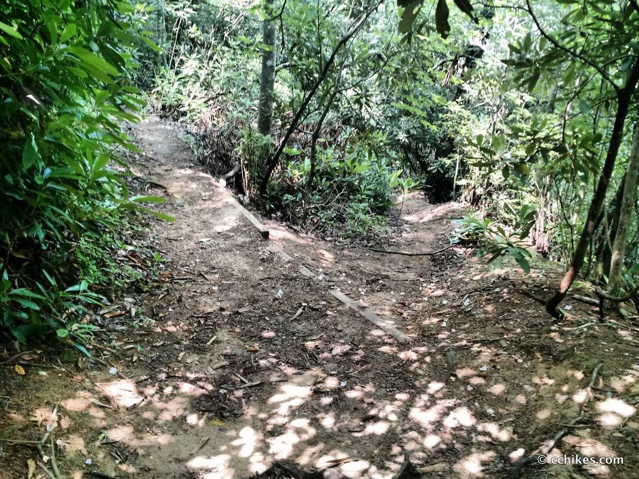
The trail is not very well marked or cleared, but I think you’d have a hard time getting lost. Some of the signposts are so weathered that you can’t even read them, so let me explain exactly how to get to the water from the road. There is no cell service in this area, so screenshot these walking instructions. Also, save a copy of this map in case you want to explore the area.
From the parking area, walk across the street and about 15 yards south (to the left) and you’ll see the trailhead. It is not obvious until you find it. You will hike the Big Bend Trail for about 2.2 miles. It is blue-blazed. It ends where it intersects with the Chattooga Trail/Foothills Trail. These are green- and white-blazed, respectively. This intersection is at a fork in the path where a small footbridge spans a creek. Do not walk over the bridge. Stay on the pathway to the left. In another 50 feet or so, the trail forks into three pathways. One leads up the hill to the left. One leads down the hill to the right. The center pathway goes straight ahead. Take the center pathway. I wish someone had been there to tell me this.
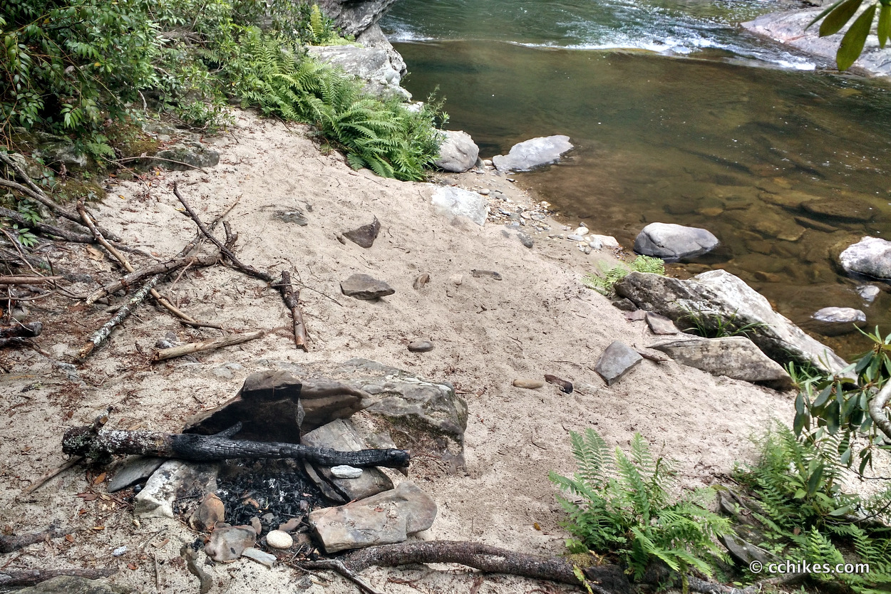
This section features the most elevation you will encounter all day, but it’s not bad. Hike for about a half mile. The trail will take you up and away from the water, which feels counterintuitive, but the pathway will eventually take you down a stairway of sorts toward the water. Your goal is to locate the small beach. This is a great place to take a break.
Judging by the pictures on Google images, I never actually found the falls. I walked another 3/4 of a mile down the trail without any luck. The pathway only got more strenuous from there and I never really got close to the water again. I’m planning to hike the entire Foothills Trail in the fall, so I didn’t push on. I can wait until later and will update this post.
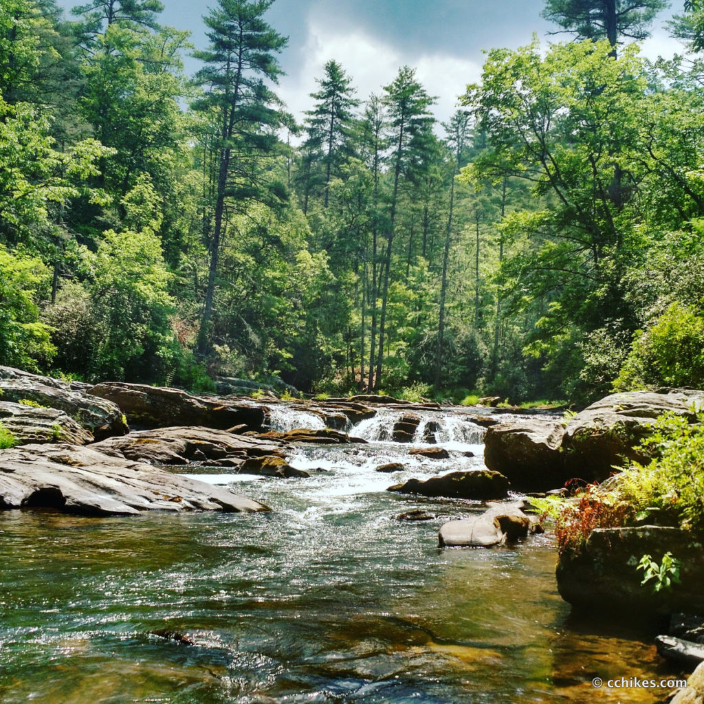
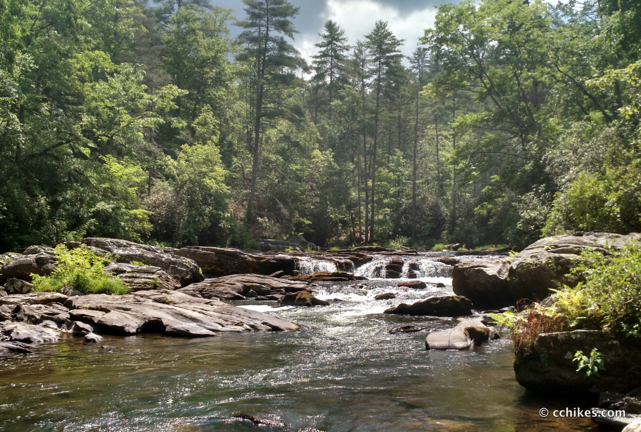
This is a beautiful hike. It’s not difficult and I never saw another person. The payoff is great as well. There’s not much of a falls, but rather the entire river ambles around, between, and over boulders. The water is cool and crystal clear. I imagine the trout fishing must be very good. The small, natural beach is a perfect base camp if you’re planning to spend the day playing in the water. Just remember that this is where the movie, Deliverance, was filmed. If you hear banjo music, you might want to move along.
If you’re not planning to get in the water, then I would recommend doing this hike in the late fall or winter when the trees are bare. That way, you’d have minimal humidity and the views of the river from the cliffs would be much better and more frequent. This is right down the road from King Creek Falls. The Foothills Trail connects the two.
I ran into a Ranger when I was looking for the trailhead. He told me that you can actually drive down to the falls on a very narrow gravel road, but you will need a truck or SUV or anything with a relatively high suspension. My Camry had no chance. I started down the road and then did a 57-point turn reminiscent of a scene in the first Austin Powers movie. If you encounter another vehicle, one of you will have to drive in reverse until you find a wide enough section to pass. The gravel road is directly across the street from the entrance to the Cherry Hill Campground. It is marked only with a stop sign.
I learned about this hike from the book, Waterfall Hikes of Upstate South Carolina.


Moody Spring • C.C. Hikes
[…] is near Big Bend Trail & Falls, King Creek Falls, and Winding Stairs […]
Winding Stairs Trail • C.C. Hikes
[…] Winding Stairs Trail is a 3.5-mile hike of moderate difficulty in the Mountain Rest wilderness area near where GA, NC, and SC intersect. It’s very close to Cherry Hill Campground and Burrells Ford Campground. There’s actually a spur off the trail that takes you right into Cherry Hill. I parked at the Northern Terminus just off SC Highway 107. This is the same gravel pull-off you use to hike Big Bend Trail & Falls. […]
King Creek Falls • C.C. Hikes
[…] You can choose to visit other falls in the area or call it a day. This is right up the road from Big Bend Falls. The Foothills Trail connects the two. Winding Stairs Trail is nearby as well. If you don’t […]