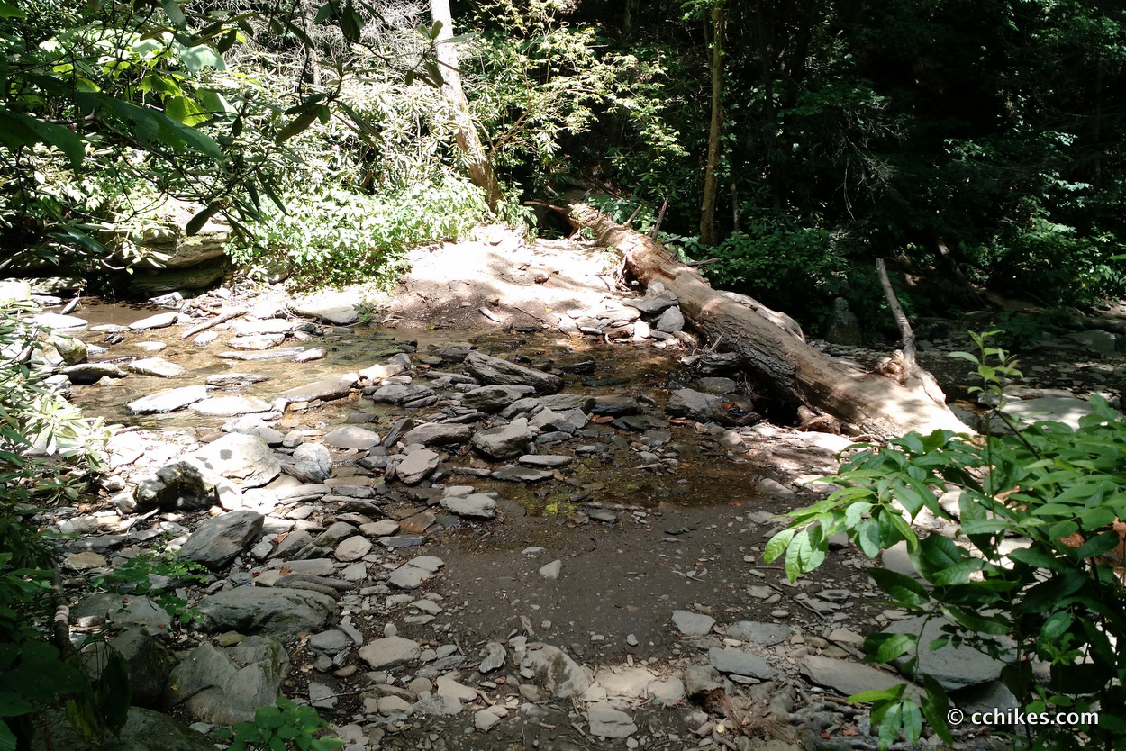
Catawba Falls is a fun, family-friendly nature area about 25 miles east of Asheville, NC. There is ample public parking in a gravel lot that features a privy. That means no sinks or soap, so bring some hand sanitizer. The hike starts off on a logging road, so it’s a very easy walk with a pretty steady and unimposing grade. You’re mostly following the river, so expect to cross it several times. You really shouldn’t get your feet wet unless it’s recently rained and the water is unusually high. After a while, the grade becomes a little steeper and the pathway becomes more rocky and root-covered. Still, I wouldn’t describe this part of the hike as strenuous.
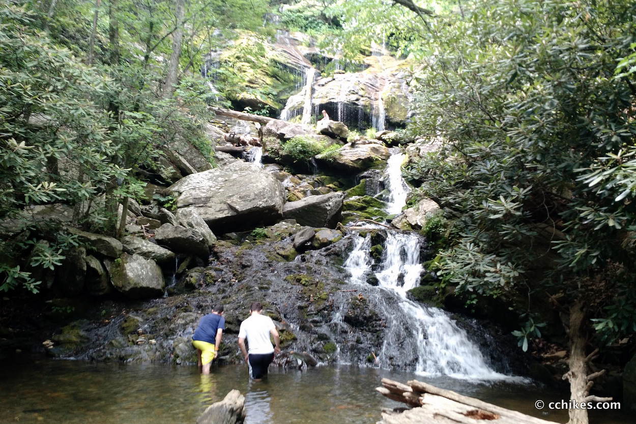
The path leads to a small waterfall (the lower falls) with a shallow swimming hole. This is where most of the families spend their day. The large rocks are covered with towels, lunchables, and out-of-place electronics. It’s not a very big area, and I don’t really see the attraction of it, but I guess it’s a good way to get the kids out of the house and away from the TV. Catawba Falls breaks in stages from here on up. Each stage features trickling walls of wet stone and some sort of rest area if you’re bold enough.
From here on up, the hike becomes very strenuous. I hadn’t really planned for that kind of activity on the day I went (it was very hot and humid). I was prepared to turn around when I saw an 8-month pregnant woman walk down the trail past me. I was summarily shamed into making the full ascent.
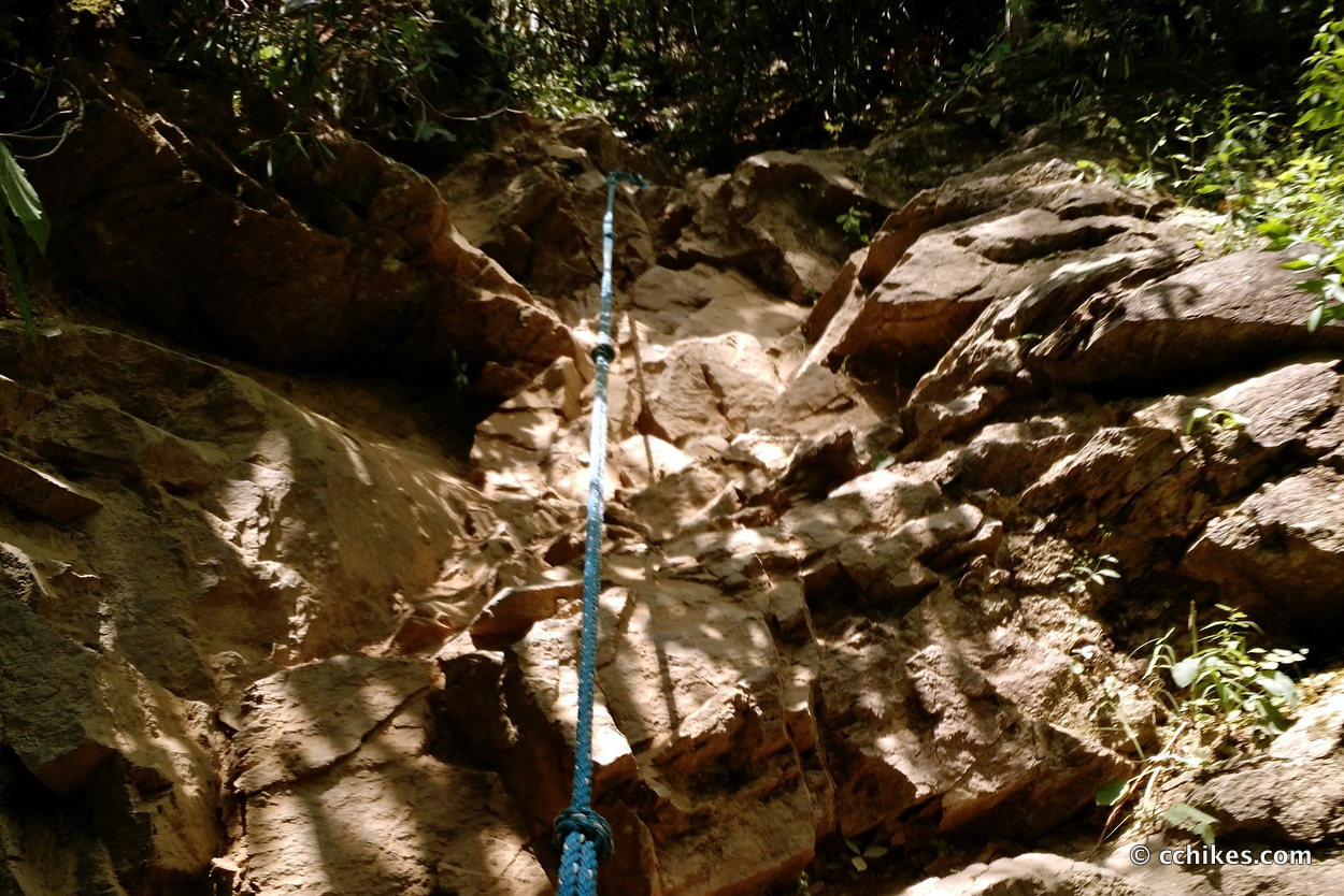
Much of the hike to the top is near-vertical. One section even features a rope secured with a piton to help hikers navigate the dusty crags. The upper falls boasts a pretty nice swimming hole, craggy boulders, and slow-flowing cascades. While pretty, it’s really not that great compared to Hooker Falls and Triple Falls. Honestly, I don’t really think the summit is worth the effort. It was overcrowded and underwhelming. I was so busy sweating and trying not to come off like a professional mouth-breather that I forgot to take a picture at the top. I couldn’t fathom trying to descend from the summit while I was tired from a day of swimming in the sun. It’s pretty dangerous when you’re awake and alert, so it must be much more dangerous for people who are tired and/or drunk.
Expectations matter. I think this hike is worth it if you’re out for a fun—albeit strenuous—climb with a spectacle at the top. But if you’re specifically looking to go swimming, maybe head to Bubbling Spring Branch Cascades instead. It’s right there in Pisgah National Forest and you get to drive on the Blue Ridge Parkway.
There’s a pretty good signal in the area, so your GPS should work.
I learned about this site from North Carolina Waterfalls: A Hiking and Photography Guide. I own the book and highly recommend it.
If you shop through any Amazon link on this website, you support me at no cost to yourself. Learn more in my disclosure.

Update
When I first hiked this trail, I was in pretty bad shape. I only realize that in retrospect. At the time, I thought I was in decent shape. I went back yesterday and made this hike in a light rain. I’m in much better shape now.
The day before this, I knocked out the 13-mile Coosa Backcountry Trail in Vogel State Park. I have what I think is a torn ligament in my left knee, so I was a bit handicapped. Even with that handicap, nothing about this hike or climb exhausted me. It’s crazy what a difference a few months a 20+ pounds of weight loss makes. The technical section with the rope was still precarious, especially in the mud, but it wasn’t difficult like I remembered it.


Gear—The Transition To Trail Runners • C.C. Hikes
[…] that I didn’t have to be miserable. After experiencing terrible cramping hiking to the top of Catawba Falls, I drove straight to REI in Asheville and bought a pair of Merrell Men’s Grassbow Air Trail […]