


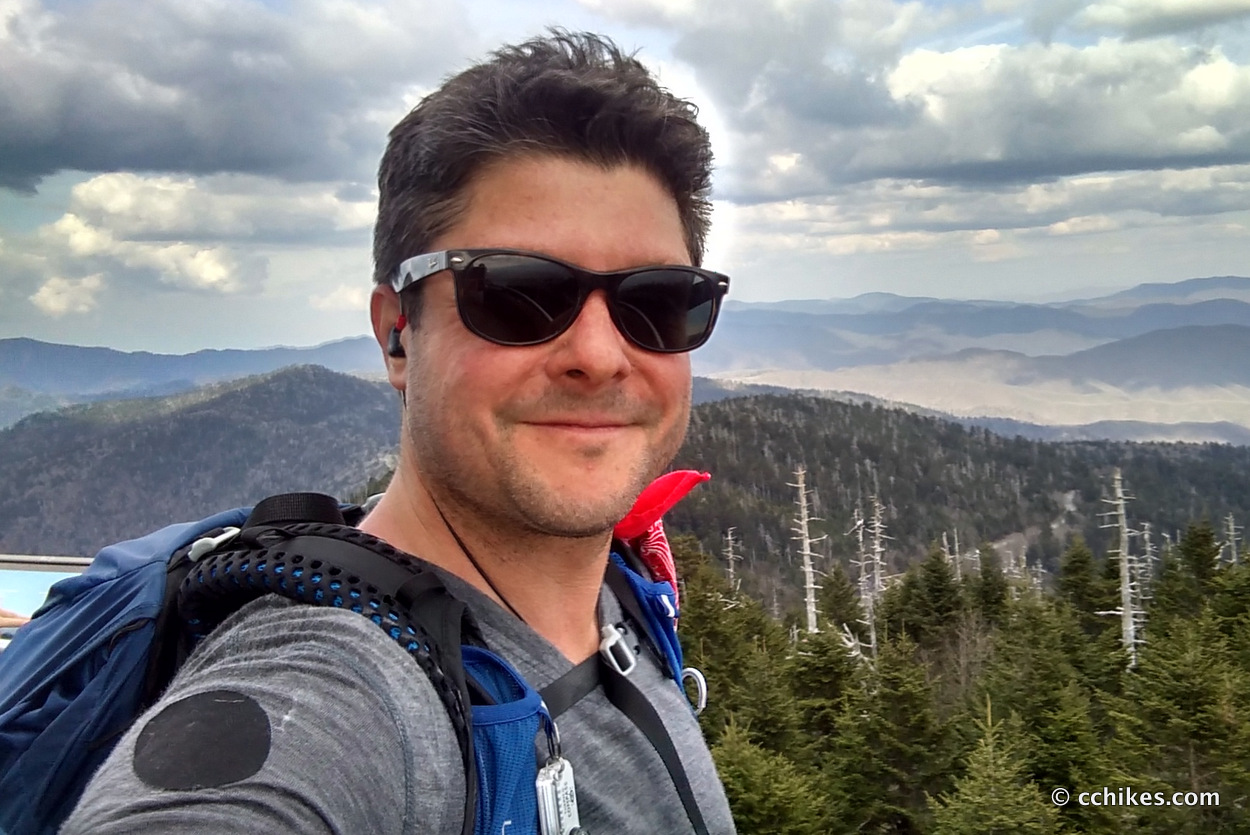
Clingmans Dome is the largest mountain in Tennessee and the high point of the Appalachian Trail. I recently had a couple of days free between some work trips. Since I rarely get the exercise I need on work trips, and since it’s impossible to eat well while on the road, I thought I’d squeeze in some big miles to try to stay in shape.
I planned to do around 17 miles per day—about what I’ll be doing on my John Muir Trail thru-hike. I drove to the Deep Creek Campground near Bryson City and parked in a gravel lot (use the map below to navigate there). It’s right next to the first-come, first-served riverside campsites, but you don’t need to pay any fees to access the gravel lot. You can make use of the privies and other facilities nearby, however.
This is the access point for several trails and you can choose the length of your loop. One thing to keep in mind is that you have to reserve permits for backcountry camping in Great Smoky Mountains National Park. If you’re a rule-follower, then backpacking in the Smokies is not an impulsive decision.
Orienteering
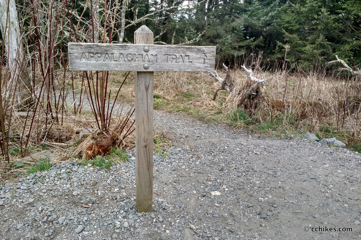
My ideal loop would have involved taking Deep Creek Horse Trail → Deep Creek Trail → Fork Ridge Trail → Appalachian Trail (AT) → Mount Collins Shelter. But I couldn’t get a permit for the shelter. I could have gone that route anyway and blended in with the rest of the hiker trash, but I didn’t feel like fighting the seasonal (spring/Easter) and AT NOBO thru-hike crowds for flat ground. If I had approached that way, and then followed the return route listed below, it would have featured a consistent 17 miles each way.
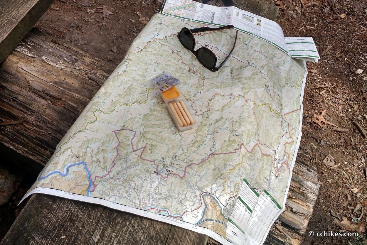
I relied on this map to track my progress on the trail. It’s prudent to take a declination-correcting compass on your backpacking trips. The trails in the Smokies are very well marked with blazes and signs, so you probably won’t have to rely on it. But just in case, the declination is -6°.
If you shop through any Amazon link on this website, you support me at no cost to yourself. Learn more in my disclosure.


Day 1
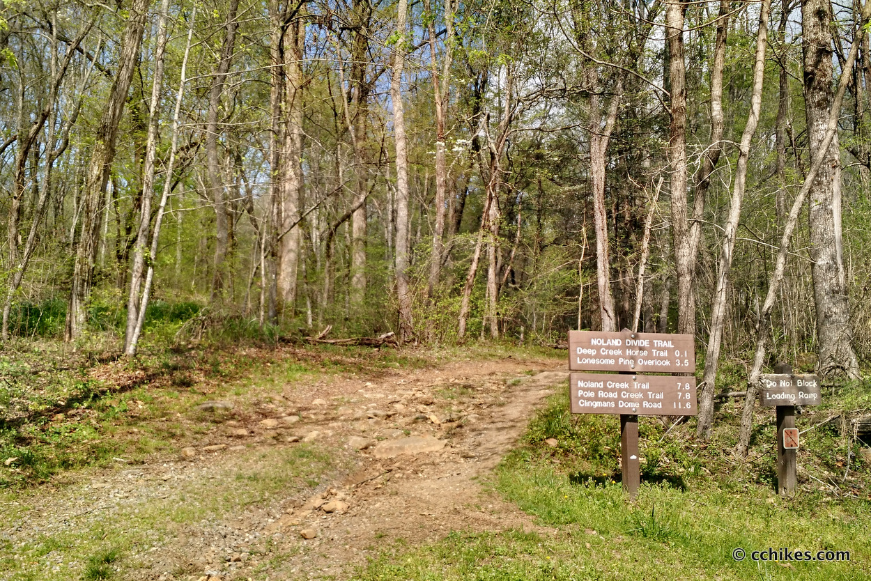
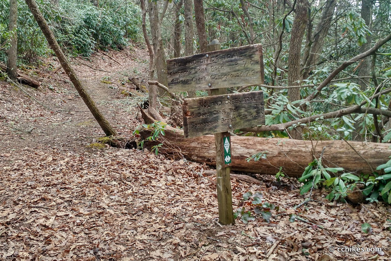
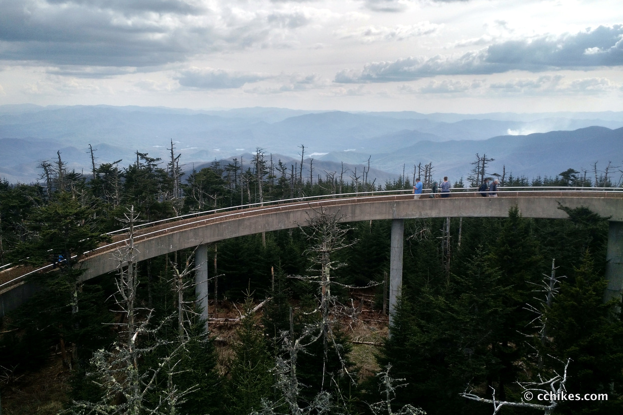
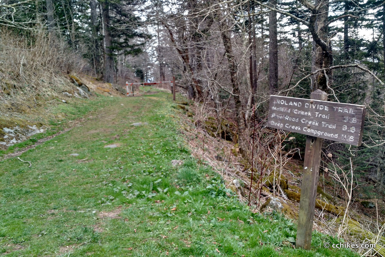
I took the Deep Creek Horse Trail → Deep Creek Trail → Pole Road Creek Trail → Noland Divide Trail → Clingmans Dome Road → Clingmans Dome. Then I backtracked to Campsite 61 on Noland Creek Trail to spend the night.
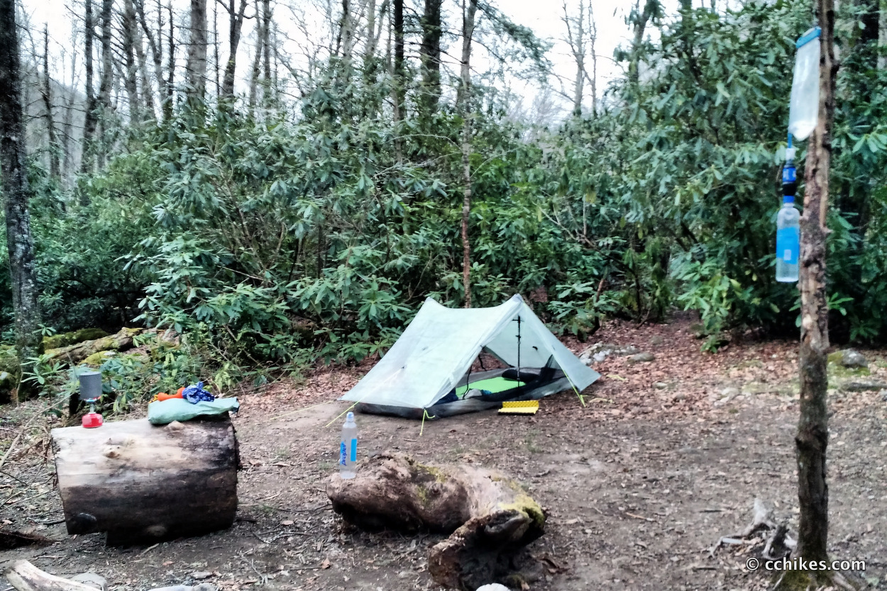
Due to some downed trees blocking the trailhead, I initially missed Noland Creek and took Noland Divide for nearly 2 miles instead. This was disheartening; not only because I would have to backtrack to Noland Creek and descend to the river in the dusk/darkness, but because I would cover that stretch of trail 3 times before I was done. I abhor backtracking.
My self-loathing was truly palpable and was only relieved by some post-dinner bourbon graciously offered to me by a fellow camper named John from Gastonia, NC.
Day 2
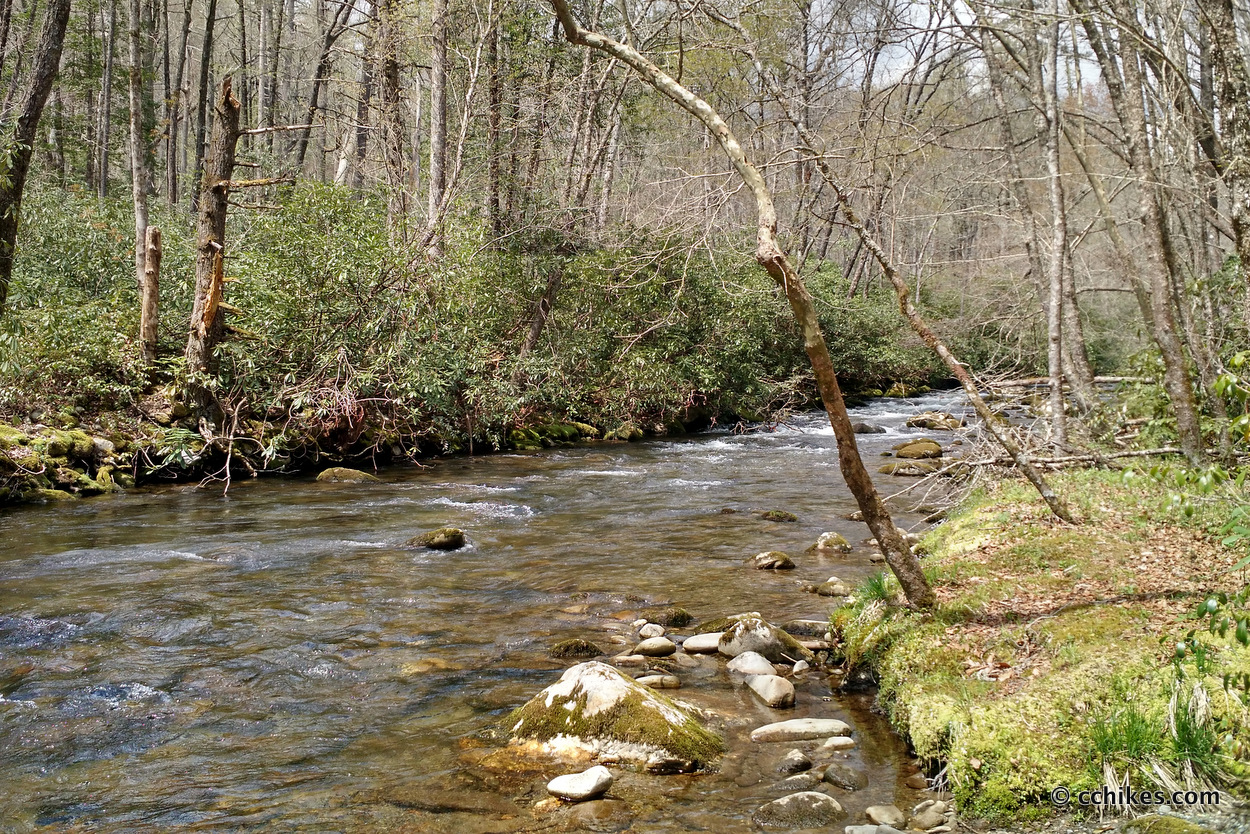
I slept pretty well thanks to the roar of the river. After waking and breaking camp, I hiked a mile or so back east to Noland Divide Trail and took it another 8 miles south to Deep Creek Campground and the parking lot. Campsite 61 was great, but I regretted having to climb back to the ridgeline the first thing in the morning. I actually was surprised to have to walk mostly uphill for the first couple of hours on Sunday.
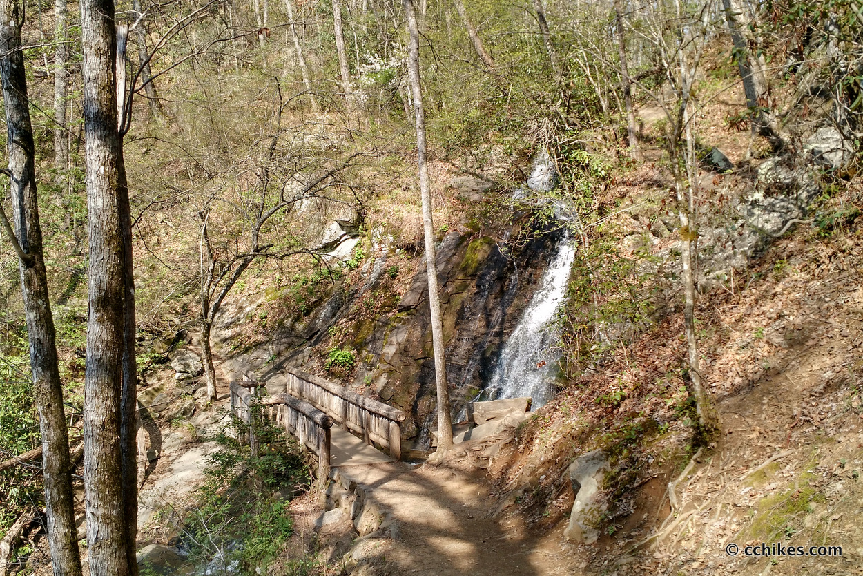
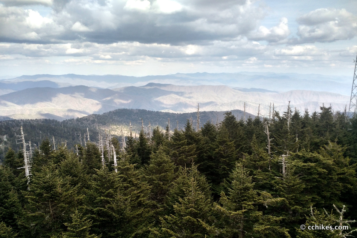
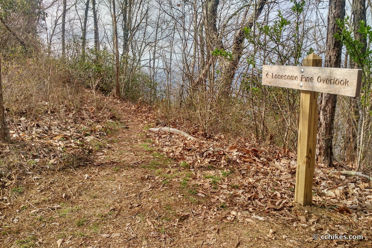
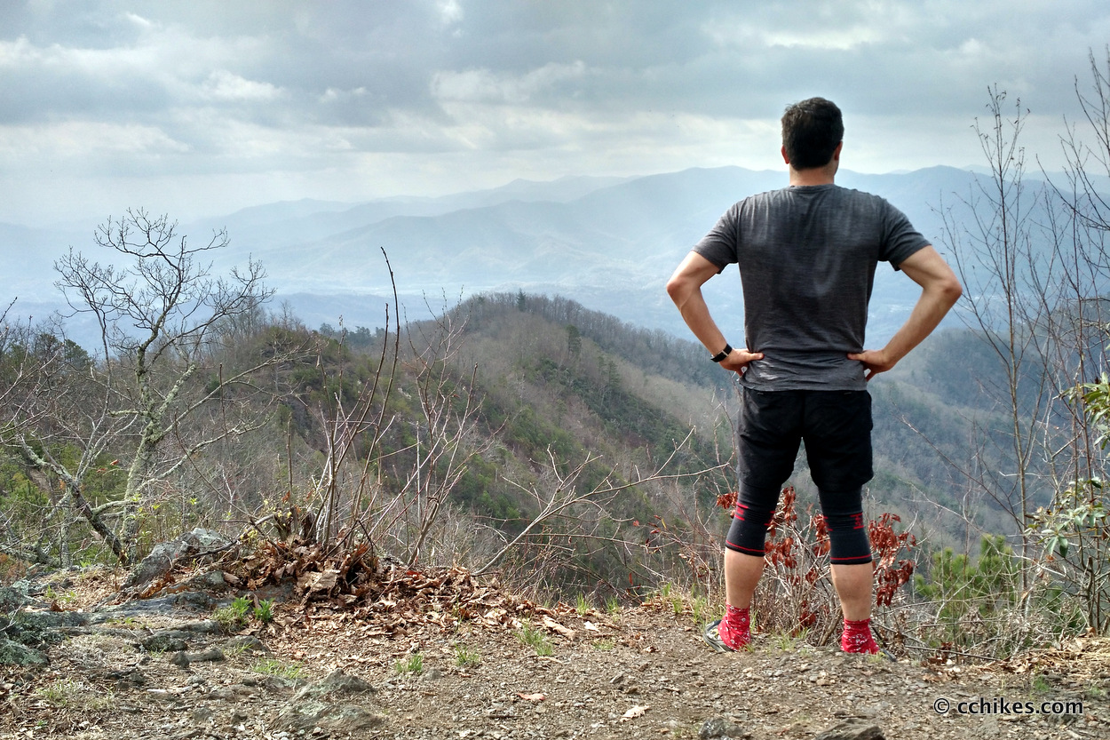
The ridge and contour walking on Noland Divide Trail offered great views, especially from Lonesome Pine Overlook. At the overlook, you can see the trail you already walked as well as the trail ahead. That’s rare in what’s commonly referred to as the green tunnel.
The last few miles of trail are all downhill. Let me add that walking up Deep Creek Trail is much more gradual than walking up Noland Divide Trail. But Noland Divide offers a straighter shot to Clingmans Dome.
Impressions
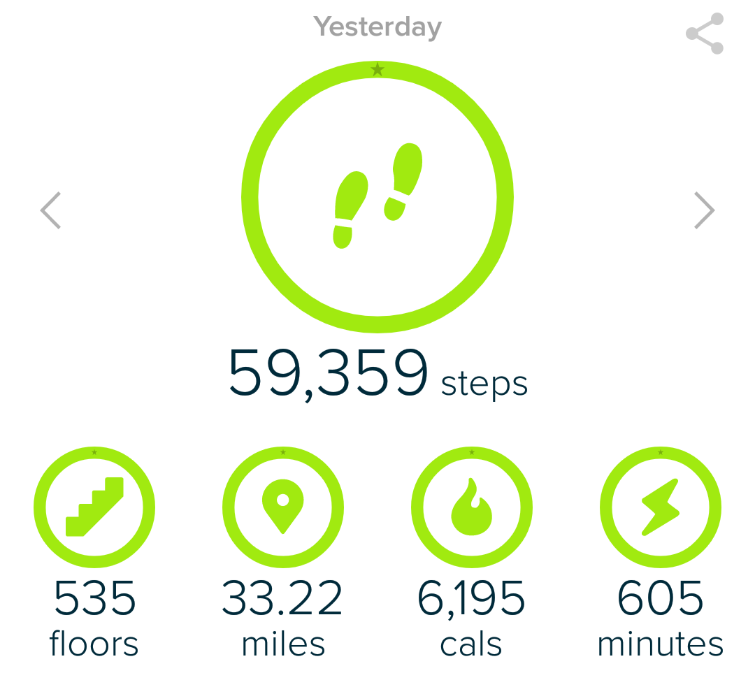
My error on day 1 resulted in around 25 miles on Saturday and another 9 or more miles on Sunday morning. I’ll call that 34 miles because I don’t really feel like looking at the map and doing the math. It was too much to do on a day that featured the climb to Clingmans Dome, but I only have myself to blame.
This was the most elevation I’ve ever done in a single day, but it was spread over a longer distance than when I hiked the 15 easternmost miles of the Foothills Trail in northern South Carolina and all 13 steep miles of the Coosa Backcountry Trail in north Georgia.
There’s something about hiking in the Smokies that is just harder than hiking in other places. I don’t know what it is. Maybe it’s the rocks on the narrow single-track. Maybe it’s the constant stream crossings. Maybe it’s the intermittent sunshine as you make your way around mountain contours. I think 10 miles in the Smokies takes the physical toll of 15 miles in the Mountain Bridge Wilderness or Pisgah National Forest. Some of the pathways are overgrown and seem to reach out to stall your pace.
I felt this when I hiked my Catoochee Valley Loop and I felt it again here. I’m in better shape now than I was then, and my knees are holding up better, but these are still tough miles. There’s also the odd juxtaposition of seeing lots of tourists and day-hikers at the terminuses and practically no one in the wilderness. It’s jarring.
Either way, this was a great weekend hiking trip. It would be better if you did it the way I originally intended by camping at Mt Collins Shelter and seeing Clingmans Dome on the way out on the morning of the second day. That said, this is all about elevation. If you don’t like climbing, you will not like this hike.
I listened to the final book in The Grim Company trilogy on this trip. I highly recommend these books. They’re somewhere between A Song of Ice and Fire and Mistborn on the fantasy story scale, and great for keeping your mind off the pain when you’re grinding out big miles.
This was also my first time to do big miles since I bought my new Altra Lone Peak 3.0 hiking shoes. I’ll get a proper review up after 100 more miles or so, but the early results are encouraging.
Navigate
More
Discover more trails that involve the Appalachian Trail.
Discover more North Carolina trails.
Discover more Tennessee trails.
Discover more loop hikes.
Discover more waterfalls.


Reese Serene
Hey! I know this post is a year old but I am planning on hiking the Deep Creek to Clingman’s Dome loop trial. It is about 34 miles. I am trying to get an idea of where campsites are along the trail so I know what to aim for each day. Would love an advice you have for this trip!
Chad Chandler
The campsites in the Smokies are permit-based unless you’re a thru-hiker on the AT (and can prove it). I mean all campsites—not just the shelters. Check out this webpage to look into the availability of sites and book your spot. The sites closest to parking lots fill up pretty far in advance, as do sites at popular trail intersections. But if you’re flexible and don’t mind descending to a site near a water source, you should be able to reserve a place. Most sites accommodate a lot of people. All sites are filled with mice.
Even if an available campsite seems out of your way, there are enough connecting trails near Climgmans Dome to alter your loop as necessary.
I personally try to avoid the Smokies in the busy season because it gets so crowded. I’m actually breaking my own rule about avoiding the AT in the busy months by doing the Standing Indian Loop this weekend. But I figure the AT bubble has already passed, and most kids are still in school, so maybe I’ll hit a sweet spot of relative isolation. I’ll post the results next week.
If you find that you can’t get a permit when you plan to do your loop, and you don’t mind adding more miles to your trip, check out the 58-mile Appalachian Trail/Bartram Trail Loop. It’s just outside of Great Smoky Moutain National Park and requires zero permits. Plus, you start and end at the NOC, so you can grab a beer and a hot meal when you finish. Best of luck!
Note—That reservation system might not work properly on a Mac. If you fail to see a way to actually book a site, you’ll need to call. Plus, the rangers are very good at suggesting alternatives if some sites are full.