


Twin Falls (not to be confused with Twin Falls in Pisgah National Forest), also known as Reedy Cove Falls, is a great little waterfall attraction that is accessible to just about anyone. There are two ways to access the falls—the easy/safe way and hard/dangerous way. I’ll address the easy way first and I recommend that you do it the easy way before attempting the hard way.
The easy way to get to the falls
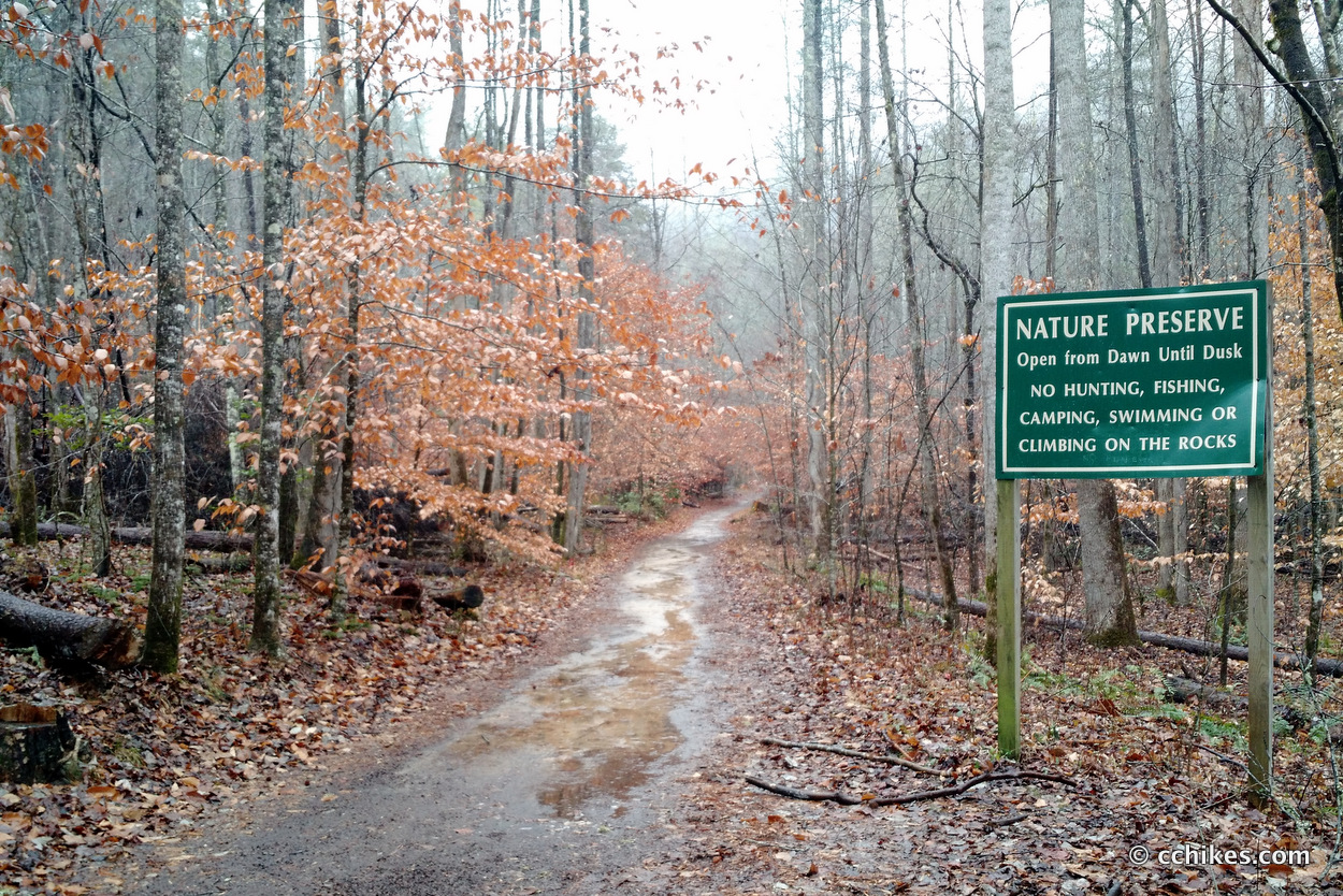
Twin Falls is easy to access from the road. You don’t need hiking gear or any physical aptitude to complete this very short hike. Use your GPS to navigate to the point on the map below. Get your device going well before you get close to the destination because there is no cell service in the area.
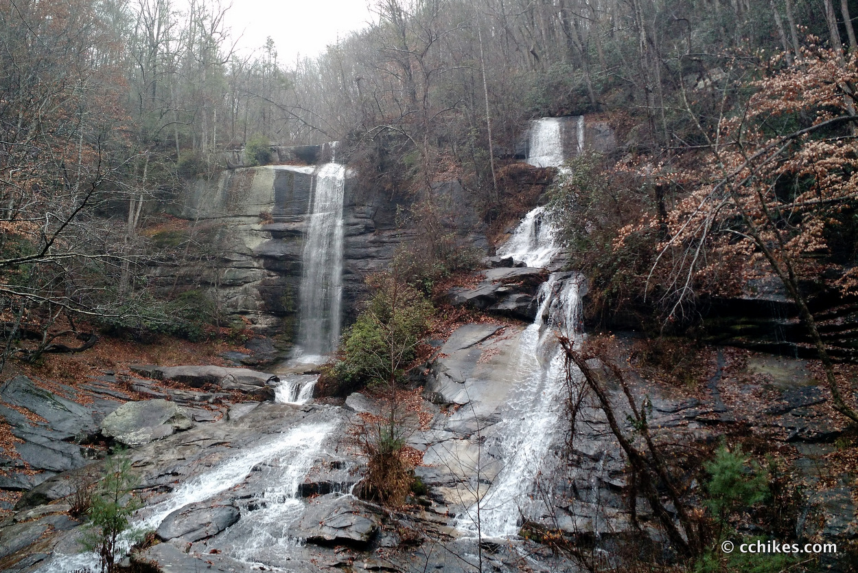
Park in the gravel lot, but be careful not to block the gate. Follow the creek on the level pathway until you get to the waterfall viewing platform. Reedy Cove Creek splits into two (and sometimes three) streams before cascading over the cliff face. It’s quite impressive.
If that’s all you want to do, then this ends the easy/safe way. You can walk back to your car. If you want to hike above the falls, then carefully navigate the slick stone creek bed and make your way to the left corner of the cliff face. From there, scramble up the hill and you’ll find a trail that takes you to the top.
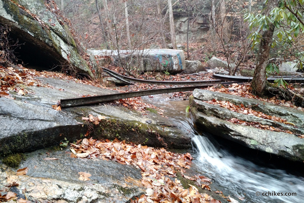
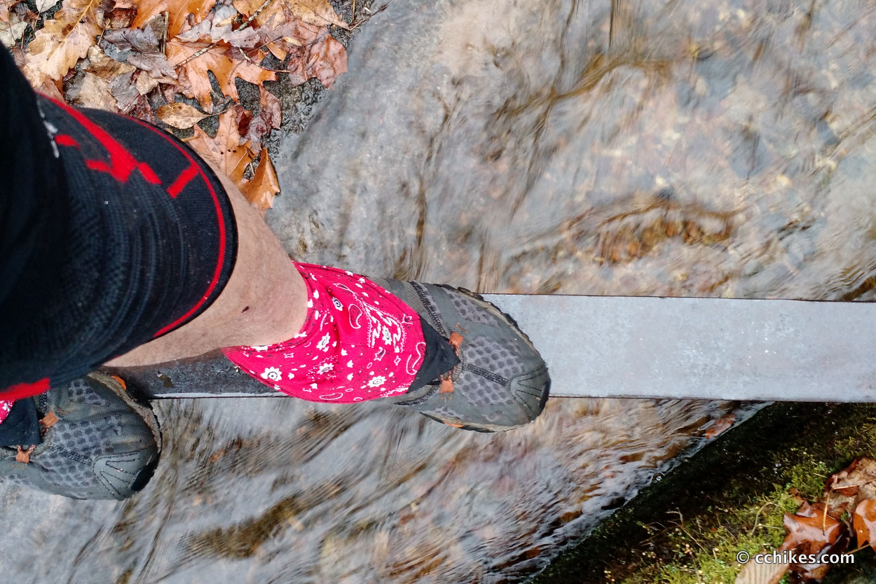
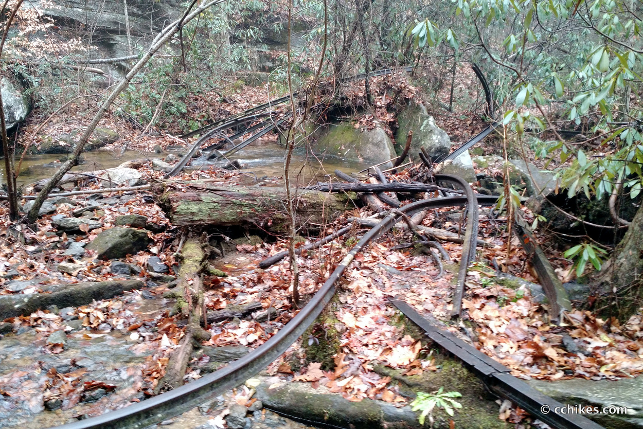
There are steel rails from an abandoned train line in the creek.
There’s also another small waterfall and a swimming hole at the top. It’s pretty fun to explore the area. My guide book said there was a triple-breaking waterfall 1½ miles upstream, but I couldn’t find it.
I must point out that the rocks are very slick. A fall from the top of the falls would likely be fatal. Exercise caution every step of the way.
The hard way to get the falls
Pay attention on the drive back out of the area. Before the road out intersects with Hwy 178, you’ll see a red gate on your left. There is room for a couple of cars to park. This is the trail head for a pathway that will take you to the top of the falls. The trail is 1½ miles long and is not strenuous.
Once again, don’t block the gate. You’ll walk around the gate and towards a wooden fence. Pass through that fence and then you are on the trail. It mostly follows an old roadway (or railroad?), so the grade is subtle. After a while, it switches to single track the rest of the way. Even this area largely follows the contour of the mountain.
The problem with going this way is that the trail spits you out at the top of the falls right at the edge. If you’re not paying attention, you could step right into the cascade. In order to get a good look at twin falls, you have to cross the creek and then scramble down to the base of the falls.
I can promise you that it’s much easier scrambling up the hillside by the falls than scrambling down. If you’re confident in your climbing skills, then go this way. If you have pets or small children with you, then you’re much better off going the easy way.
Navigate
More
I learned about this waterfall from a book that I own and highly recommend.
If you shop through any Amazon link on this website, you support me at no cost to yourself. Learn more in my disclosure.


Thomas T. Fetters
I just found your photo of the twisted rails at Twin Falls in Pickens County.
I am doing a deep study of the Appalachian Lumber Company that ran from Pickens up into the high hills of Pickens County.
Did you take other views of the rails? Could I use your photo with full information as to its source if I complete this study?
This washout ended railroad operations fairly quickly after the storm. All in all, the company railroad (ALC) was active from 1928 into 1929.
The timber cut was converted at a sawmill just north of downtown Pickens and was used to make cabinets for Singer Sewing Machines sold across the country. After the storm, Singer reverted to trucks to haul the timber to the mill.
As a student at Clemson College, I got to ride the Pickens Railroad from Pickens to Easley and back in the locomotive.
Years later, I was invited to walk on the route of Appalachian Lumber from the mainline across pasture lands to the highway that ran north to Mount Sassafras with a local historian from Pickens. It was very easy going as the right of way was still level with no grades.
Maps of the entire line are not easy to find, especially up in the high hills near North Carolina.
Tom Fetters
The Piedmont & Northern
Palmetto Traction, Street Railways of SC
Logging Railroads of South Carolina
Lustron Homes
Logging Railroads of the Blue Ridge & Smoky Mountains
The Charleston & Hamburg Rail Road
Logging Railroads of the Blue Ridge & Smoky Mountains, Volume 2
Chad Chandler
You’re welcome to use whatever images you want on here. I can probably find better quality images in my files, but you might be better off just heading over there are looking at it yourself. You can even start high at the gate on the street so that you don’t need to scale the waterfall. Best of luck!