


I’m calling this the Burrells Ford Loop since the hike begins and ends in the public parking lot and campgrounds on Burrells Ford Road. The loop combines stretches of the Foothills Trail, the East Fork Trail, and the Chattooga Trail. By all online accounts I read, this was supposed to be a 20-mile loop at a minimum. You could add more miles by walking spurs like the Ellicott Rock Trail. Imagine my surprise when I finished the loop by lunchtime on my first day of hiking. I was going fast, but not nearly that fast.
I’m doing a series of shakedowns over the next few months to test my gear in varying environments and weather conditions. I have several pieces of new kit, including a single-walled tent, a DIY summer sleeping quilt (50° rated), and a fall/spring sleeping quilt (20° rated). I’m still trying to fine-tune my clothing layering system so I can anticipate what I’ll need and what I can leave at home based on weather forecasts. I’m also steadily increasing my miles-per-day challenge on these intermittent trips.
Much of the camping and hiking on this loop follows the Chattooga River. There are many campgrounds and bail-out points along the way. It seemed like a nice, low-risk way to test so much new gear. This is the region where GA, NC, and SC intersect. It’s where Deliverance was filmed, so don’t stop if you hear banjo music.
If you’re going to navigate to this site via the Google Maps link below, get your GPS up and running while you’re still in civilization. There is zero cell reception in the valley regardless of your provider. Once you’ve parked, you can set your mobile on airplane mode to save power.
Orienteering
Here’s a printable map you can take with you. I’ve updated it and highlighted the route I took. It may have been 12 miles at most, including the road walking I did. Note that the colors on the map don’t correspond with the blazes. The Chattooga Trail is green-blazed and the Foothills Trail is white-blazed. If the East Fork Trail was blazed, I never noticed.
If you really want to explore the trail system in Mountain Rest, you should spring for a real map.
If you shop through any Amazon link on this website, you support me at no cost to yourself. Learn more in my disclosure.

About the hike
If you’re just day- or section-hiking a part of the Foothills Trail, you don’t have to register at any of the state park offices. And you don’t need a permit to park at the Burrells Ford Road parking lot, so this is an impulse-friendly car camping/backpacking location. Campsites are first-come, first-served. The area features King Creek Falls and Big Bend Trail & Falls, and there are more waterfalls within day-hiking distance. Winding Stairs Trail and Miuka Falls are just across SC Hwy 107.
To hike this loop, you pick up the Foothills Trail heading east/northeast. The trailhead is located on Burrells Ford Road near the turnoff for the parking lot. You can actually pick it up behind a wooden information board in the parking lot. If you camp down by the river, don’t underestimate the walk back up to the parking lot/trailhead the next morning. There is a privy in the parking lot for those willing to walk for a little privacy.
The first part of the Foothills Trail features the only challenging elevation. Once you’re near the top (.6 miles from Burrells Ford Road), you run into an unmapped intersection. I’ve drawn this fork on the map above in black magic marker (impressive, right?). These signs are right next to each other at the fork.
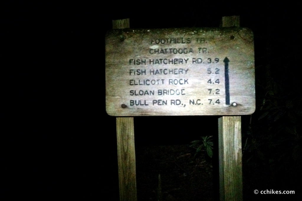

Why in the world is this not part of the original map? I sat at the intersection—utterly bewildered—and finished my hot tea while the sun rose above the trees.
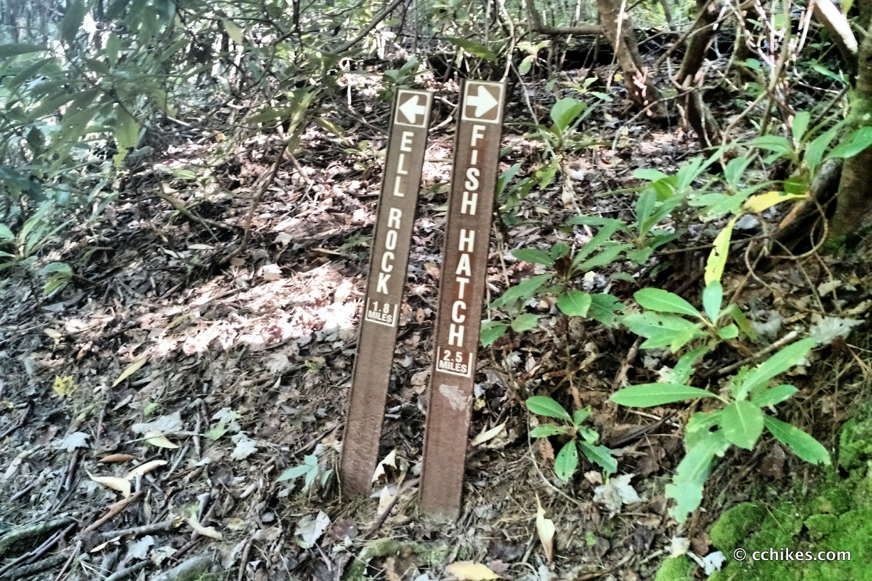
You can either take a trail straight downhill to the fish hatchery (3.3 miles—I have no clue where this comes out, but I’ll update the map when I hike it), a trail that heads downhill and to the right toward the Chattooga Trail (1.1 miles—comes out near Spoonauger Falls), or continue uphill on the Foothills Trail and then walk down Fish Hatchery Road to pick up the East Fork Trail (5.2 miles).
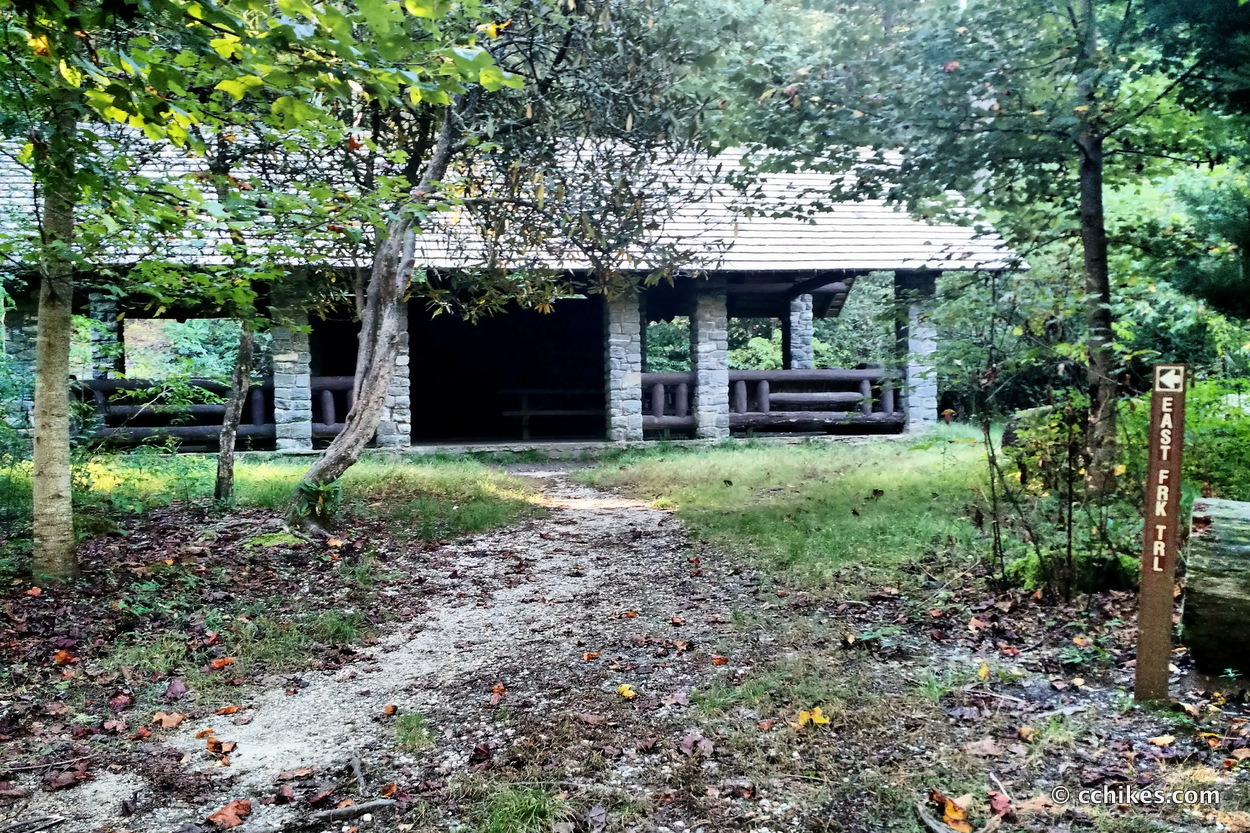
I wanted the extra miles, so I continued on the Foothills Trail until it hit the road. The trail spits you out at the top of the mountain near where Fish Hatchery Road intersects with SC Highway 107. You walk a mile or so down the road as it switches back and forth to the valley floor. It’s a pretty walk. Wild turkeys crossed my path several times. You walk through the fishery visitor parking lot (not to be confused with the loop parking lot) and the East Fork Trail picks up just to the right of a pavilion. There is a public privy here as well.
This section of the trail (2.5 miles) is really easy. The only challenging sections involve overcoming some blowdowns and some slick side creeks. Eventually, you will reach a bridge and see the sign for Ellicott Rock. The signage here is confusing. Crossing the bridge will take you back toward Burrells Ford Road, but there is nothing to tell you that you are now on the Chattooga Trail. Once you cross the bridge, there is no signage pointing you to the trail. As you step off the bridge, you will walk through the campsites toward your 2 o’clock. You will eventually find the trail. Just keep the river on your right. Eventually, you are spit out onto Burrells Ford Road. Turn left and walk back up to the parking lot. It will be on your right.
Impressions
This was terribly confusing. The trail information online is old and out of date. It’s a tragedy of the commons since no one seems to have any ownership. The state park people know nothing about the long-distance trails and the Foothills Trail people know nothing about the intersections with the shorter spurs. There is nowhere to go for guidance. But as a personal shakedown, this was successful.
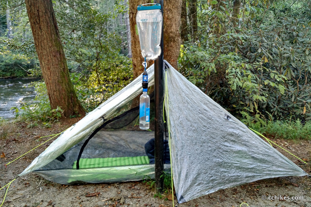
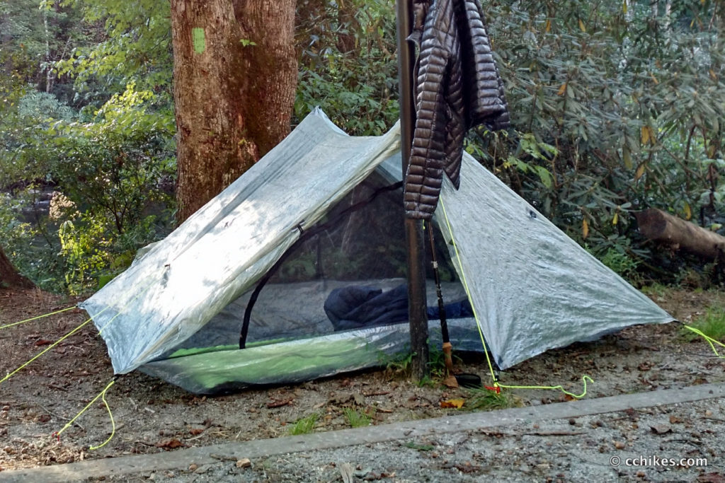
I arrived late Thursday afternoon and walked past the gate and down toward the Chattooga River. I set up camp at one of the many free campsites by the river. I brought my summer sleeping quilt and was surprised when the temps in the valley dropped to 45°. But thanks to my thermal sleeping layers and my down jacket, I was never really cold. My layering system seems to work as planned. This was the first time I set up my tent. It was easy to pitch and was roomy inside. Condensation was a bit of an issue, but that’s my own fault for setting up 20 feet from a river. I woke at 5:30 a.m. and packed in the dark.
I was packed and drinking my tea by 6:30 and stepped onto the Foothills Trail at 7:00 a.m. My legs felt good all day and my gear held up well. I’ve probably hiked 100 miles with this pack so far and it’s only getting more comfortable. All in all, this is a scenic and relatively secluded hike with limited elevation changes. Even if you see lots of cars in the parking lot, you’re unlikely to run into many people on the trail beside fly fishermen scouting new spots. Most people car camp near the river and don’t wander very far from their coolers. As a matter of fact, the only time I’ve ever encountered other hikers in this area was on the very short trail to King Creek Falls.
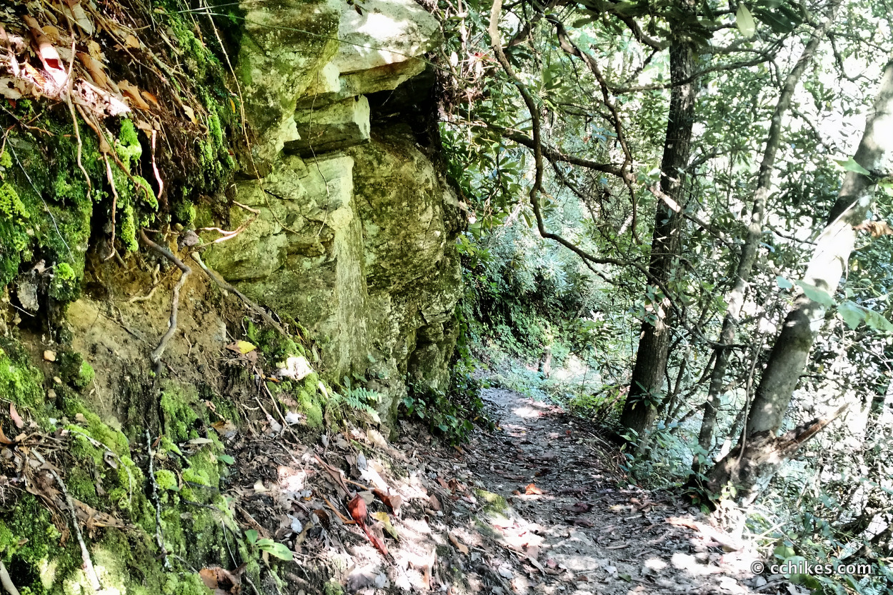
These trails are dark from spring to fall and always a little wet. You’ll pass through frequent tunnels of rhododendron and mountain laurel. The hardwood forest is beautiful, but the thick overgrowth encroaches on the lightly trafficked pathway. You will encounter blowdowns, face-height spiderwebs, and insects that live to explore your ears. I suggest bringing some insect repellant regardless of the season. Oh, and you’ll actually get some sun when walking by the river, so bring sunscreen as well.
In retrospect, this loop might have been better hiked starting from the campsites on the Chattooga River Trail. That way, you stay in the valley and follow the river trail to the East Fork and then the Foothills Trail. That would lead you back to the parking lot without having to do any road walking (if you can figure out where to pick up the spur that connects directly with the Foothills Trail. Good luck!). But that puts all of the elevation at the end of the hike, which I usually try to avoid.
Navigate
More
Discover more hikes involving the Foothills Trail.
Discover more South Carolina trails.
Discover more loop hikes.


Chandra Nelson
We were driving on the road what I assumed was Burrell’s Rd off hwy 107 ( there was a parking lot with cars parked and a map in a glass case) we drove down pass a bridge that crossed over Chatnoogs River and went for another 4 miles up a gravel winding rd. My question is, do you know how far you can drive on tjis road & where it might come out at?
Chad Chandler
I’m not sure what road that is. Was it near the fish hatchery?
Liene
Two years later after you’ve posted this, and still no adequate maps of this area. I believe Chandra (previous comment) is talking about Burrells Ford Road (Forest Service 708). It crosses the Chattooga and 7 miles later spits out on Highway 28 in Georgia. This is how we shuttled cars to hike the Chattooga Trail, as the southern terminus is at the Ridley Fields parking area. As far as picking up the Foothills Trail from the campground, you can head towards King Creek Falls and you’ll see signs, first to go south (intersects with Chattooga trail just south of campground) and then a little further going east (heads up towards Burrells Ford Road). Can’t wait until someone puts together a functioning map – I spent at least 20 minutes giving directions to folks on our last visit.