

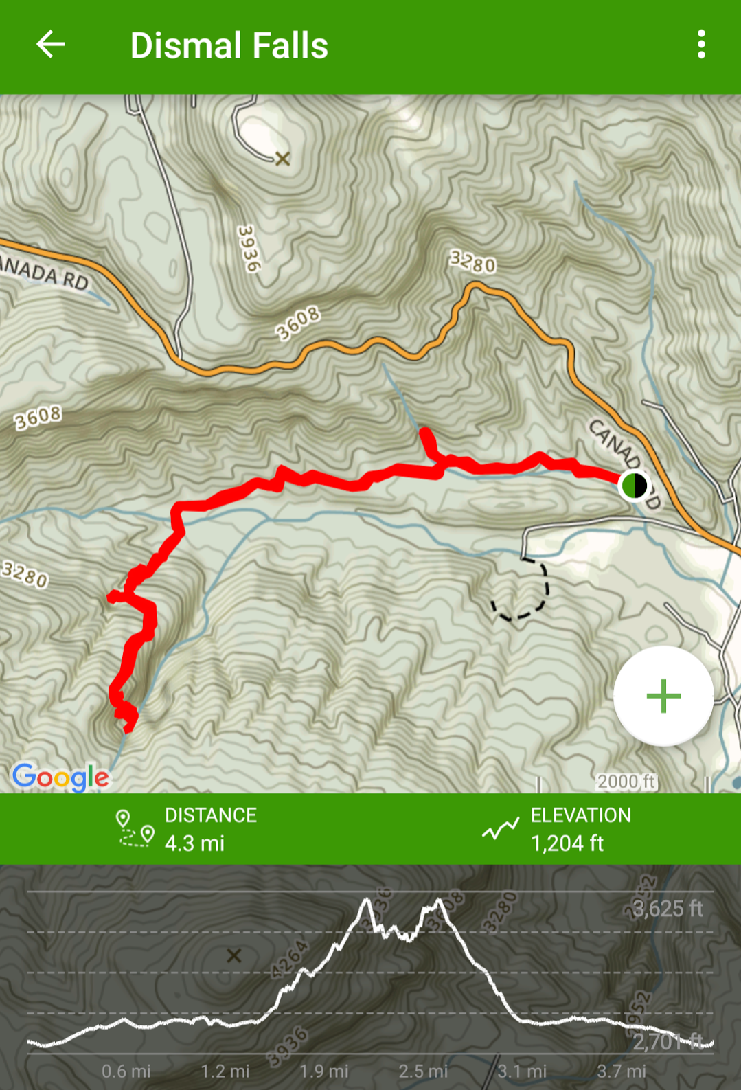
The Dismal Creek area is tucked away in western North Carolina, not too far from Panthertown Valley. The trail—and I use that term loosely—features 4 waterfalls. If I had to guess, I’d say it’s a little under 2½ miles from the trailhead to Dismal Falls, making this +/- 4½ miles, round trip.
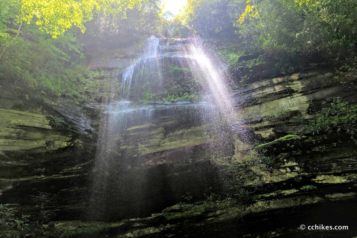
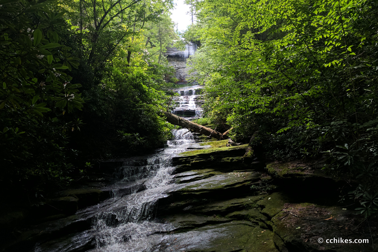
The first ¾ of this hike is easy to moderate. The last ¼ is strenuous to the point of being technical. Scrambling is involved. You will have a steep hike to the mountaintop and an even steeper hike down to the bottom of the ravine. You will likely slip and fall at least once, but I think the view of the 150-foot cascade of Dismal Falls is worth it. Actually, the waterfalls get more impressive as you walk, so you’re rewarded for your efforts.
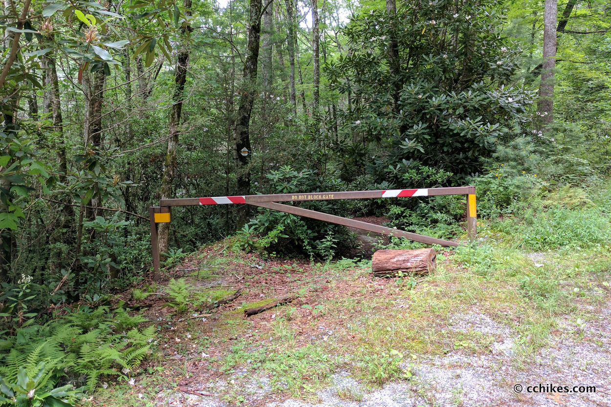
Use your navigation app to get to the parking area via the map point below. Cell reception is spotty, so get it up and running early. Look for a private road for a camp called Trails Carolina. The entrance to the camp will be on your left. You’ll take the sketchy, overgrown, gravel pathway on the right. Park near (but do not block) the gate.
Orienteering
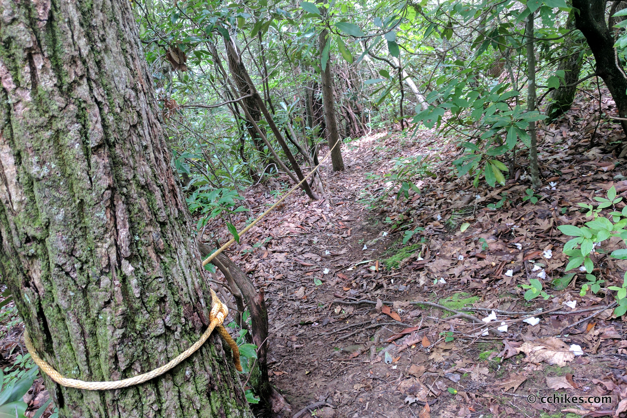
Much of this trail is an old forestry road. It is frequently crossed by shallow creeks/streams, so expect to get wet/muddy. There are no blazes on this trail. It would be very easy to get lost here. Some people have tried to mark the trail with tape, but it’s unreliable to the point that I wondered whether malcontents had moved the tape to confuse unsuspecting hikers.
I used these walking instructions to navigate the trail. I also downloaded some GPS map points via the AllTrails app (membership required). It was invaluable when there were several trails I could “turn right” onto.
I ran into 3 guys from the Atlanta area on this trail. They had neither a map nor written instructions. I pulled up the written instructions on my phone and told them to use their phones to take some photos they could reference later. They didn’t bring their smartphones. I couldn’t believe it! A smartphone is more valuable in dense forestry than a compass (you don’t need a signal to use your GPS). They were only going about 1 mile per hour and I just couldn’t walk that slowly. I offered to use sticks to make arrows pointing the correct way at confusing intersections of the trail. It worked! I ran into them on my way out and they were having a great time making a day out of this short trail.
Walking instructions
These instructions are not comprehensive. There are many forks and side trails. Still, you might want to screenshot these instructions as well as those linked above that I took with me.
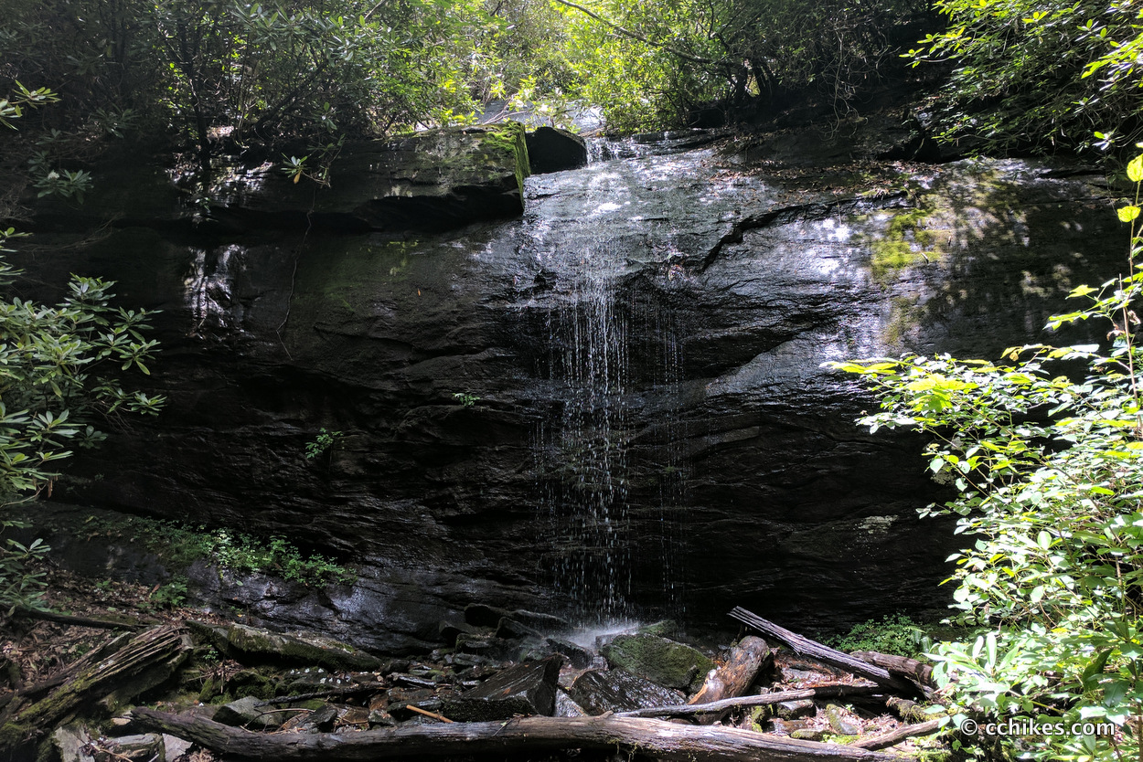
- The first half mile or so follows an old forestry road. The trail here is pretty obvious. After you’ve crossed the creek 4 or 5 times, be on the lookout for an obvious pathway on your right. This takes you through a campsite and up a small hill to Aunt Sally’s Falls.
- Walk back to the main trail and take a right. You’ll soon come to a fork. Take the pathway on the right. I don’t know where the pathway on the left goes, but it’s not part of this hike.
- Walk until there’s another obvious pathway to the left. Take this left. You will walk through a campsite and then cross a creek.
- After the creek, you will come to another campsite. There are lots of pathways here. You want to turn 90° to the right and walk up the hill.
- From here on, you just follow the most worn pathway and listen for waterfalls. You’ll soon get to Trailside Falls.
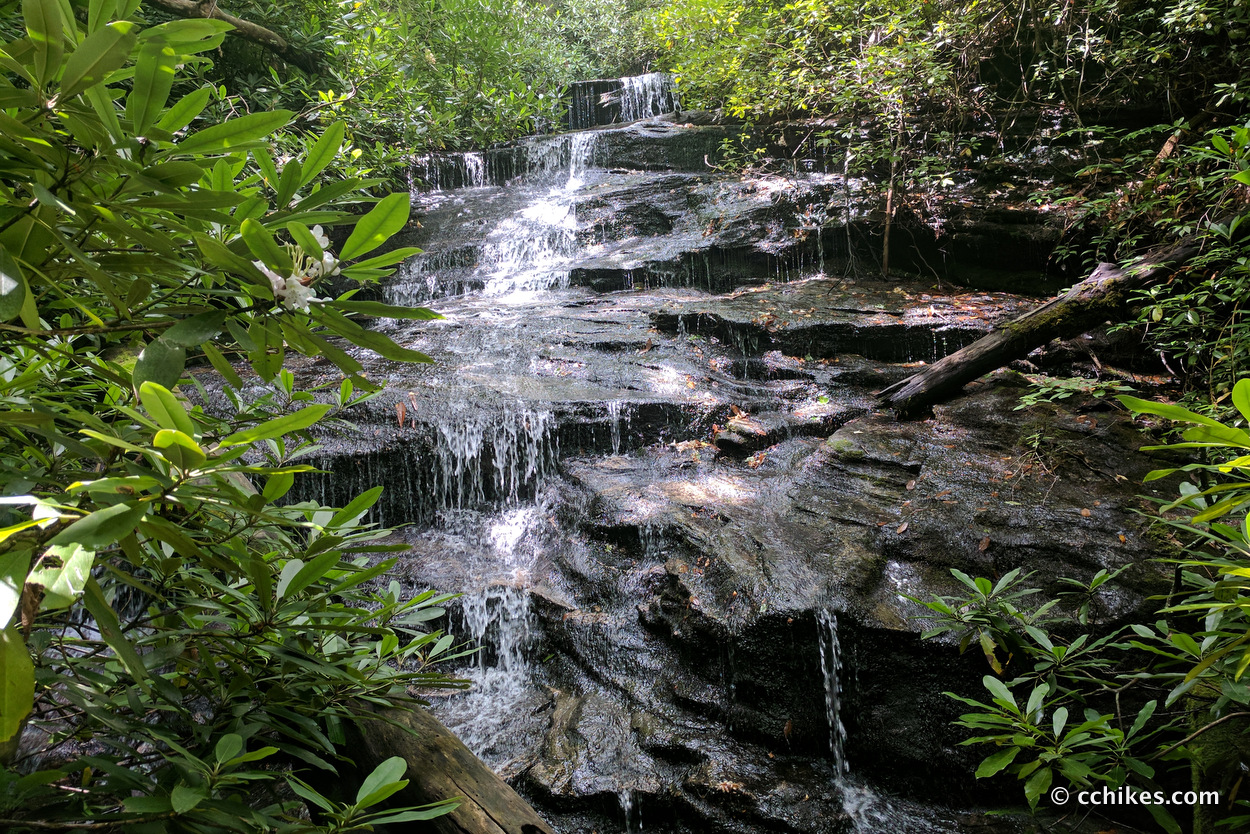
- Not long after Trailside Falls, you’ll get to another fork. To the left is a large, overhanging boulder. That is the way to Dismal Falls. To the right is a pathway that will take you to Rhapsodie Falls. Turn right and visit Rhapsodie Falls.
- There are several trails out of the Rhapsodie Falls area. I suggest you backtrack to the aforementioned fork and take the pathway to the left of the boulder. This begins the steep climb.
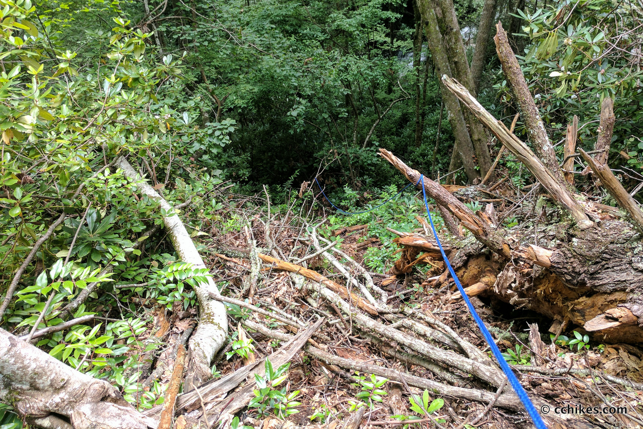
- Once you’re up and over the mountain, you give up all of that newly gained elevation very quickly. This section is steep and slippery. People have tied ropes to help you get down, but I recommend relying on your trekking poles. Never trust ropes you didn’t tie yourself.
- Most of the scramble downhill is on a fairly obvious trail. Just make your way to the bottom of the falls along the path of least resistance.
Impressions
This is a fun hike if you like to push yourself. It took me a little over 2 hours, round trip, but I hike pretty fast.
Pictures of waterfalls never quite capture the scale/scope/depth of the scene, so I tried taking a video. It’s better than a photo, but it’s still difficult to convey just how high up and far back that top cascade really is.
I would not recommend this trail to novice hikers. The lack of blazes and confusing side trails could get you lost very easily. This is a remote area. If you’re planning to hike this trail alone, make sure to tell someone when and where you’re going.
There is poison oak all over the place, so rinse off your legs in one of the creeks by the trailhead on your way out. Flying insects are also problem in this wet environment, so bring some bug spray.
I don’t recommend this as an overnight or weekend camping area because the campsites are all on-trail. I startled a group of girls who were camping, but what could I do? Their tents flanked the pathway. I had no choice but to walk through their camp.
If you’re hiking with people of varying fitness levels, it would be pretty easy to break this up. The hike to Rhapsodie Falls is easy to moderate. The strenuous parts mostly come after that. You could leave part of the group at Rhapsodie Falls. It’s a great sitting/picnic area and the mist feels like natural air conditioning. Those wishing for a more strenuous hike could go to Dismal Falls and back. Then everyone could walk out together.
Update
I had no idea until recently that this trail system connects with Panthertown Valley. I knew it was in the general area, but I really had no clue that it linked up with that trail system. This opens up all kinds of possibilities to turn this day hike into a weekend trip. I’ve already outlined a 9-waterfall loop in Panthertown (there are actually more than that if you don’t mind getting wet). Being able to add these 4 waterfalls to that agenda would make for a pretty epic weekend hike.
As I stated above, I usually rely on my GPS coordinates to navigate the area. I ran into a couple at my favorite waterfall camping site in Panthertown Valley who had a comprehensive contour map of the area. He showed me the different ways they like to access the forest and I was confused when I saw Aunt Sallys Falls and Dismal Falls on the map. Then it clicked. I can’t wait to explore these connecting trails.


Leave a Reply