
I’ve hiked just about all of Panthertown Valley in both directions. It’s a beautiful area that mostly features easy to moderate hiking. There are a few strenuous sections of trail, but they’re avoided with this loop except for the short climb to and from the ridge. That said, this is not a great loop for beginner hikers/backpackers because of the orienteering involved.
I’m guessing this loop is around 15 miles total. If you make use of some of the alternate routes listed below, this could probably be cut down to around 10 miles or so. You’d miss some waterfalls, but it would still make for a great experience.
I started my hike after work on Friday. I bagged 3 waterfalls in 2 hours and then made camp. Most of my hiking was on Saturday and I finished by noon. I did the loop counter-clockwise. If I hiked all day Saturday, camped, and then hiked out on Sunday, I might recommend doing it clockwise. This can also be done as a day hike if you’re pretty quick.
Orienteering
I relied on my own GPS map ↗ on my smartphone to track my progress on the trail. Many people don’t know this, but you don’t need an internet connection to ping GPS. It even works while your phone is in airplane mode. This GPS map showed me exactly where I was on the trail at all times. Feel free to copy this map or download the location data points and import them into your preferred GPS app. These step-by-step instructions will show you how to do that.
As you know, tech can malfunction, break, or run out of power. It’s prudent to take a contour map and a declination-correcting compass on your backpacking trips as well. This is the map and compass I used. You can also download and print this incredibly low-tech map of the waterfall loop.
If you shop through any Amazon link on this website, you support me at no cost to yourself. I only recommend products that I have personally bought, tested, and endorse. Learn more in my disclosure.
Nantahala National Forest, Panthertown Valley Trail Map
|
||||


About the loop
There is little signage in Panthertown Valley. You get the standard, brown markers at major trail intersections, but there is very little blazing and you’re often left scratching your head, wondering where the trail went. I’ll try to provide some tips below, but my experience is not that of a first-timer to the area.
I should add that the forest canopy can be very dense. That keeps water from evaporating, so you will walk in mud on most of these trails. Embrace the mud, otherwise, you’ll waste time and energy trying to stay dry. Bugs are also a problem, so bring some spray.
Trail directions
Once again, this is a counter-clockwise loop. If you’re planning to hike clockwise, you can reverse everything except for the instructions on the 3 spurs. Cell connection is spotty in the valley, so get your navigation app up and running while you’re still in civilization. Once in the valley, you can use your smartphone’s GPS while in airplane mode to pinpoint your location on the trail. Download the GPS map linked above before you leave home and screenshot these directions.
- Park at the west entrance to the valley. Navigate there via the map point below.
- Take the Panthertown Valley Trail (downhill).
- Turn right on the Wilderness Falls Trail (mostly flat and then steep downhill by the falls). This section features Wilderness Falls and Frolictown Falls. There’s a rocky bald area at the top of Wilderness Falls. You want to take the trail that steeply descends directly next to the falls. Frolictown Falls is across the trail junction at the bottom of the mountain. Take the path straight ahead to access the falls.
- Turn/continue onto Granny Burrell Falls Trail (flat). This is the first of many confusing junctions. Use the GPS map to make sure you’re on the correct trail. Continue past the Great Wall Trail intersection to reach Granny Burrell Falls. This is a very muddy trail. The area below the falls features a fun swimming hole. This is the second most popular swimming area after Schoolhouse Falls.
- Backtrack to the intersection and turn left on Great Wall Trail (mostly flat until it goes up and over a big hill). The flat part of this trail is filled with primitive campsites that are near water. I camped at a primitive site after the stone staircase. There was no water source there, so keep that in mind.
- Turn right on Big Green Trail (hilly).
- Turn right on Mac’s Gap Trail (flat). You do not have to ford the creek. There’s a way across on rocks via a trail to the right.
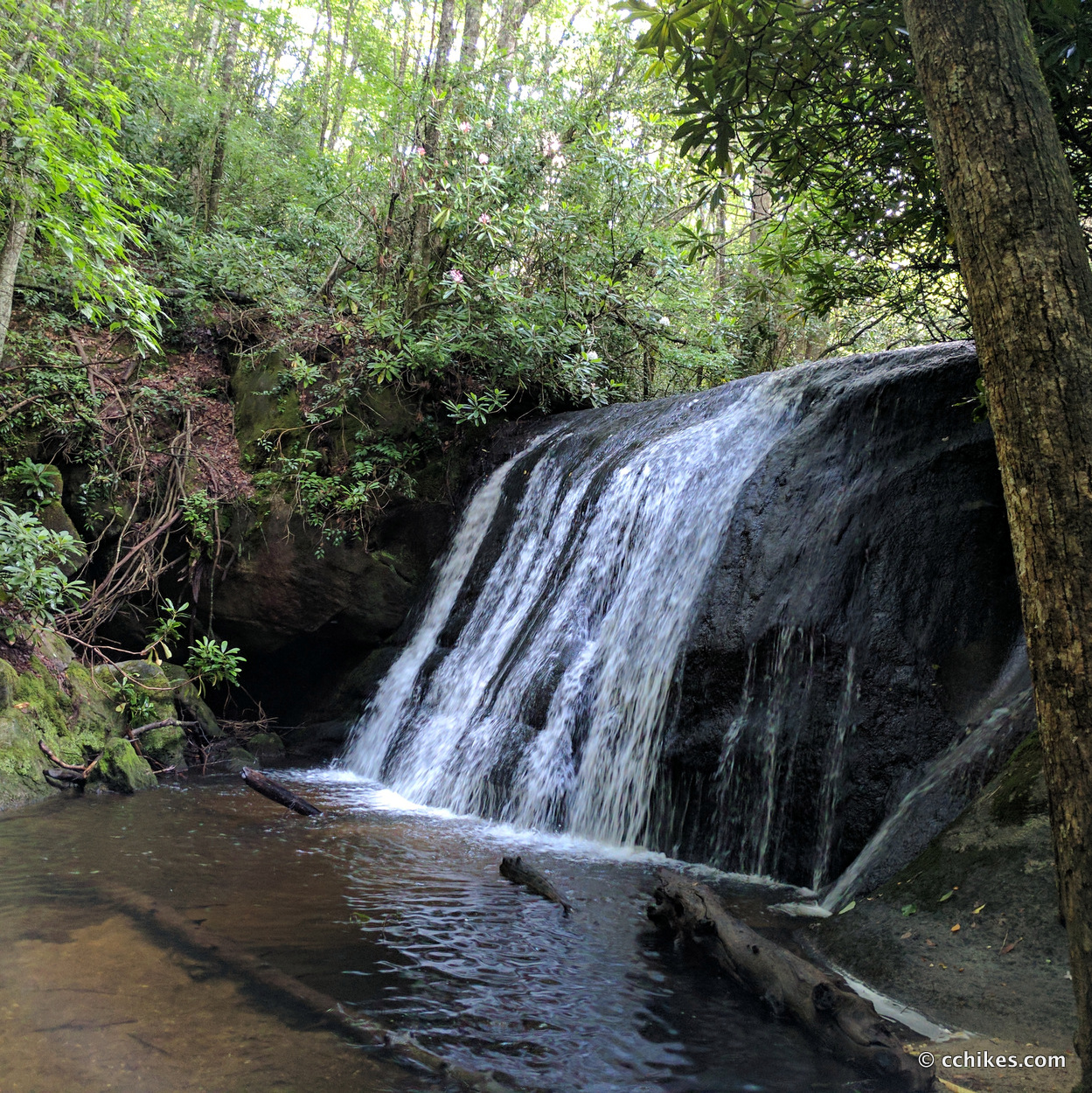
- Turn right/continue onto Greenland Creek Trail (flat and very muddy). Take this spur until you reach Greenland Creek Falls.
- Backtrack to the intersection with Mac’s Gap Trail but continue on Greenland Creek Trail in the other direction. Take this spur until you reach Mac’s Falls. Mac’s Falls features a shallow swimming hole. You’ll have to listen for Pothole Falls. It’s relatively small.
- Backtrack to the trail intersection with Mac’s Gap Trail. Turn right onto Mac’s Gap Trail (flat). Continue on Mac’s Gap Trail past the intersection with Big Green Trail.
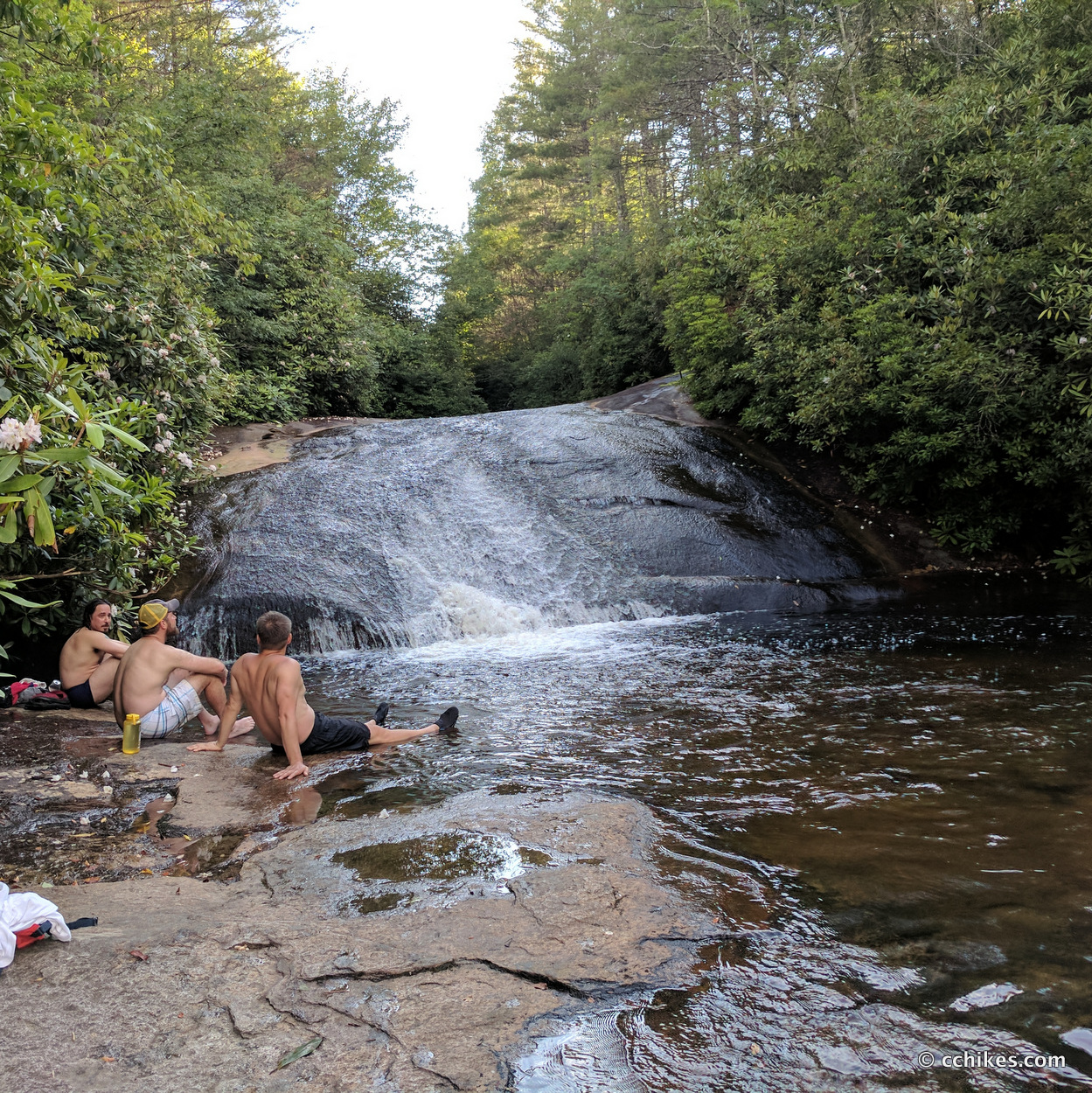
- Turn right onto Little Green Trail (steep uphill to the ridge and then a steep downhill to the falls). Continue until you reach Schoolhouse Falls. This is the most crowded area in the valley and the most popular swimming area by far.
- Continue on Little Green Trail until the intersection with Panthertown Valley Trail. Turn right and walk over the bridge.
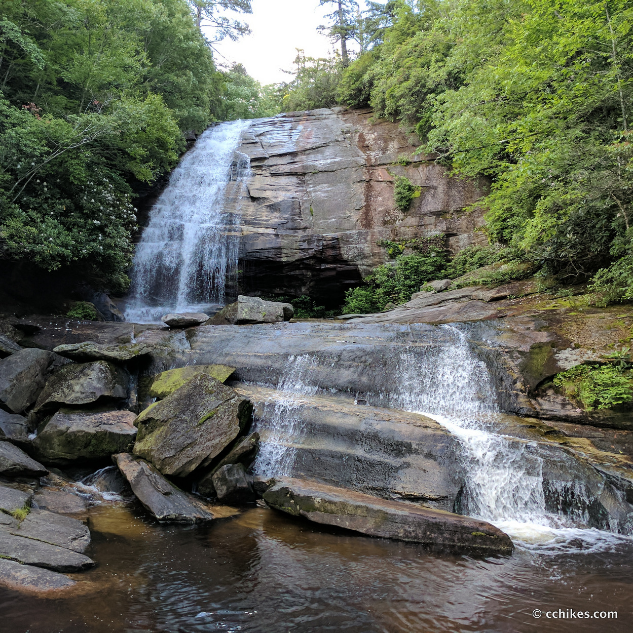
- Turn left onto Devil’s Elbow Trail (hilly) until you reach Riding Ford Falls Trail on your left. Turn left and walk (downhill) about 50 yards. There will be an unmarked trail on your left. Take that down the hillside. It will lead you to a flat camping area surrounded by rhododendron. From here, you’ll hear Jawbone Falls. This is the most beautiful campsite and swimming hole in all of Panthertown Valley. I’ve avoided sharing it on social media because I don’t want it to become crowded. You have to walk further downstream on a trail that follows the water’s edge (flat and muddy) to reach Riding Ford Falls. You will have to get wet to access the bottom of Riding Ford Falls. If there’s a trail to Warden’s Falls, I couldn’t find it.
- Backtrack all the way to the intersection near Schoolhouse Falls and turn right onto Panthertown Valley Trail (flat). Turn right at the next intersection to stay on Panthertown Valley trail (flat until the last 1½ miles, then it’s uphill)
- Take Panthertown Valley Trail all the way back to the west entrance to the valley.
Alternate routes
- If you want to minimize the uphill walking, then continue straight after Granny Burrell Falls in step 4 and turn right onto Mac’s Gap Trail. Take it all the way to Greenland Creek Trail in step 8. That will cut out Little Green Trail and the climb to/from the ridge.
- You can also skip the Devil’s Elbow Trail spur in step 13. This is probably the most confusing part of the loop and finding the waterfalls requires some bushwhacking. It’s very easy to get turned around here. Use the GPS map.
- If you’re coming from the east, you could easily park at the east entrance to the valley and take Mac’s Gap Trail to start your hike near Greenland Creek Falls. This link has a map point that will direct you to the east trailhead.
Photos
Here are pictures so that you know what to expect at each waterfall. These are in spatial/chronological order if you hike the loop counter-clockwise. The scale of several of the cascades is totally lost in pictures, but what can you do?
If you’re reading this on a big screen, you can click on each photo for a larger view.
Wilderness Falls
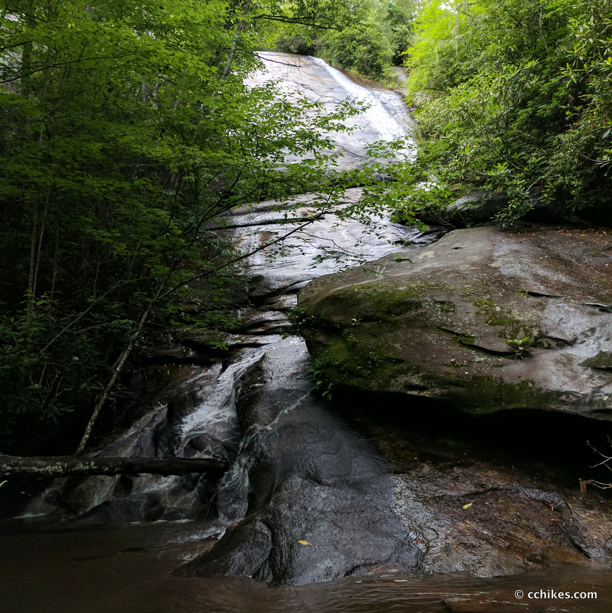
Frolictown Falls
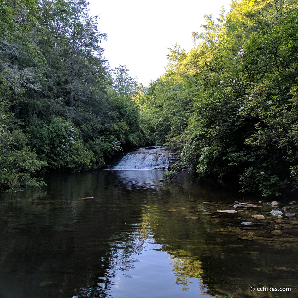
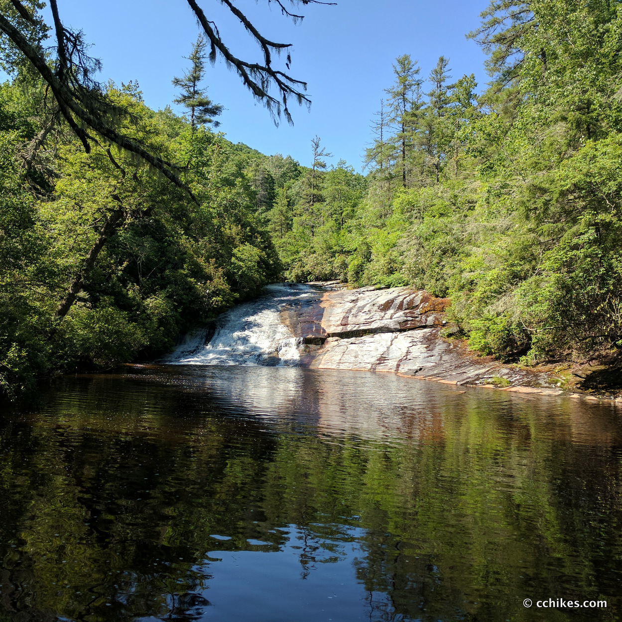
Granny Burrell Falls
Greenland Creek Falls
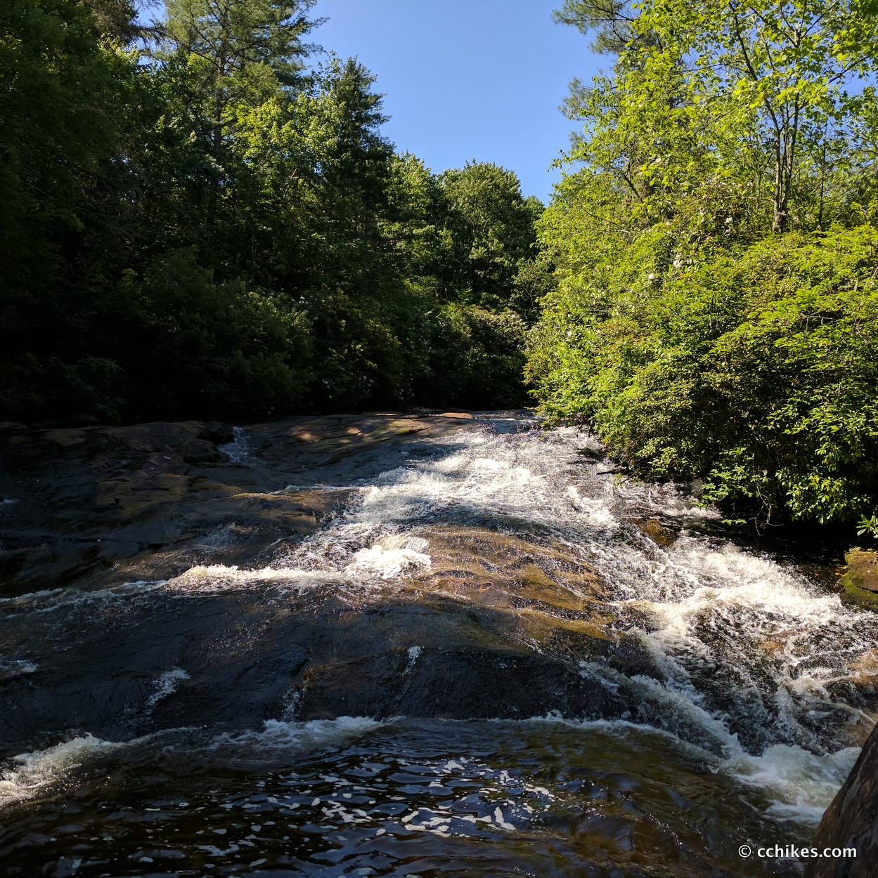
Mac’s Falls
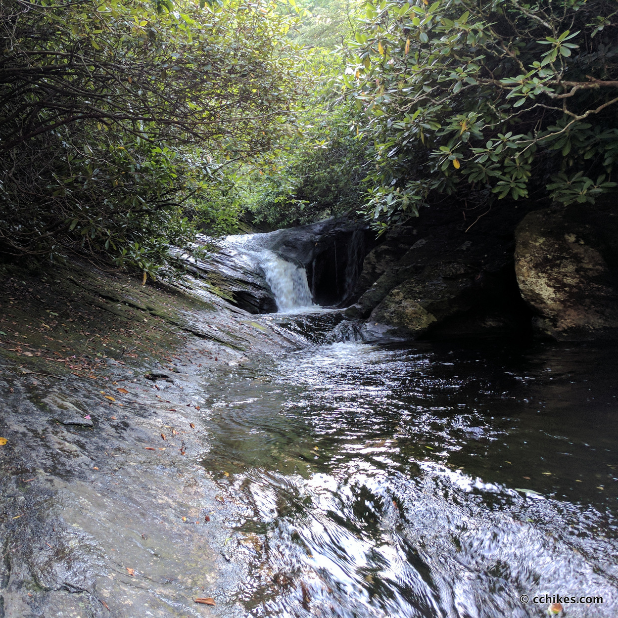
Pothole Falls
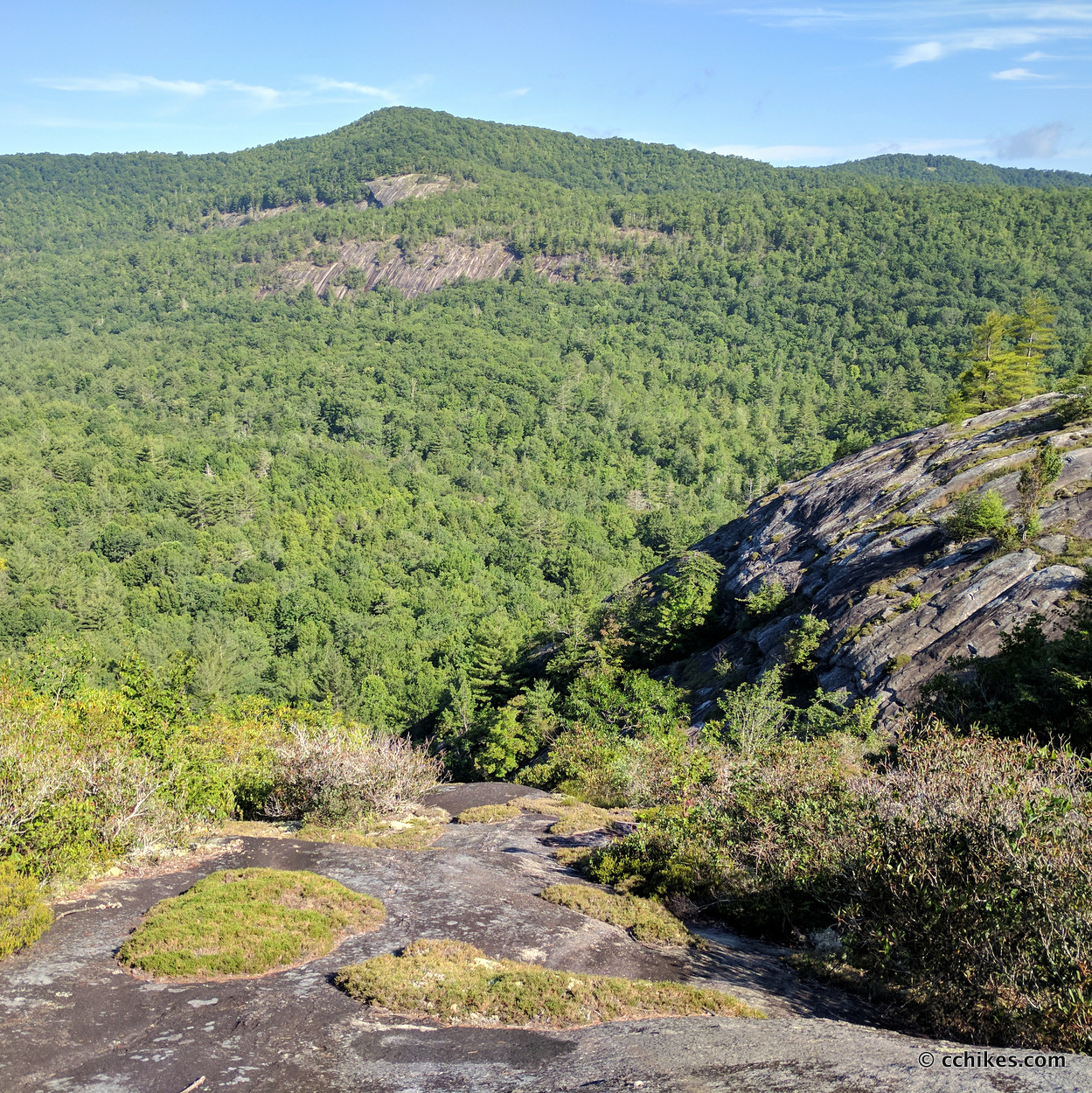
The view from the ridge
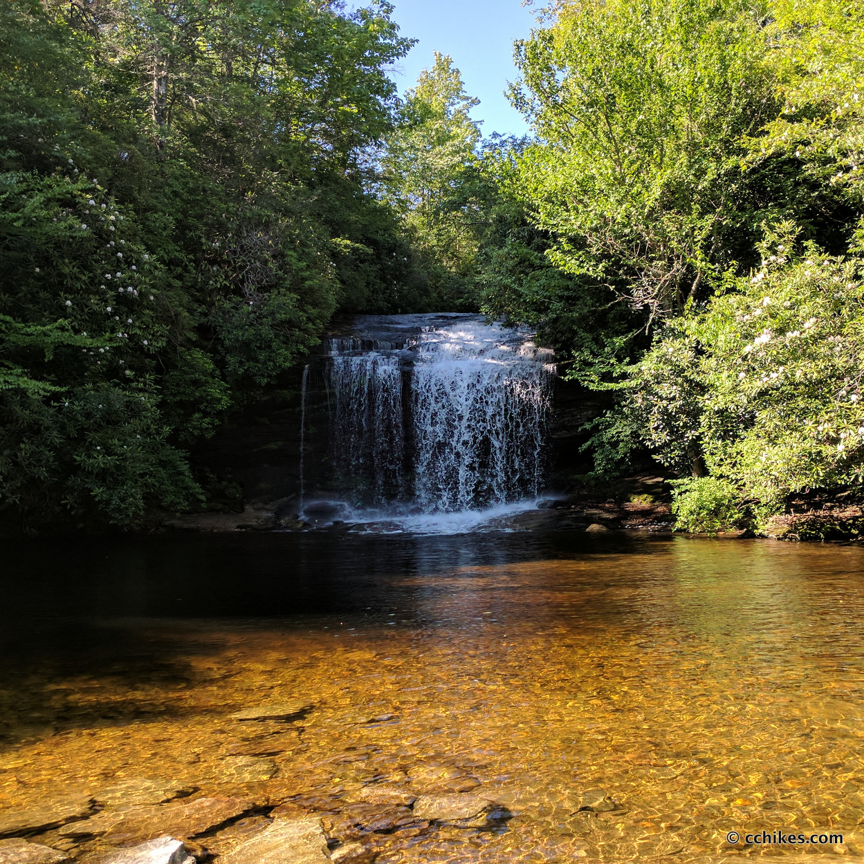
Schoolhouse Falls
Jawbone Falls
Riding Ford Falls
Impressions
This is a really fun loop. I like walking to landmarks, which is why I have a whole category on this website devoted to waterfalls. Most of this hiking is easy. You’ll rarely walk more than 20 minutes without coming across a campsite. If you’re carrying 2 liters of water, you can pretty much walk until the sun starts to set and then camp at the next site you find.
If I had to guess, I’d say 80% of the visitors in Panthertown Valley at any given time are somewhere along Panthertown Valley Trail, at Schoolhouse Falls, or upon the ridge. I don’t blame them; that’s a fun little in-and-out hike (maybe 8 miles total if you start from the western entrance on the map below) that takes you past an overlook, a natural beach, a waterfall you can walk behind, and a ridge climb.
Another 15% of the people are clustered around the Granny Burrell Falls area. That means the remaining 5% are spread throughout the 6300-acre park. So when you’re on any other trail, you’re virtually alone. I ran into someone at Riding Ford Falls and we were both so surprised that we laughed about it.
There are lots of bears in this area. I hung my food on this trip because it was just me and I exclusively use the freezer bag cooking method when I backpack. But if I was spending a weekend with people at a campsite, and we were going to cook hotdogs and s’mores over the campfire, I would bring a bear canister and stash it well away from my tent.
I listened to The Lies of Locke Lamora while I knocked out this loop hike. I highly recommend this book. It’s a crime/conspiracy story set in a fantasy world that’s more medieval than fantastic. It takes a while to get going, but once it’s in gear, you don’t want the ride to end. Fortunately, it’s just the first book in a series.
Navigate
More
Discover more loop hikes.
Discover more North Carolina trails.
Discover more waterfalls.


Shannon Sullins
Great post! I have hiked the loop before but cant recall where a good spot would be to setup camp and still enjoy the day. Can you suggest a good camp spot that is walking to a swimming area and can fit 3-4 tents?
Chris Hastings
If you camped along Panthertown Wall there are many sites and you’d be within a mile of Granny Burrell Falls which is a good swimming spot. This is the first time I’ve been on the page to see your question.