

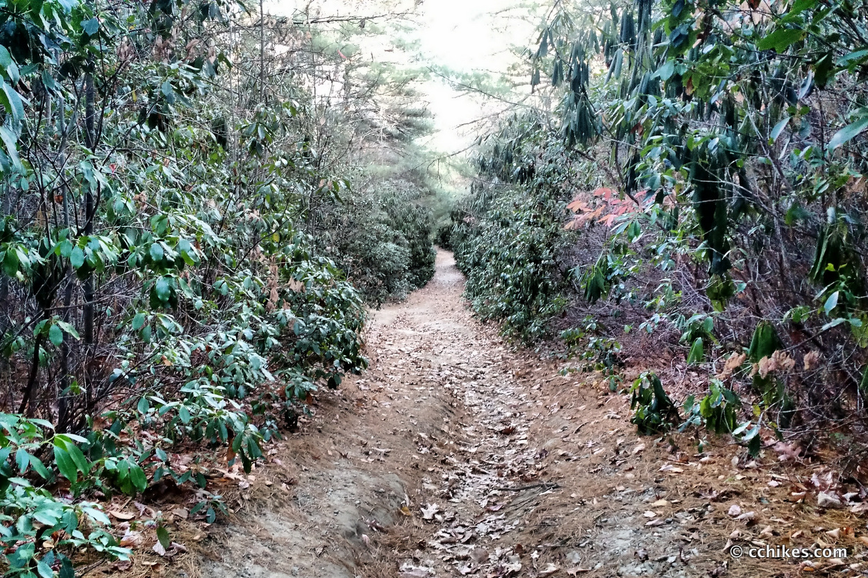


I don’t know how I’ve never been to Panthertown Valley before. It is a truly unique part of Nantahala National Forest that features a pretty extensive trail system. Best of all, the pathways intersect frequently, allowing you to stitch several sections together to create loop hikes of varying lengths. You can do a quick day trip or stretch into a long weekend of camping. Most trails are well blazed, but it’s easy to get turned around. You’ll want to download the GPS points and/or buy a map.
I drove straight from work to the trailhead and hiked until I found a decent place to camp—barely beating the sunset.
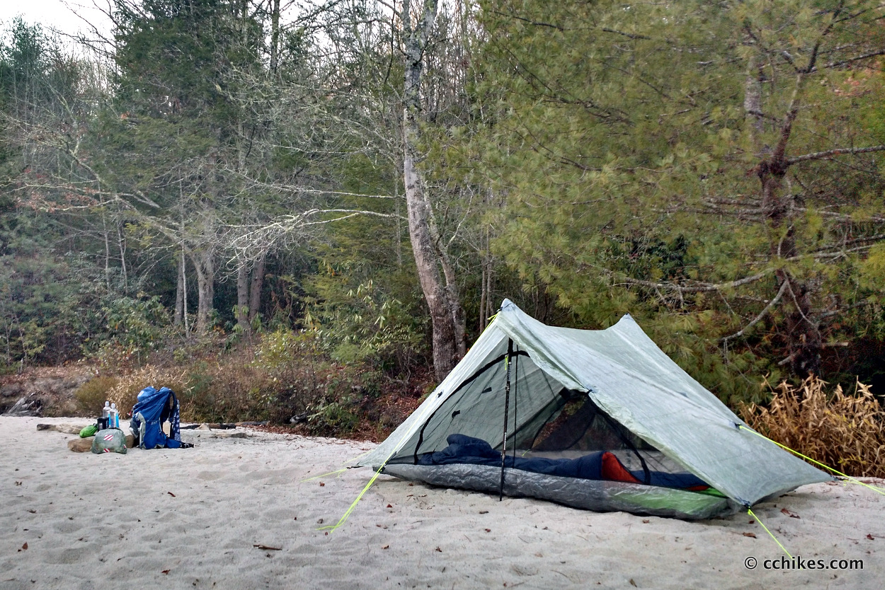
While picturesque, I came to realize that this was a terrible place to camp. I have a single-wall tent, so condensation can be a problem. It’s a guaranteed problem when I set up next to water. The temperature dipped below freezing in the wee hours of the morning and the breeze coming off the water was frigid to say the least. Coincidentally, when I got moving in the morning, there was a large, dry campsite maybe 100 yards further down the trail. Oh well.
People ask me what I do at night when I camp alone. I usually listen to an audiobook (I listen to books when I hike as well), but sometimes I’ll download a show or film from Amazon Prime. My external battery holds enough juice to completely recharge my smartphone 4 times. I also pop some Tylenol PM to help me get to sleep faster and sleep through the night.
Trails
- Park at the west parking lot and walk straight (east) on Panthertown Valley Trail. This is a mild downhill along an old logging road the whole way.
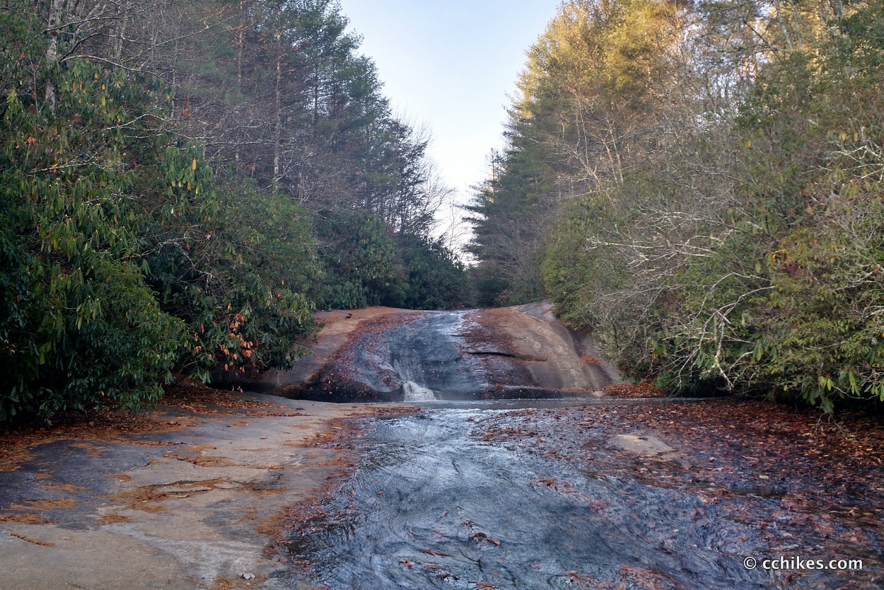
- Turn right (south) on Little Green Trail. Schoolhouse Falls is not far from the intersection. After that, the trail takes you up to the rocky summit.
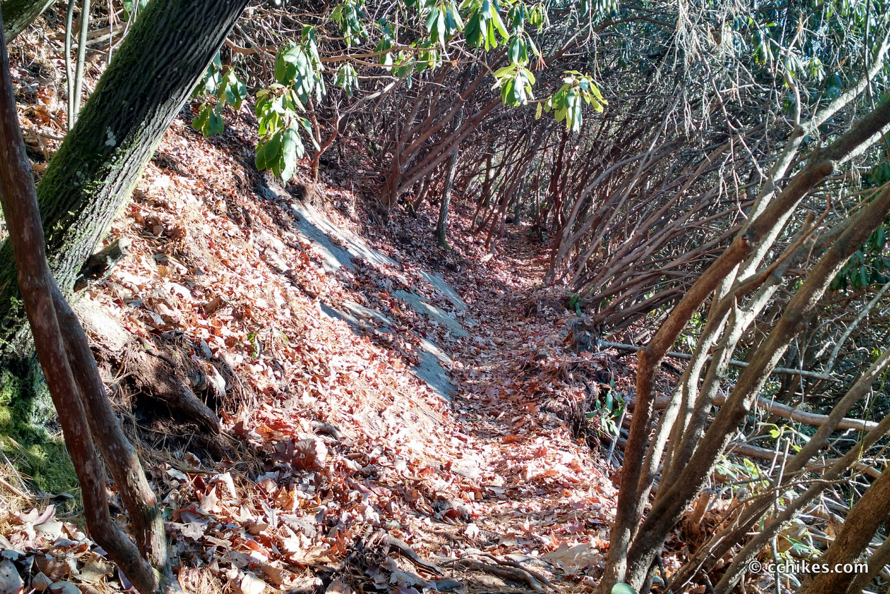
- Bear left at the fork and then turn right (northeast) on Mac’s Gap Trail. This is a wide, flat path along the valley floor. This area is filled with existing campsites.
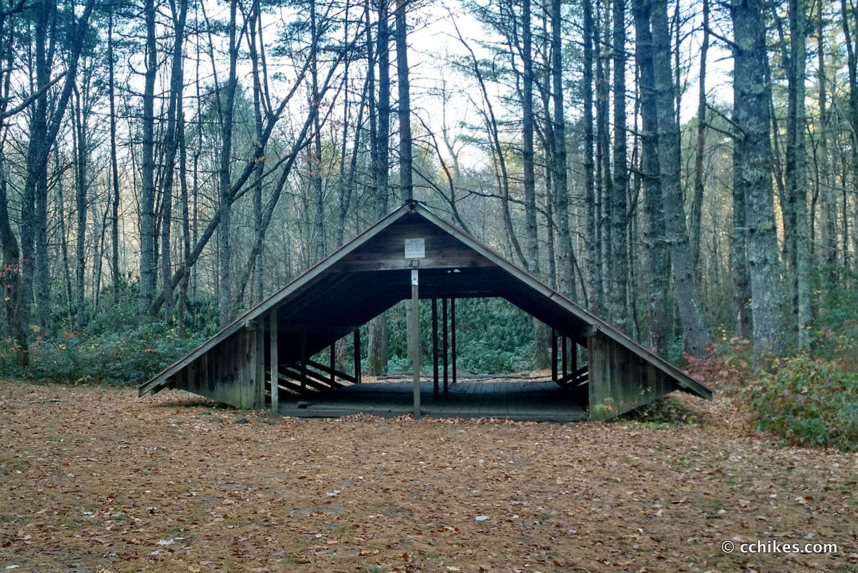
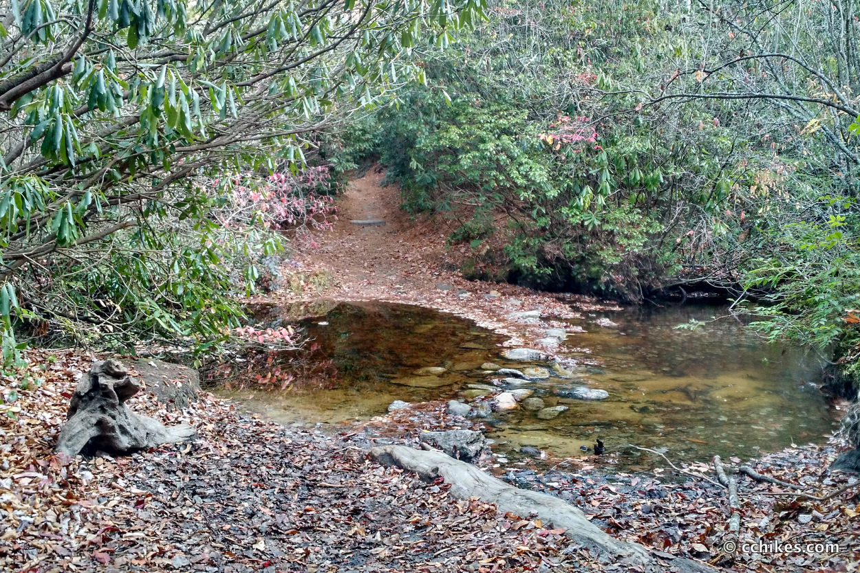
- Turn left onto Granny Burrell’s Falls Trail. The Falls are not far from the intersection. This is very flat and easy hiking. The trail makes a sharp right turn at one point (across a creek), so be careful not to accidentally continue (south) onto Great Wall Trail. If you do go straight, you’ll run into a shelter and recreation area if you’re into that kind of camping.
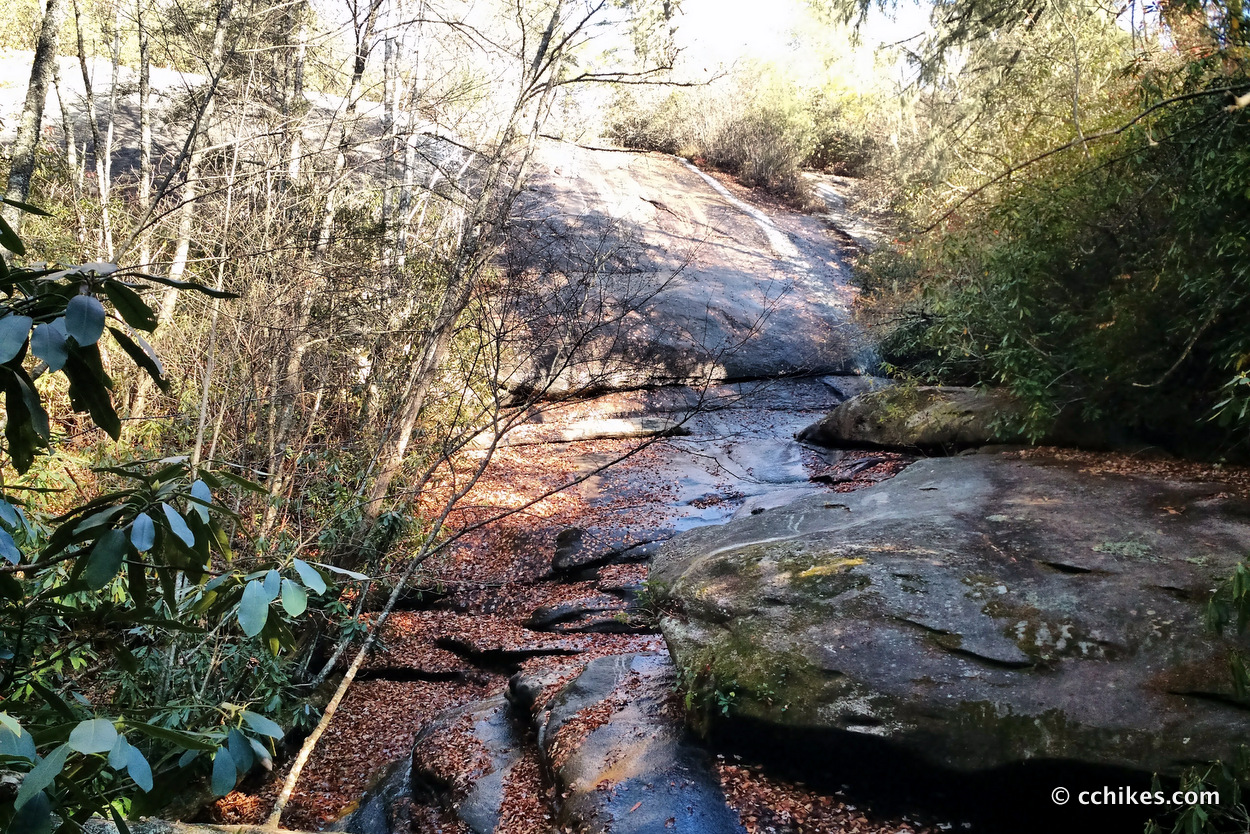
- Turn right (northwest) onto Wilderness Falls Trail. As you might expect, Wilderness Falls is in the middle of this trail. This is probably the most technical hiking in the forest, but it’s not really difficult. I should add that the GPS coordinates were a little off here and the trail can be confusing at times.
- Turn left (west) onto Panthertown Valley Trail and walk back to the parking lot.
Impressions
This is a great trail system! Some of the trails are old logging roads that have been reclaimed by the wilderness. Others are narrow footpaths. There is usually a wide pathway and oftentimes a soft, sandy surface. The elevation was challenging, but never very strenuous. The Little Green trail is the best spectacle in the area with its rocky peaks and the expansive views of the valley.
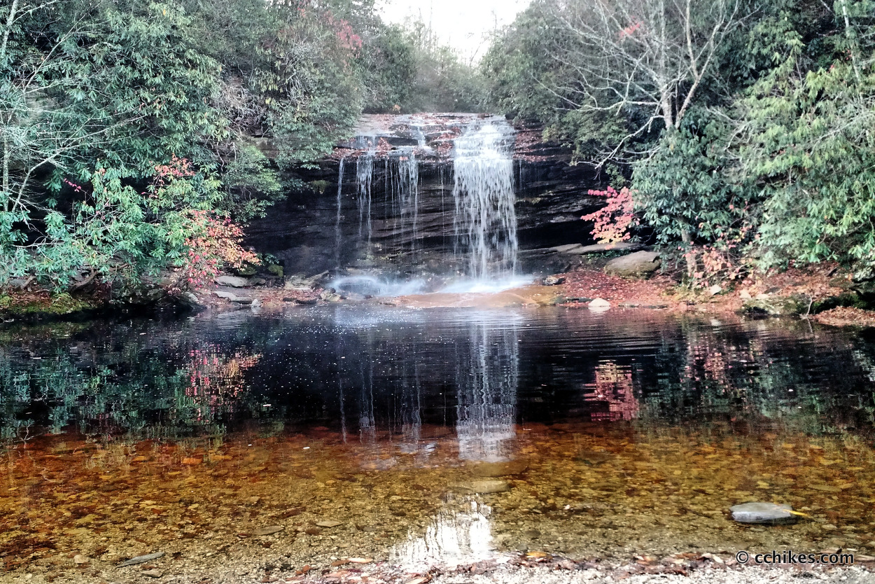
I saw three waterfalls on my loop hike, but there are many more in Panthertown Valley.
There are campsites everywhere in the forest, especially along Mac’s Gap Trail. The valley is unusual in how wide and flat it is. Thanks to the evergreens, much of the valley floor features soft pine straw footing that’s ideal for tent camping. Schoolhouse Falls features a very large campsite. You won’t see most of the campsites on the elevation, but you will see thin side trails. These trails typically go to existing campsites, so keep your eyes open if it’s getting dark.
I probably hiked around 7 miles and I don’t think I did anything that kids and dogs couldn’t do. I will definitely go back again to piece together a 20+ mile weekend hike. I was in a hurry to knock out my miles and get home to watch some football.
Update
I’ve gone back to Panthertown Valley several times since I first hiked this loop. If you really want to squeeze the best out of the area in a small amount of time, try to hike the 9-Waterfall Panthertown Valley Loop.
Navigate
More
Discover more North Carolina trails.
Discover more loop hikes.
Discover more waterfalls.


Leave a Reply