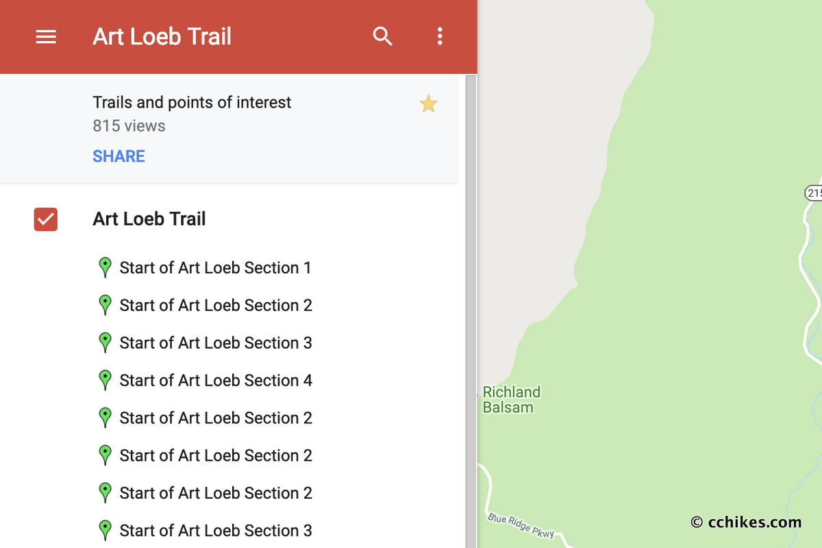


A big reason this travelog works so well is because of the way it’s integrated with Google Maps. Each trailhead is mapped for easy navigation by car, and most backpacking trip routes are mapped for use while on the trail.
Many people don’t know this, but you don’t need an internet connection to ping GPS. It even works while your phone is in airplane mode. A GPS map will show you exactly where you are—or are not—on a trail at all times. There are many GPS apps made for outdoor activities in the various app stores. I use Google’s MyMaps app because it has a desktop and mobile client and my digital life is already very integrated with Google’s products and services. Anyone with a Google account can use this service for free.
Google users can copy any map of mine with just a few clicks. The map will be saved in your MyMaps account and stored in your Google Drive account online. If you use another GPS app, you can download the KML data (map points that track the route) and import them into the app of your choice. Gaia GPS is a good one if you don’t have a Google account.
Who can use the MyMaps app
If you have a Google account, you can follow the steps below to copy any of my maps to your MyMaps account online. You can edit, update, and customize them according to your trip itineraries. There is value in ownership and planning. But there is no MyMaps app for iPhone/iOS. After customizing your maps, you’ll need to follow the instructions on how to download the map points and import them into the GPS app you use on your smartphone.
How to copy a map—Google account users only
For example, let’s say you’re planning to hike the Art Loeb Trail and want to use my map. These are the simple steps you would take. You need to be logged into your Google account for this.
- Open my Art Loeb Map ↗
- Click the star near the top-left corner.
- Go to My Maps ↗ online.
- Click “All” at the top and you will see the map. You don’t own it, but you can use it.
- To own it, all you have to do is click on the map and then select “Copy Map” from the settings button (⋮) near the top-left.
- Now you own the map and can do whatever you want with it. I can’t see your map. Log your campsites, pinpoint your water sources, or anything really.
- Download the MyMaps app (Android users only) and you will see your map there. Just make sure you open the map while you still have an internet connection and it will work on the trail whether you have a connection or not.
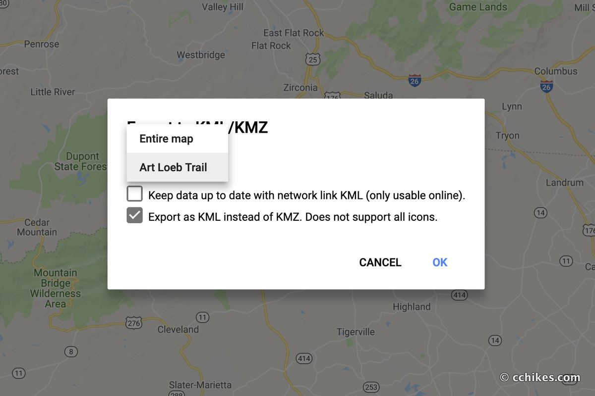
How to download the map points/route—Anyone (including iPhone users)
For example, let’s say you’re planning to hike the Art Loeb Trail and want to download my trail route. These are the simple steps you would take. You do not need a Google account for this.
- Open my Art Loeb Map ↗
- Select “Download KML” from the settings button (⋮) near the top-left.
- If the map has many layers, you will select the ones you want to keep.
- If you want to save the map to your online MyMaps account through Google (you would need a Google account for this), then check “Keep data up to date with network link KML.” If you just want the data, then leave this box empty.
- Check “Export as KML instead of KMZ,” and then click “OK.”
- The data will download and you can upload it to whatever GPS app you prefer. Like a said before, Gaia GPS is a good one.


Ron Dumoff
Brilliant on the MyMaps tutorial. Hiking UHT this summer and got a little nervous about trail visibility. Now I’m cool!
Thanks
Chad Chandler
I’m glad you got value from it. Good luck on your UHT hike.