Read about my complete Uinta Highline Trail experience, including prep, gear, logistics, and post-hike impressions.
If you’re not familiar with the Unita Highline Trail (UHT), it’s a footpath that follows the ridgeline of the High Uintas Mountains in northeastern Utah. Learn more about why I chose this trail.
By all accounts, the UHT is challenging to navigate. Most of the trail is above the tree line. Sometimes there is an obvious footpath to follow. Other times there are cairns to point the way. But it’s nothing like the well-trafficked, frequently blazed Appalachian Trail. And after downloading the GPS tracks of other UHT hikers, it’s apparent that people view the High Unitas as a choose your own adventure type of hike.
I’m traveling with someone who has never been on a deep wilderness backpacking trip of this sort and she is absolutely terrified of getting lost. I can get a little obsessive about trip planning, so we’re a good fit.
What I’m taking with me
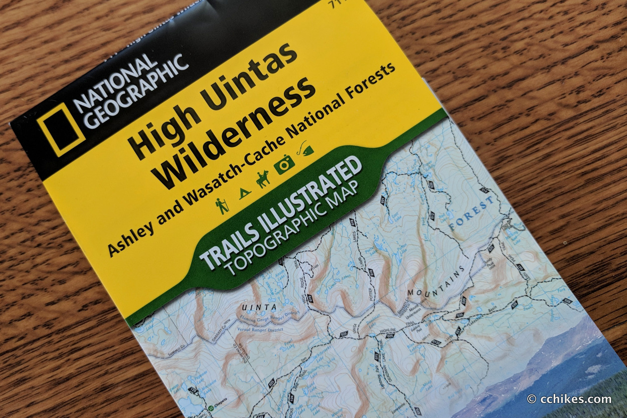
I’ll be taking two maps with me on my hike of the Uinta Highline Trail in Utah. I typically use paper maps for campsite planning and elevation preparation. I use GPS maps for real-time navigation.
I’m only doing the westernmost 65 miles of the trail from Chepeta Lake to Hayden Pass. This comprises the High Uintas section of the Highline Trail, which means I can get by with only one map—Trails Illustrated #711. If you’re doing the whole 102-mile trail, you’ll also need to buy Trails Illustrated #704: Flaming Gorge National Recreation Area.
If you shop through any Amazon link on this website, you support me at no cost to yourself. Learn more in my disclosure.

I plan to rely on my own GPS map ↗ on my smartphone to track my progress on the trail. Many people don’t know this, but you don’t need an internet connection to ping GPS. It even works while your phone is in airplane mode. This GPS map will show me exactly where I am on the trail at all times. Feel free to copy this map or download the location data points and import them into your preferred GPS app. These step-by-step instructions will show you how to do that.
When I hiked the John Muir Trail last year, I didn’t have to create my own map. Because that trail is so popular, there are apps you can buy and download to your phone that indicate the trail, water sources, campsites, etc. Those apps are updated regularly and are better than anything I can create with old data. Not so with the UHT.
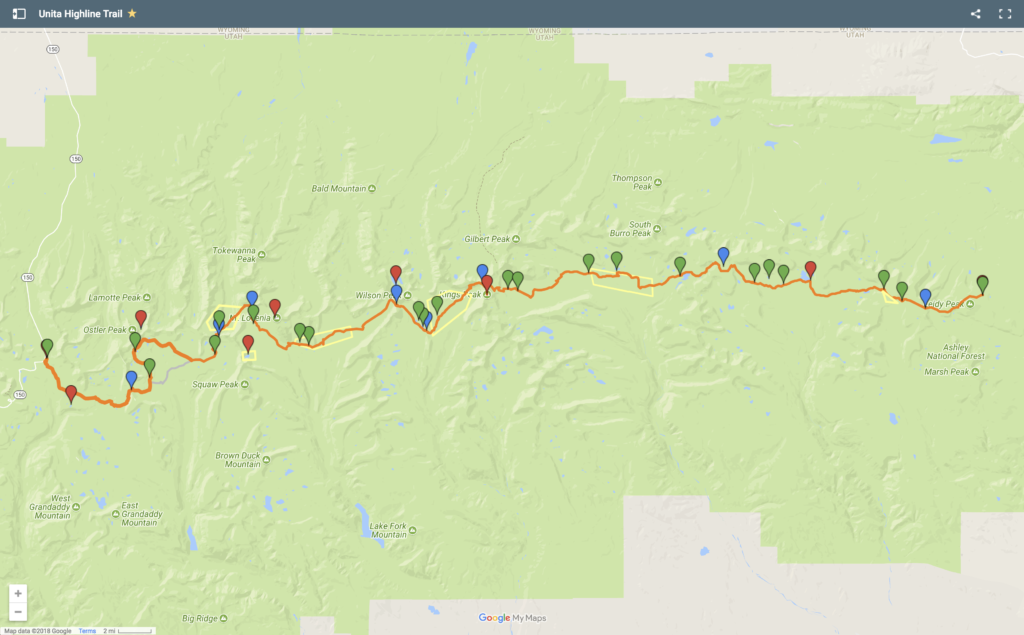
This map actually features two data sets—a Main UHT Map and an Emergency Map. The Main UHT Map is composed of trails, points of interest, campsites, and mountain passes. The Emergency Map features bailout points, alternative paths, and places to find help in a worst-case scenario.
Note that the eastern end of the trail is a little farther than where we’re starting. The way our daily mileage works out, it makes more sense for us to start at the Chepeta Lake trailhead than the Leidy Peak trailhead. If we had another day, I would have started at Leidy Peak instead. The travel logistics are much easier from there.
After my hike, I’ll post a review with my impressions from these orienteering resources.
Post-hike impressions
I can’t stress enough just how necessary the GPS map is on the Uinta Highline Trail (UHT). There are certain sections where the trail is well marked by signs and cairns—especially in the high mountain passes. But there are many sections where it’s hard to discern a trail at all. Even more confusingly, there are places where many trails seem to diverge through dense woods for away from popular destinations. I don’t know if these are simply game trails or side trails to unmarked attractions, but it’s hard to know if you’re on the UHT. There were several times when I’d check to see if I was on the right trail only to see the dot well off the GPS line. But as long as I was headed toward a certain mountain or lake, I knew I could pick the trail back up eventually.
The contour map was useful to plan and track mileage, but I never needed to use it for navigation because the GPS map is so much more convenient. That said, I would never venture into the wilderness without a contour map and a compass. I should add that the contour map was better for campsite planning. My GPS map doesn’t have waypoints like a Guthook app. It was also essential when we decided to bail out on Henry’s Fork to hitch a ride to Hayden Pass.
Next: Power Supply Plan


Michael Smith
Was there any bear issues on the UHT trail? Do I need a food canister?
Enjoyed the write up and I purchased the trail map through your page, thanks!
Chad Chandler
Zero bear issues. We both used OpSacks, which are soft-sided and not hard. We slept with our food in our tent and had no problems. I own two different bear canisters. They’re heavy, but they have their use. I did not use them on this trail. Best of luck with your hike!
Michael Smith
Thanks so much for the response! One more question, my daughter and I were planning on hitting the trail first week of July and I’ve read that’s too early, what’s your experience? Sounds like the bugs are bad and Dead horse pass might be an issue this early in the season.
Thanks again!
Emmaline
Super helpful read! I’m having trouble accessing your map. It downloads to my google drive account but I can’t figure out how to open it on the my maps app. Total newbie here. Thanks for the awesome resources!!
Jim
Headed out tomorrow to do this hike E>W. Starting at McKee and ending at Hayden. Only thing Im worried about is lightening. Wish me luck!