Read about my complete Uinta Highline Trail experience, including prep, gear, logistics, and post-hike impressions.
After hiking the John Muir Trail (JMT) around Labor Day in 2017, I decided I would make it an annual tradition to take a trip like that once or twice per year. Aside from airfare, it’s actually pretty cheap if you minimize your restaurant and hotel visits. I like to do big miles each day, but I’ve learned that I get pretty bored after being on the trail for about a week. So I wanted to look for something around 150 miles that I could crank out in a week or less. Trip length would depend on the total mileage. I’m not limited by time off work.
I spend a lot of time hiking and backpacking in the southeast, so I want these late summer/early fall trips to take place somewhere that looks nothing like the southern Appalachian mountains, also known as the green tunnel. I considered sections of the Superior Hiking Trail in Michigan, the Colorado Trail, the Long Trail in Vermont, and the Oregon Coast Trail. In researching long-distance trails, I ran across an account of someone’s hike on the Uinta Highline Trail. I started researching this relatively unknown trail and found that it had just about every feature I desired.
About the Uinta Highline Trail
- The trail runs 104 miles east to west, which I’d love to crank out in 5–6 days (17–21 miles per day, which is what I averaged on the JMT).
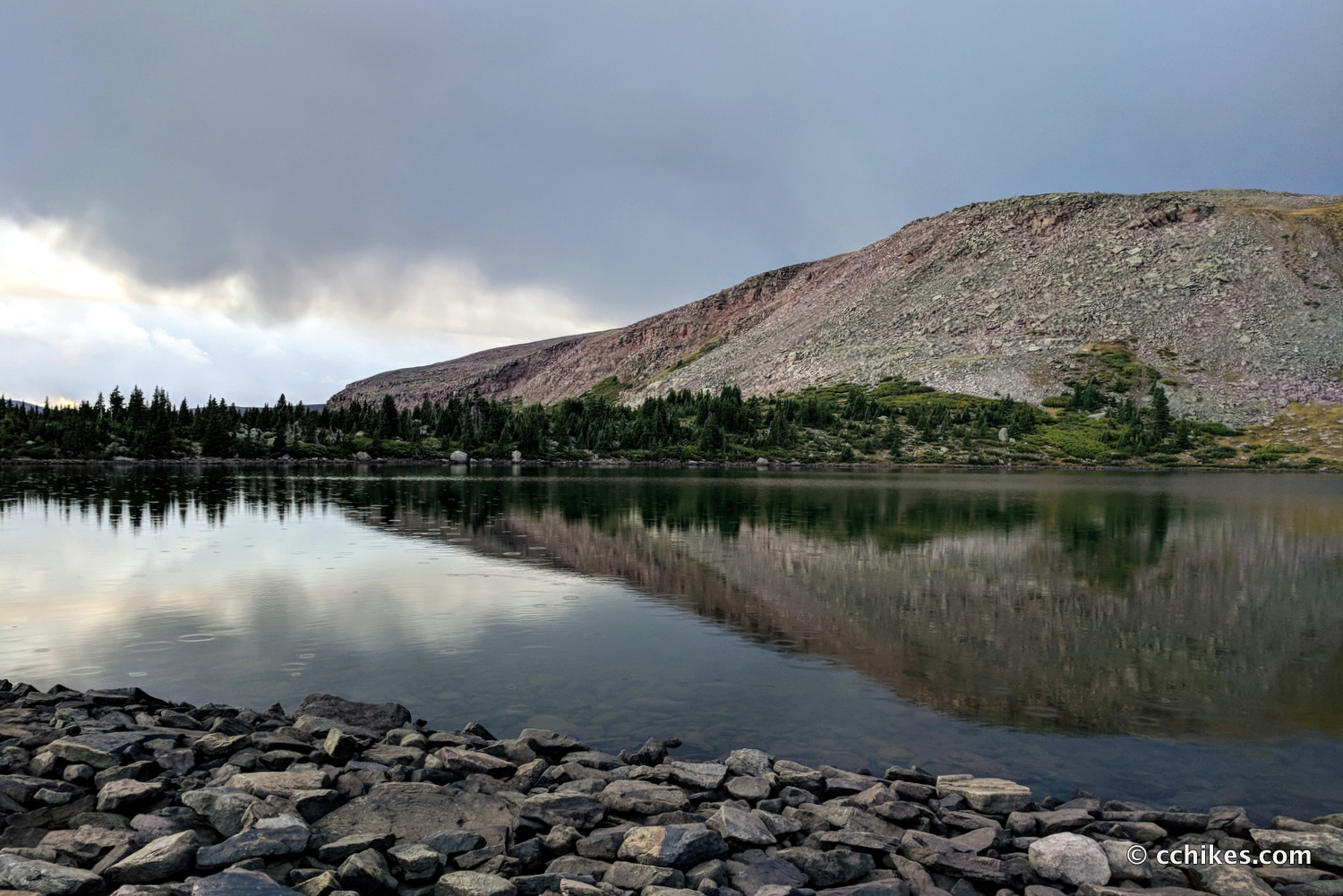
- The trail largely follows the ridgeline and offers great views of the valleys.
- The trail is mostly above the treeline and features vistas of grassy expanses and rocky passes.
- The trail is filled with lakes, rivers, and creeks, meaning I won’t have to carry much water (my heaviest gear after food).
- The High Uintas are very remote and uncrowded, meaning I’ll find the solitude I love until I get bored.
- The High Uintas are filled with a diverse array of wildlife.
- The lakes and rivers are filled with fish, so I may experiment with an ultralight fly fishing rig.
- I get to experience a new city (Salt Lake City) upon completing my hike.
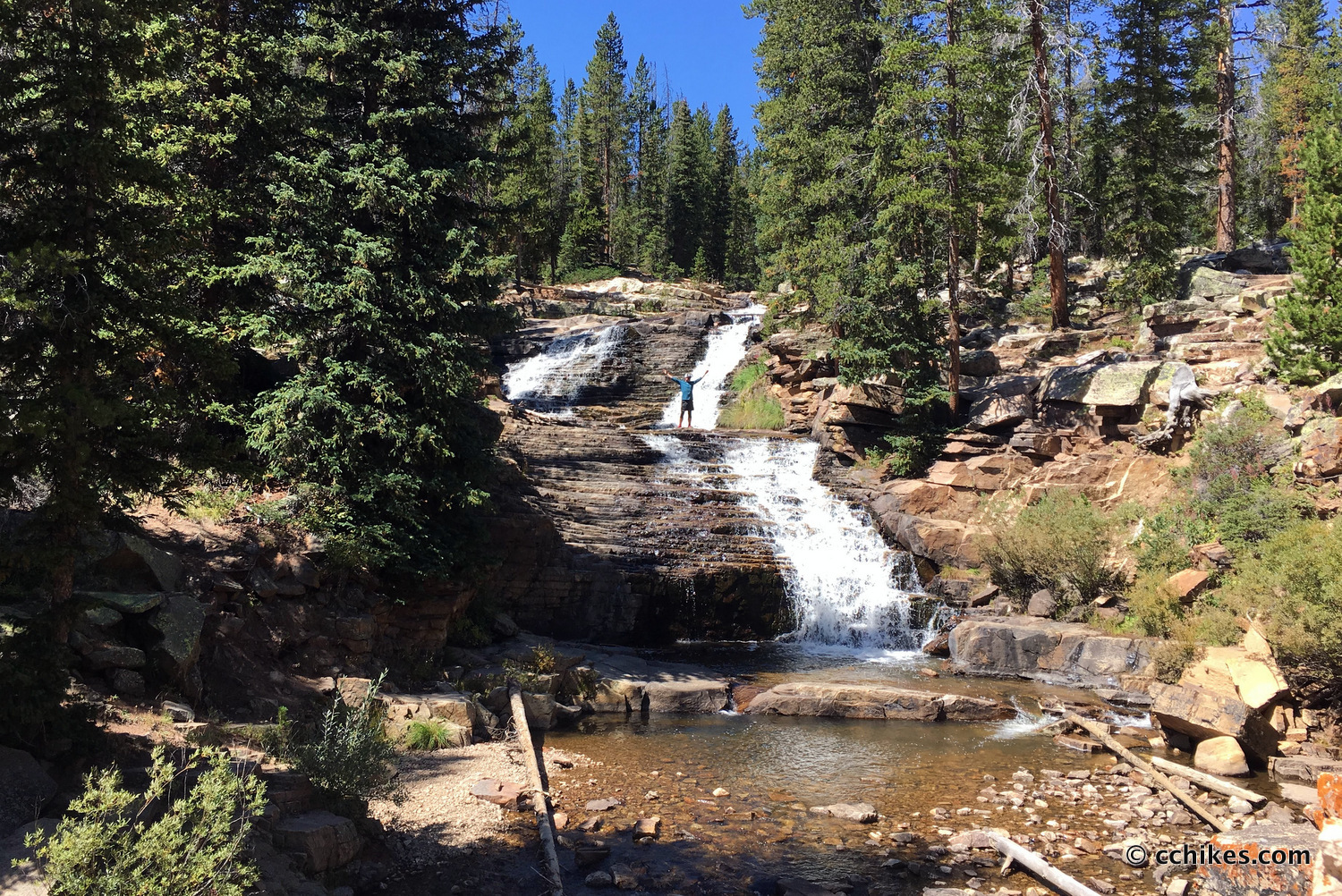
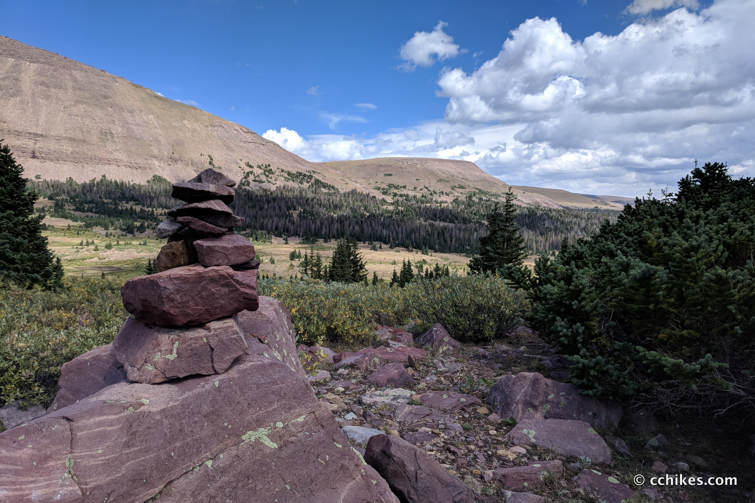
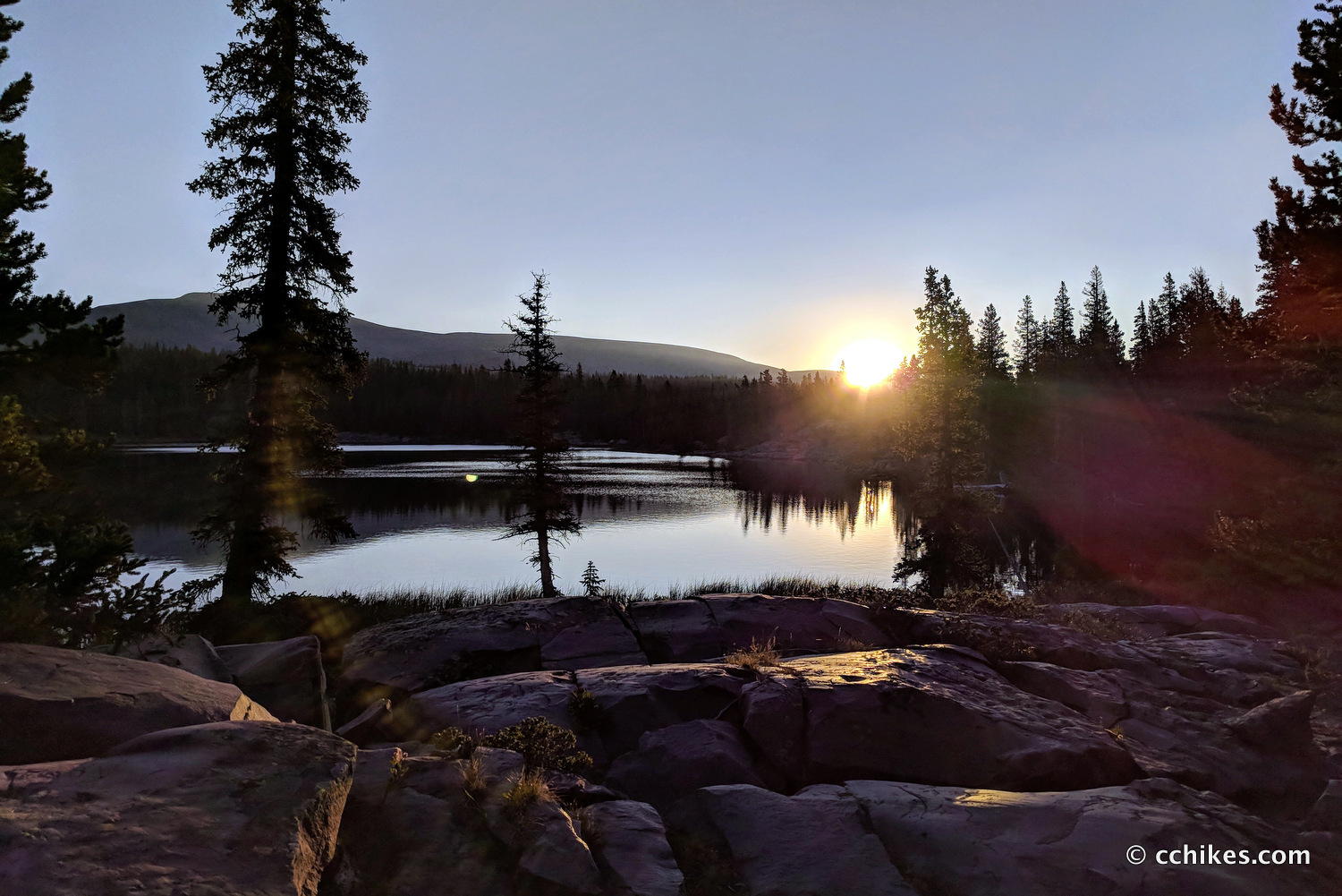
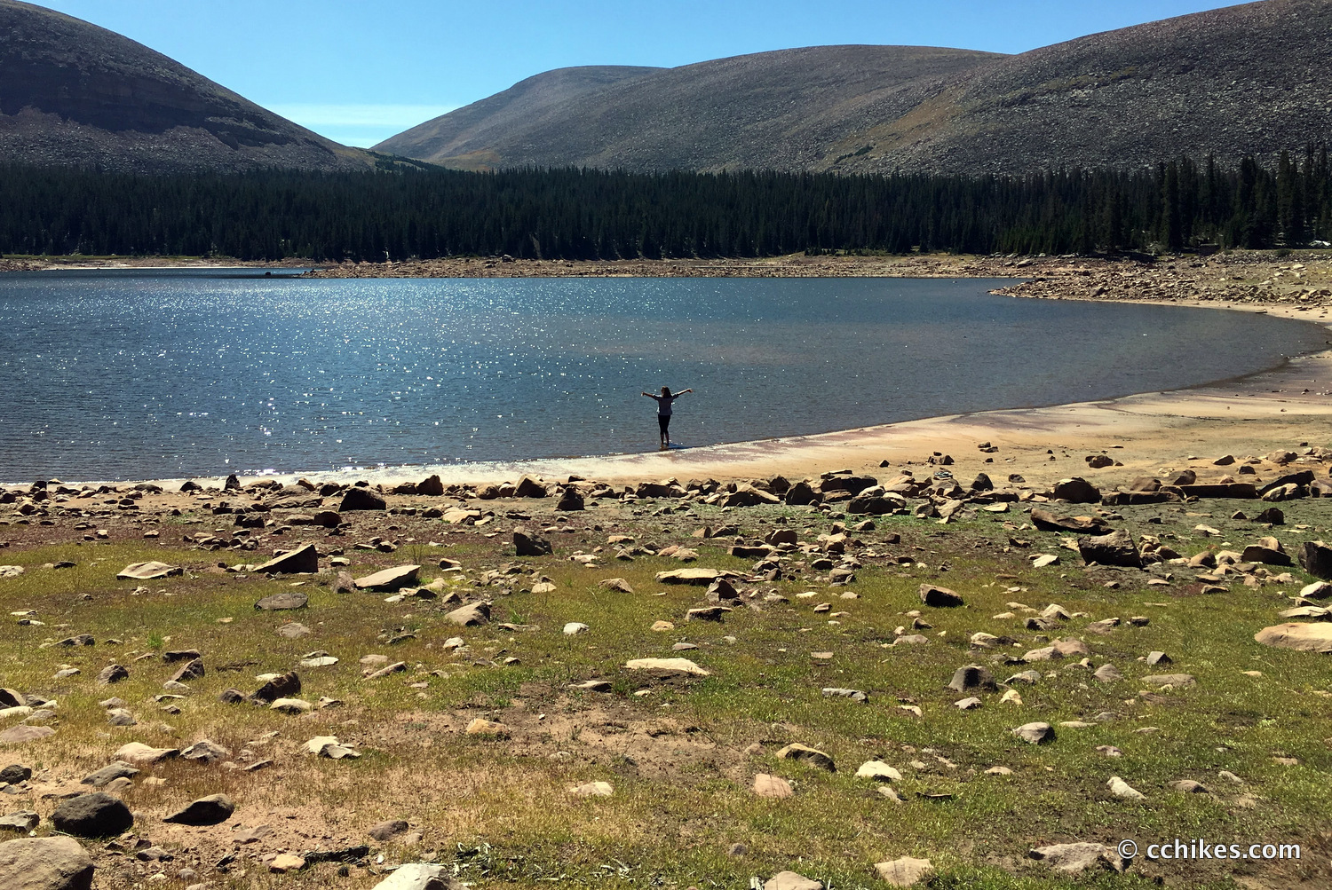
Take a look at the GPS map of the area and scroll down this webpage for some pictures.
The only drawback to this trail is one of its most attractive features to me—its remoteness. Getting dropped off at the eastern trailhead and picked up at the western trailhead will be a challenge, and likely an expensive one. And having a pre-planned exit time will leave little room for flexibility. But that’s a trade-off you make any time you decide to go to the middle of nowhere and walk to another part of nowhere.
Change of plans
When I told my girlfriend about the High Uintas, she showed an enthusiastic interest in joining me. She was enamored of my photos and videos of the JMT and wanted to do something similar. That was a game-changer. She can’t do the big miles that I like and doesn’t have the kind of vacation time that I enjoy, but we worked out a compromise plan that would allow us to do the 65.1 westernmost miles of the trail in 5½ days (around 12 miles per day). This section features 12,204 feet of elevation gain and is rated as moderate hiking. It’ll be tough climbing over the high passes, but it’ll be rewarding as well.
Here’s a contour map of the section we’ll be doing.
She’s going to do more hiking and treadmill training in the meantime to tease up her average walking speed and I’ve promised to slow down. If we average around 12 miles per day, we should have plenty of time to lounge around during the day and after making camp in the late afternoons. I’m not used to downtime, but I’m also not used to having someone with me. It might finally be time to pull the trigger on that ultralight Tenkara fly fishing rig I’ve had my eyes on.


Don Coleman
Hi Chad,
I just saw your post when I was searching UHT trailheads. I hiked the JMT last July and I’m taking my wife on the UHT the last week of July. I haven’t decided which direction we will take yet but possibly starting at Leidy Peak Trailhead.
When are you planning your hike?
Chad Chandler
We’re planning to do it the last week of August. That way, we get to spend a casual Labor Day at home afterward. We’re planning to start at Chepeta Lake and walk to Hayden Pass. I like the idea of walking west toward Salt Lake City, but nothing is set in stone yet.
Let me know how you plan to get to/from the trailheads. The shuttle service is really expensive, but you’re basically asking someone to spend an entire day in the car to drop you off. It’s actually cheaper to get dropped off at Leidy Peak, but my girlfriend can’t do the bigger miles that would require per day.
Edit 2019: The shuttle service linked above has gone out of business.
Scott Briggs
I’m planning on doing this with some buddies July 20-24th. I wish we could find someone to trade cars/keys with – that shuttle service is quite pricey.
Marit
Hi Scott Briggs,
You still trying to do it? We are looking at doing the 21st, maybe we could split the shuttle?
Don Coleman
Scott,
We’re planning to hike from Chepeta Lake to Hayden Pass July 23 to 27. My father in-law will drop us of and pick us up (hopefully). I’m up for trading car keys but our dates don’t match up.
Don Coleman
I’ve put together a route and track for GPS if anyone needs a copy.
John
Don,
I’m interested in the route and GPS track.
Keller Newton
Hey,
I’ve done the Jmt alone. This looks interesting to me. Is the trail marked well?
Thanks for any help
Chad Chandler
No, the Uinta Highline Trail is not well marked at all. You will absolutely need a GPS map on your smartphone. At high elevation, there are large cairns to follow. But it can be very difficult to follow the footpath through the forest. There are small cairns (maybe three stones high) in some places, but you will have to pull out your phone frequently to check that you’re on the right track. It’s also unlike the JMT in that you may go days without seeing anyone. If you have any other questions, let me know. I’m happy to help.