


The Twin Falls area (not to be confused with Twin Falls in Pickens County, SC) features two 100-foot waterfalls that are very close to one another. The falls are in a well trafficked (but somewhat confusing) trail system in Pisgah National Forest near Brevard, North Carolina. I always prefer loop hikes over out-and-backs, so I used the interconnecting trails to form a 6½ mile loop.
Orienteering
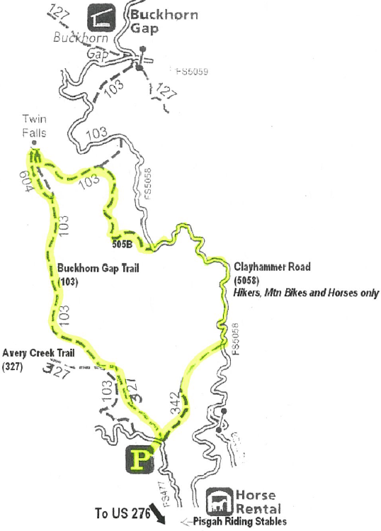
If you plan to hike the loop as well, you might want to print this map before heading out.
-
- Turn off US 276 onto National Forest Road and drive toward the riding stables. Reset your odometer at the intersection. Drive exactly 2.3 miles. You will pass campsites and the stables and head up the winding mountain road. The Avery Creek trailhead is down a steep hill on the right and is very easy to miss. The road widens a bit and there is enough room for a few cars to park. My Camry was able to slowly negotiate the gravel road, but a truck or SUV with higher clearance would be preferable.
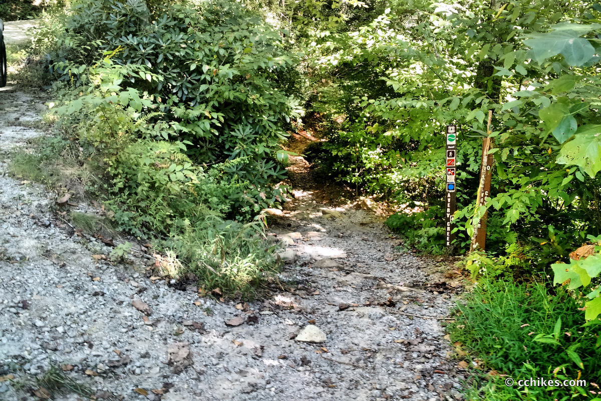
- Take the Avery Creek Trail (blue blaze). You will quickly come to the intersection with Clawhammer (called Clayhammer on the map) Creek Trail. This is where the loop closes, so keep that in mind for later in the day when you’re headed back to your car. Just keep hiking straight (a.k.a. left) until the trail intersects with Buckhorn Gap Trail (orange blaze). Bear right onto the trail.
- The trails converge for a while (blue and orange blazes). You will hit another confusing intersection near a campsite. Buckhorn Gap Trail (orange blaze) will seem to go straight and to the right at the same time. Take the right, cross the footbridge, and then notice the double blaze. This indicates that you will immediately turn left.
- Buckhorn Gap Trail will eventually split off Avery Creek Trail and turn to the right. If you’re doing an out-and-back hike to the falls, this is a turn you must remember. It would be very easy to simply continue on Buckhorn on accident. If you do that, simply take Buckhorn Gap Trail all the way back to the gravel road and then walk down to where your car is parked at the Avery Creek Trailhead.
- You will see a side trail to Twin Falls (yellow blaze) on the left. Take this a few hundred yards to the waterfalls.
- When you get your first glimpse of the falls, you’ll notice a flat campsite on the right side of the trail (higher than the creek). Just before this campground is a path that leads back down to the right. That is where you will go after exploring the falls.
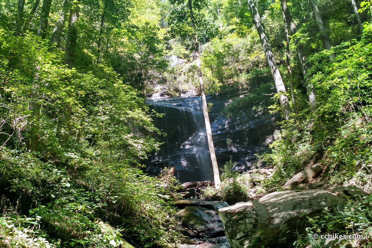
- Have fun hiking all around the first waterfall, which breaks in several stages. There are trails that take you to the top and to the other waterfall. From the base of the second waterfall, there are several paths that aren’t really trails. Bushwhacking is discouraged here. This picture of the first waterfall doesn’t even come close to showing the top cascade that is hidden behind the canopy.
There is no cell reception in the area, so make sure you get your navigation app up and running before you get into the middle of the forest. The road that leads to the stables is just northwest of the US Forest Service Ranger Station. The Google Maps link below will take you to the turn-off. I think it will take you all the way to the trailhead, but I haven’t tested it. Let me know in the comments if the coordinates are accurate or not.
Here’s a set of hiking instructions that you should print or screenshot before you start out on your hike. Note that some of these trails are designated as hikers-only, some allow hikers and mountain bikers, and others allow hikers, bikers, and horseback riders. That means there are footbridges for hikers and water crossings for bikers and horses. It can be confusing at times, but a little common sense should be enough to keep you headed in the right direction. I ran across several people who were hiking and biking in the area. Everyone seemed to be a little sketchy about where exactly they were and I was pleased to be able to compare maps.
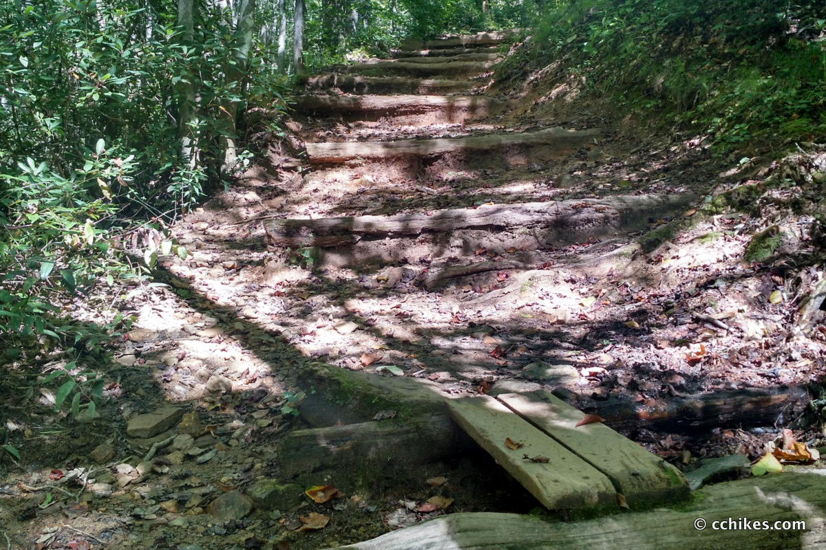
- Hike back to that campsite on the main trail and down towards the creek. You will hike with the creek on your right until you reach the hitching posts. The path seems to continue following the creek, but you want to walk through the hitching post area and pick up the trail that goes up the hill on your left. This is Buckhorn Gap Trail again. This section features the most strenuous elevation of the entire loop.
- The next juncture is confusing. The trail is closed to the left and you can go uphill or take a right. Take the right and walk until you reach a gravel road.
- Turn right onto the gravel road and walk until you see the trail marker for Clawhammer Cove Trail on the right. It’s around a half a mile before you need to really look, but keep in mind that the marker for the next trail is in the woods and easy to miss. Watch out for mountain bikers while you’re walking on the road.
- Turn right onto Clawhammer Cove Trail and hike until it intersects with Avery Creek Trail. This is downhill or flat the entire way. Trekking poles go a long way toward minimizing the jarring on your ankles and knees.
- Finally, turn left (more like switch back) onto Avery Creek Trail and walk uphill until you get back to your car.
Impressions
Everyone seemed to be confused about this trail system. I couldn’t find the trailhead at all and drove all the way back to the Pisgah Ranger Station. As soon as I said “I’m looking for Avery Creek,” the ranger said, “2.3 miles.” I remarked on how that was an oddly specific number to have memorized and he told me that he gets asked that question all the time. So apparently I’m not that big of an idiot.
I really liked this loop. There are several smaller waterfalls along the route, but make no mistake—Twin Falls is the spectacle here. Just make sure to bring some bug spray regardless of the time of year unless you want to hear buzzing in your ears the entire time you follow the creeks.
The terrain was moderate at worst and mostly easy. I was really testing myself and did the 6½ miles in under three hours with a break at the falls. I couldn’t help but wonder if you might be able to get a photo of both falls at the same time during winter when there are no leaves on the trees. I will definitely be back in the winter with my DSLR and a monopod to get some long exposure shots of the falls.
Update
I revisited this area in spring of 2017 and camped at the site adjacent to the falls. To add more mileage, I started at Pink Beds and walked over Black Mountain to reach the falls.
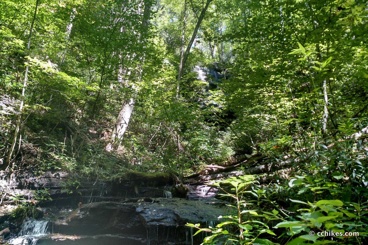
I went back again in spring of 2018 after heavy rains and got this photo beneath the cascade of the second waterfall.
Navigate
More
Discover more North Carolina trails.
Discover more loop hikes.
Discover more waterfalls.


Leave a Reply