


As I’ve said before, I’m more of a hiker than a camper. Even though hikers camp and campers hike, the best part of backpacking for me is the walking. I don’t blog most of my backpacking trips because I start walking when the sun comes up and I make camp when the sun sets. Then I eat and go to bed. At dawn, I pack up and walk until the sun sets. I make camp, eat, and go to bed. Rinse and repeat. It makes for boring reading. I’m blogging this trip because it was a fun, new way to get to a great destination.
Twin Falls is a marvelous attraction tucked just a few miles past the riding stables in Pisgah. Because the area is known more for mountain biking than hiking, and because the closest trailhead involves driving on unpaved forestry roads, it’s never very crowded. At least, it’s not crazy crowded like nearby Moore Cove Falls, Looking Glass Falls, Cove Creek Falls, Cedar Rock Creek Falls, and Daniel Ridge Falls.
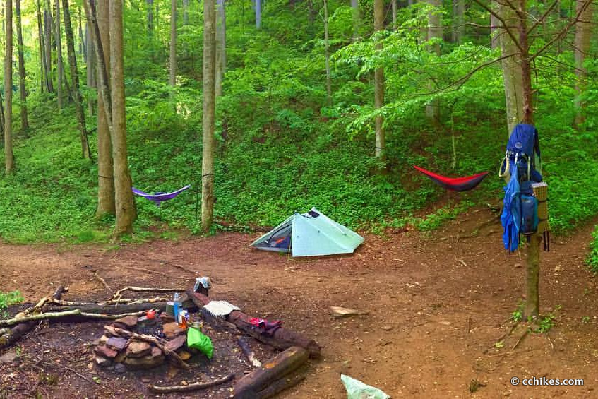
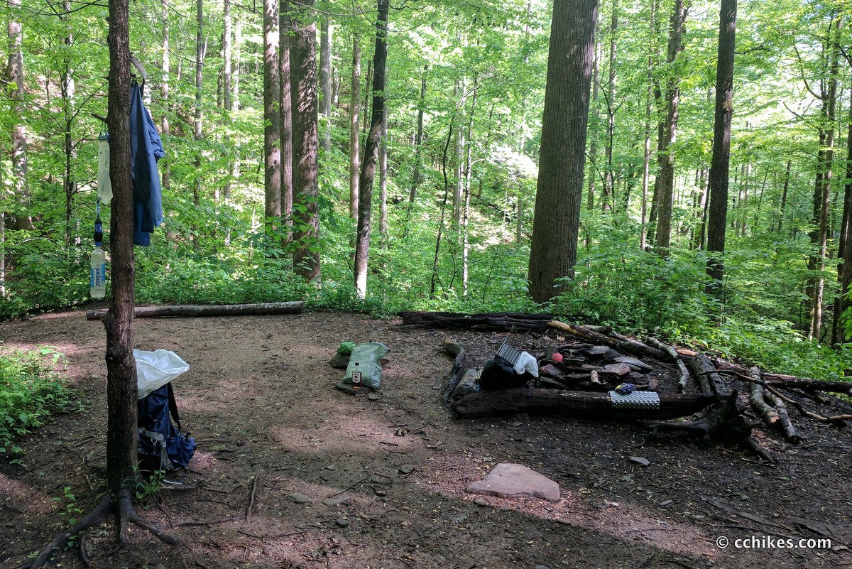
The last time I was in this area, I spotted a campsite where you can actually see both waterfalls from a single vantage point. It’s only big enough for a couple of tents, so it’s not the kind of place where you’d set up next to a stranger’s camp. That said, you could maybe squeeze a few tents in if you were with a group that was planning to camp together. The downside is that the trail runs directly through the campsite. If you’re looking for seclusion, then this is not the site for you. If you want a picturesque campsite, and you don’t mind company, then this site is hard to beat.
Day 1
The easy way to get to Twin Falls is via the Avery Creek/Clawhammer Trail Head. To tack on some elevation and miles, I parked at the Pink Beds Recreational Area. If you plan to hike this way as well, you might want to print this map before heading out.
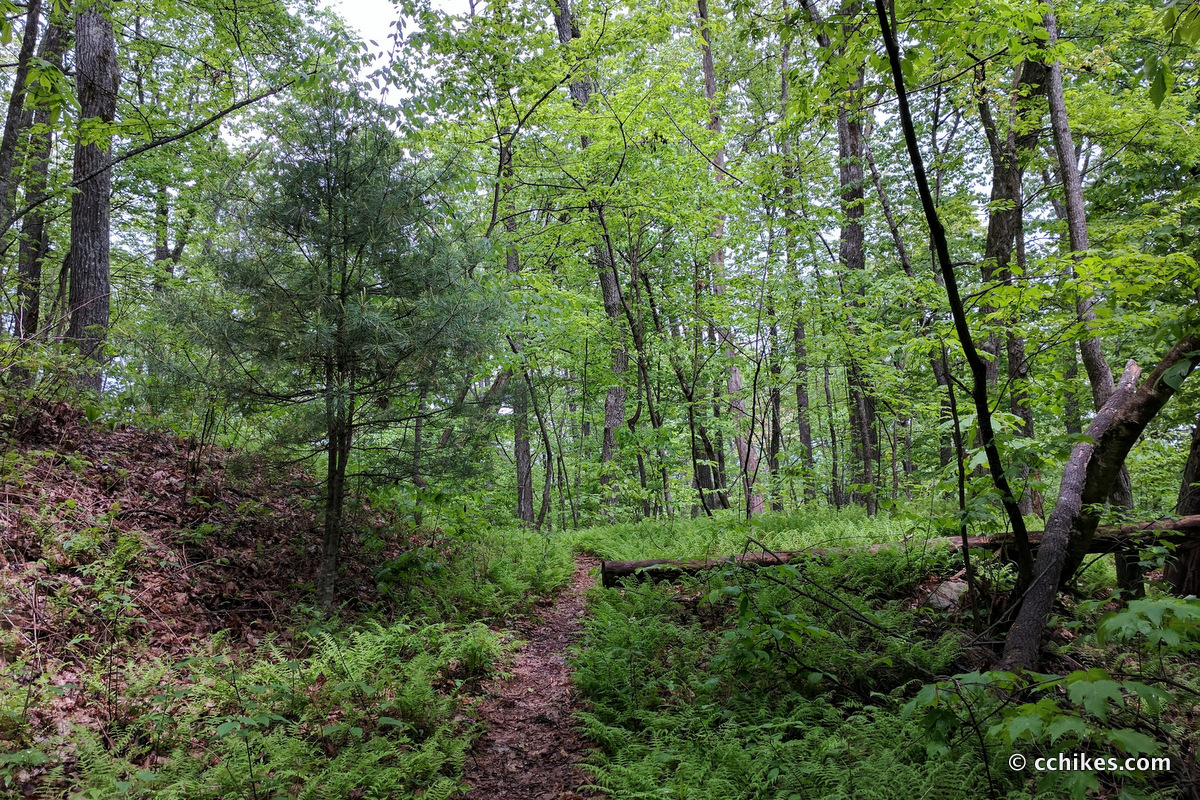
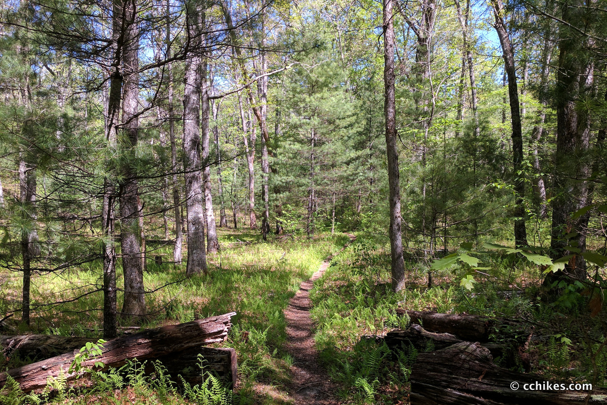
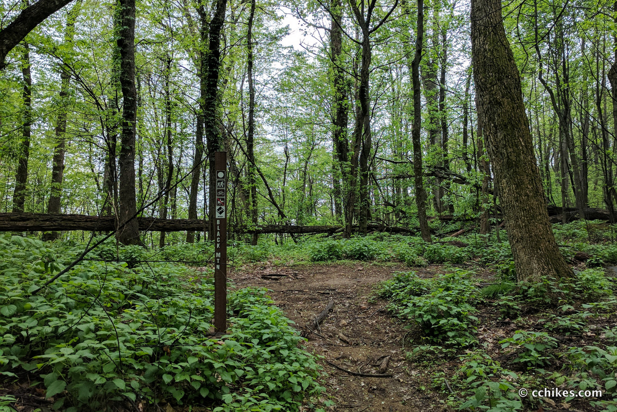
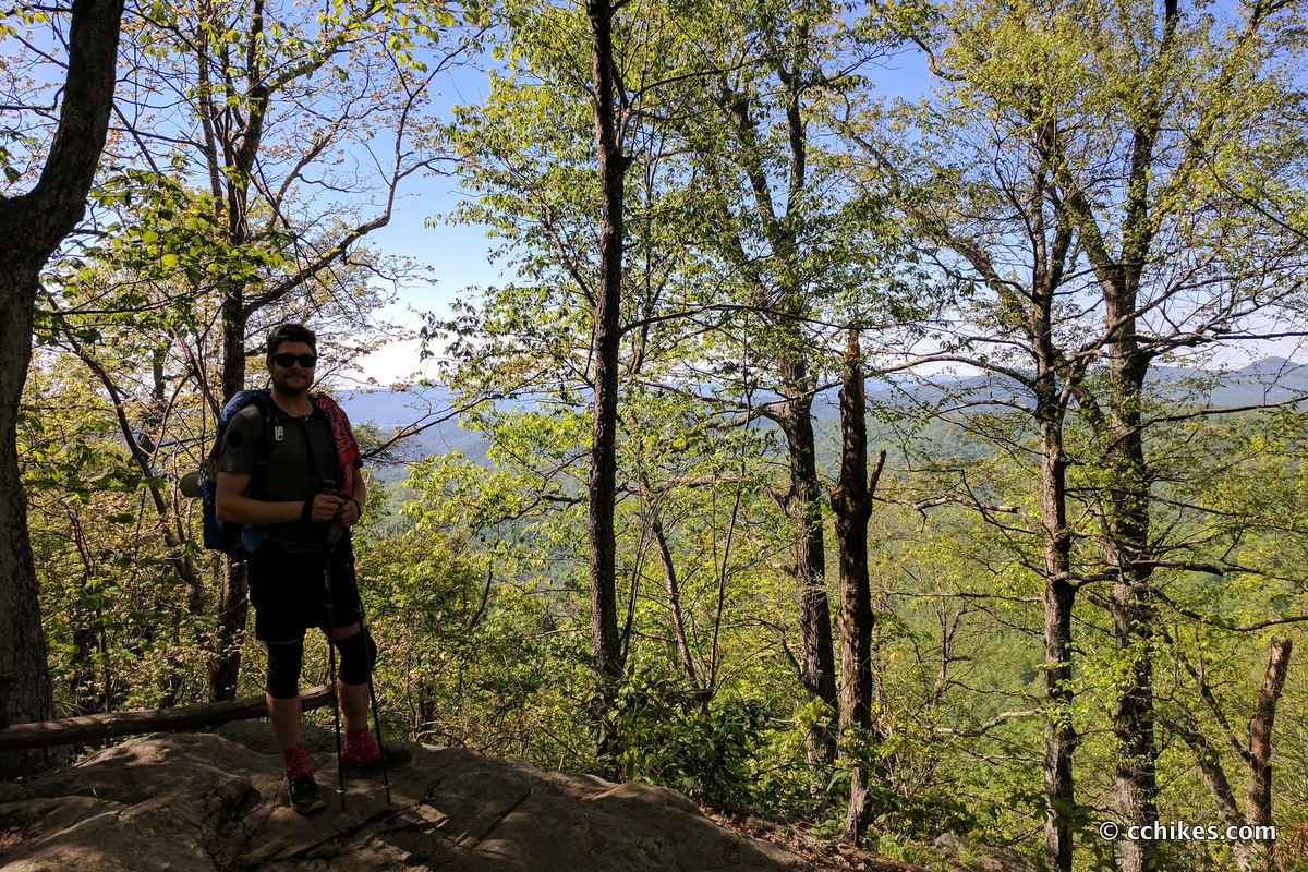
I took the northern part of the Pink Beds Loop to the cut-through at Barnett Branch. I turned right and eventually crossed the southern part of the Pink Beds loop and continued on Barnett Branch. This trail ascends the mountain. When you turn left on Black Mountain Trail, you’re walking the ridge. This is my favorite kind of hiking because you can see the view on both sides of the mountain.
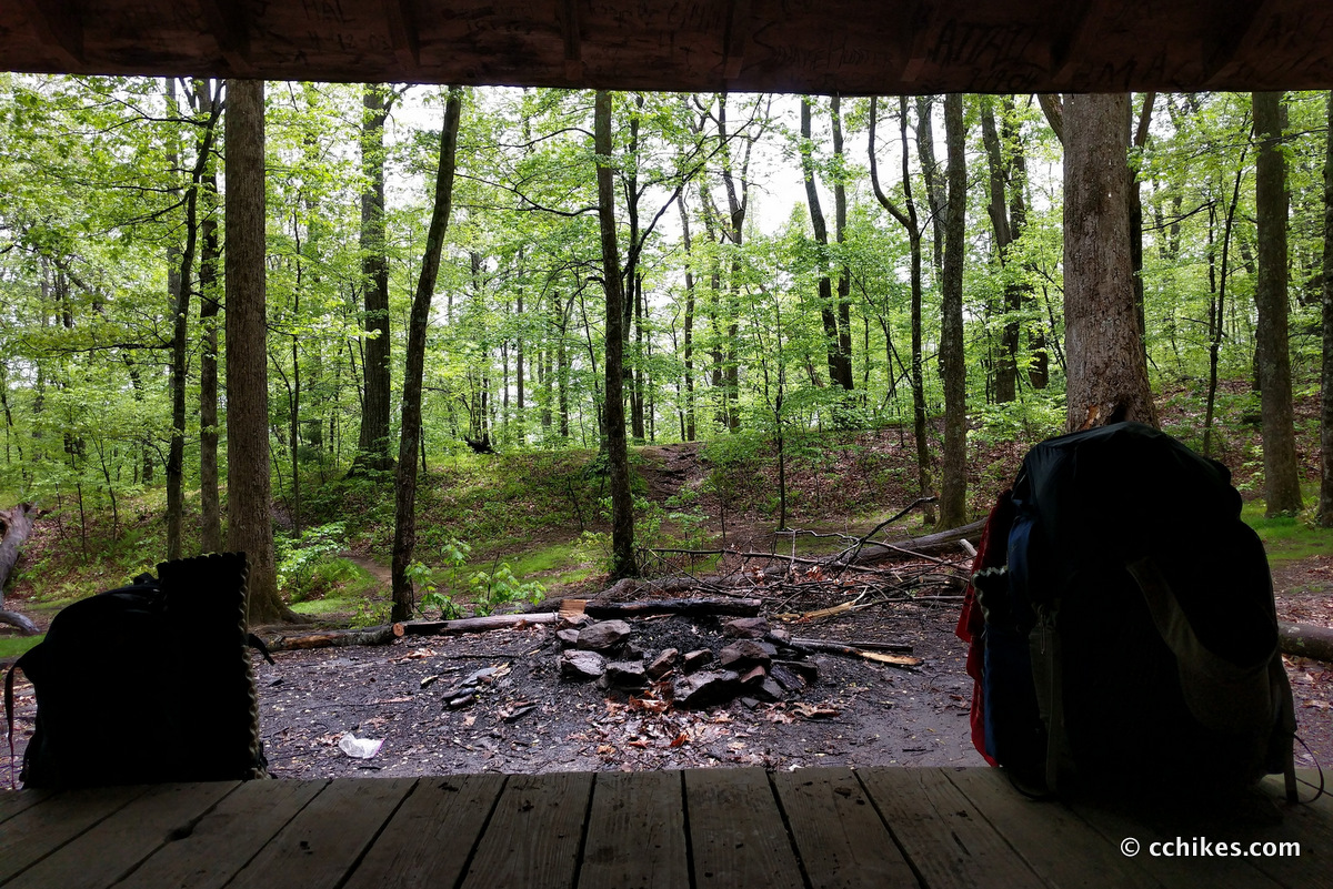
After doing some light descending, you come to the Buckhorn Gap Shelter. The shelter looks like it sleeps around a dozen people, but the campsite is massive. You could bring a big group here. I didn’t see an apparent water source, but I only sat here long enough to eat a snack while waiting for a break in the light rain.
The trail intersects with Buckhorn Gap (sort of—you still have to walk the road) and FR 5058. I could have taken a very short trail to circumvent walking on some of 5058, but it was raining hard and I didn’t feel like splashing in the mud. I took the gravel road down the mountain instead. The turn from the road onto Buckhorn Gap Trail is very easy to miss. It sharply drops off the right side of the road and heads straight down the mountain to the river.
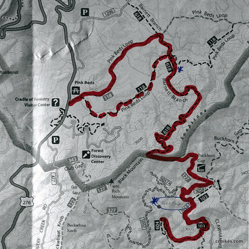
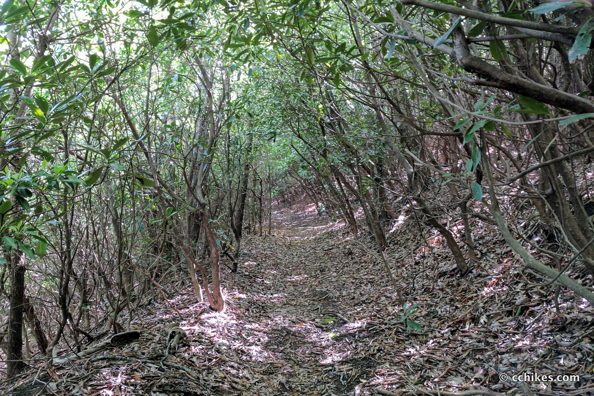
As I noted the first time I hiked the Twin Falls Loop, Buckhorn Gap Trail is confusing where it meets the river. There’s a T-intersection and every trail purports to be Buckhorn Gap. That doesn’t make sense. Just to be clear, you hit the water and turn right. This part of the trail is gorgeous; it’s like a forest setting in a fairy tale.
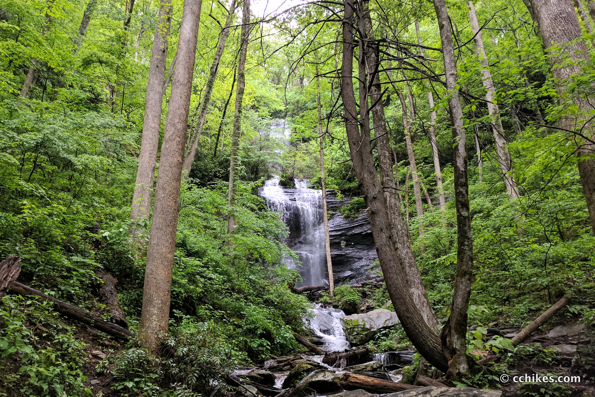
Take the trail across some rivulets and eventually it will pop you out on Avery Creek Trail at the campsite. From the campsite, you can see both waterfalls. There are trails all over that allow you to explore the attraction. Naturally, I somehow only managed to photograph one of the falls. Oh well.
It’s wonderful to hear the echoes of both waterfalls ringing through the small valley all night long. In the more camp-friendly months, you can expect to see people coming and going through the trail. But thanks to the poor weather, we had this site practically to ourselves. Over the 18 or so hours we camped here, only two groups (totaling 6 people) passed through to see the falls. None of them spent the night.
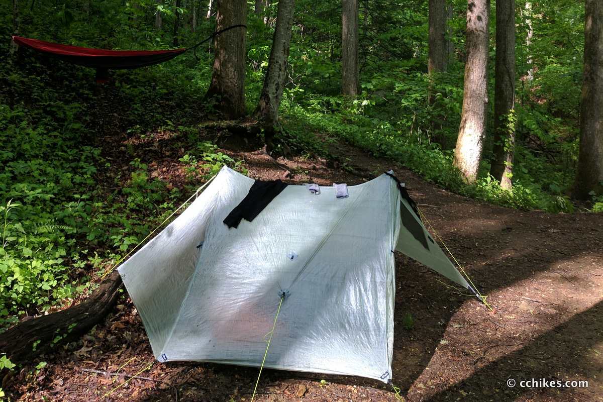
I’m planning to post a review of my Zpacks Duplex tent, so I took a time lapse video of me setting it up at the campsite.
Day 2
The next day brought a blue sky and bright sunshine. It didn’t do much to dry the muddy ground, but we were thankful nonetheless.
I followed the same path out, except I took the southern part of the Pink Beds Loop (the dashed red line on the map above) back to the car. If I had to guess, I’d say the mileage was between 6–7 miles each way, making this about a 13 mile overnight hike. This was much more gratifying than just walking in from Avery Creek/Clawhammer.
Impressions
Twin Falls never fails to impress, and this campsite is the optimal place to take it in. If you plan to camp next to the falls, get there early. There aren’t any other flat camping areas around. You can find plenty of places for hammock camping, but this is the flattest and driest ground in the immediate area. If this area had been taken, I probably would have backtracked to the intersection where Buckhorn Gap meets the water near the hitching posts.
There’s really only one mountain to climb along this route. The summit is the intersection of the Burnett Branch and Black Mountain Trails. If you’re traveling with people who are more into camping than hiking, you can assure them that’s it’s mostly an up and over hike from both directions.
This area is more like a rain forest than anything else due to the mist from the falls. You definitely want to bring bug spray. I exclusively use Ben’s 100% DEET Mosquito, Tick and Insect Repellent. They offer a new water-based formula that I tried on this trip. It still smells and tastes awful, but it’s easier to wash off. I only got one bite the whole time I was there, and I usually look like I’ve come down with a case of chicken pox.
Pink Beds is probably the flattest hiking trail in all of Pisgah National Forest. There was a great campsite on Burnett Branch not long after the intersection with the northern part of the Pink Beds Loop (see the blue asterisk on the map—the coordinates are 35.36221,-82.76078). It was large, relatively flat, and close to water. If I was taking my young nephews camping, I would stay there overnight and walk back on the southern part of the Pink Beds loop. That would be a mere 4-mile weekend trip that featured more camping than hiking.


Kevin J Moore
Enjoyed your post about twin fall at Pisgah national forest plannig on a trip there with my dog for 14 days, probably around Jan, or Feb 2022 any thoughts or suggestions?
Chad Chandler
Hi, Kevin. When you say primitive camping, are you talking about backpacking or camping near your car off a forest road?
Twin Falls is not a great place to camp. There is really only one flat ground campsite and it’s right on the trail. We only camped there because we got in at dusk and were only spending one night. We left early the next morning.
If you want other places to camp in Pisgah, there are campsites that are first-come, first-served on the way to Courthouse Falls. You can park your car in one of those sites and then set up your camp. That way you have access to a cooler and other supplies. You’re not far from the Blue Ridge Parkway if you want to do some day hikes up there as well. The gate will probably be closed that time of year, but you can park at the gate and then walk the parkway. You’ll need to call the Forest service to make sure that the gate is open before you go.
If you’re backpacking, there are tons of places in Pisgah where you can make camp. No permits or registration are required anywhere in the National Forest. Give me some more details about what you’re looking for, and I can name many places.
That said, I recommend that you go to Panthertown Valley near Cashiers, North Carolina. There’s just so much more to do in that small region. No permits are required and there are parking lots on both ends of the valley.
Best wishes!