
Cat Gap Loop is a well-populated hiking trail in Pisgah National Forest near Brevard, North Carolina. I dropped by the Sunday before Labor Day thinking that most tourists would be at one of the more popular trails in the area. Judging by the traffic, I probably wasn’t wrong, but I wasn’t right either. This place was packed.
There are a lot of campsites along the Davidson River, so people were spending the long weekend there. John Rock is a side trail off of Cat Gap. The rocky cliff face makes it a big attraction in the area.
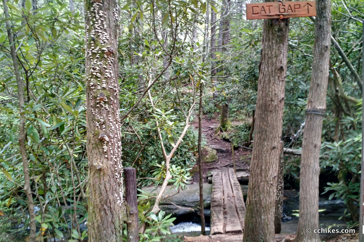
Because the loop trail begins and ends at the Pisgah Education Center/Fish Hatchery, there are public restrooms available Mon–Sat. If you just want to camp, then start the trail at the rear of the paved parking lot. You’re right on the water. If you want to hike the loop, then start on the gravel road to the left of the main building. This means you’re hiking the mountain counter-clockwise.
About the hike
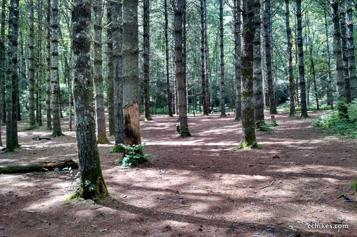
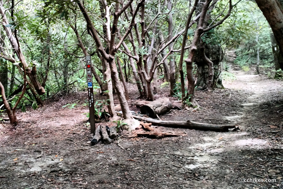
The first quarter mile of the trail is pretty easy. Once you start climbing, you’ll get few respites. That said, the trail offers an impressive array of foliage. You go from open woods to tunnels of mountain laurel to pine straw hills under evergreen canopies. But mostly it’s just mud and rocks and green tunnel. The trail is not well marked and avoiding side trails can be confusing. This is made more complicated by the fact that there is a bypass before the summit.
Cat Gap Loop is about a 4½-mile hike if you avoid the bypass and hike to the summit. It intersects with the Art Loeb trail at the top and offers the only real views of the mountains. I should add that the hike is moderate until the bypass. After that, it becomes strenuous. If you’re not in good shape, take the bypass and avoid the summit. If some of your group want to summit, and others do not, then tell them to continue on the bypass for about a half mile until the bypass reconnects with the main trail (the main trail will be uphill on the right). There is a clearing and obvious signage that they won’t miss. Tell them to wait for you there. This is also where you can pick up the trail (out and back) to John Rock, which offers the best view in the area.
When you reach the summit, there are a couple of small campsites and rest areas to catch your breath. I got to talking with other hikers who were taking on the Art Loeb Trail over the holiday. The cool breeze was so nice at the top that I was loathed to start back down.
The hike down is steeper than the hike up. You eventually intersect with the bypass trail. This can be confusing. Take the trail to the right to continue on Cat Gap. You will not see any orange blazes for a while. You’ll know you’re headed the right way when you start seeing campsites by the river. Eventually, you’ll pop out at the parking lot.
Impressions
This was a really fun hike. I’m planning to do the 30-mile Art Loeb Trail this fall, so it was good to approximate what 5 miles of that trail demands. I found the climb to the summit to be challenging, but I didn’t stop until the top. My investment in gym time is really paying dividends. A few months ago, I would have felt sick making that climb. As it was, I averaged over 2½ MPH during the elevation and over 3 MPH on more even terrain. (Update: Less than a year after this hike, I was able to day-hike the entire Art Loeb Trail in 13 hours.)
I managed this 4½-mile hike in 1 hour and 50 minutes with a break at the intersection of the Art Loeb. That’s a personal best for me. I wouldn’t aim for that pace on a multi-day hike, but I wanted to challenge myself before a lazy Labor Day by the pool.
Trekking poles are a must when tackling elevation like this. I’ve said it before and I’ll say it again—without trekking poles, your upper body strength is completely wasted on the uphills. And the security and stability provided by the poles on the downhill is invaluable. If your trekking poles double as your tent supports, then that’s even better for pack weight. I rolled my ankle on the way down the trail (I was going too fast), and I might have sprained it and fallen if my arms weren’t able to shift my body weight onto the poles immediately. That alone is worth the price of the poles.
Because Cat Gap intersects with several other trails, you can use it to create loops of varying length. I recommend the Cat Gap, Art Loeb, and Butter Gap Loop that features two waterfalls.
This hike is also very close to Daniel Ridge Trail & Falls, Moore Cove Falls, and Cove Creek Falls. Cedar Rock Creek Falls is actually just off the trail.
I’m sorry about the bad pictures. It was really humid and I was super sweaty. Every time I tried to wipe off the camera lens on my phone, I only made it worse. Lesson learned.
Navigate
More
Discover more sections of the Art Loeb Trail.
Discover more North Carolina trails.
Discover more loop hikes.


Leave a Reply