
I drive through Caesars Head State Park all time on my way to Pisgah National Forest in the Brevard and Asheville areas of North Carolina. I somehow got it in my head a long time ago that I already hiked the trails in the Mountain Bridge Wilderness. After looking at a trail map, I realized that I only really hiked the short trails with spectacles like gorge overlooks or waterfalls.
Let me begin by saying that hikers need to pay $2 per car and register at the trailhead. If you stop at the ranger station, you can pay $4.25 and cover your parking and get a color map of the trail system. I highly recommend doing this since you’ll be combining several trails to make a loop. There are bathrooms and snacks/drinks at the park office.
I’ve hiked to the Raven Cliff Falls Overlook several times. I don’t know why, but I always saw the loop hike to the actual falls as a bridge too far (pun intended). I think it’s because the park closes at 5:00 p.m. and the rangers warn everyone that the loop is a 7-hour hike because of the steep descent/ascent to/from the river valley.
The rangers are full of it. The 7½-mile hike was so relatively easy that I knocked it out in 3 hours with a long break at the suspension bridge. I went counter-clockwise and was shocked to reach the bridge after only about 3½ easy miles.
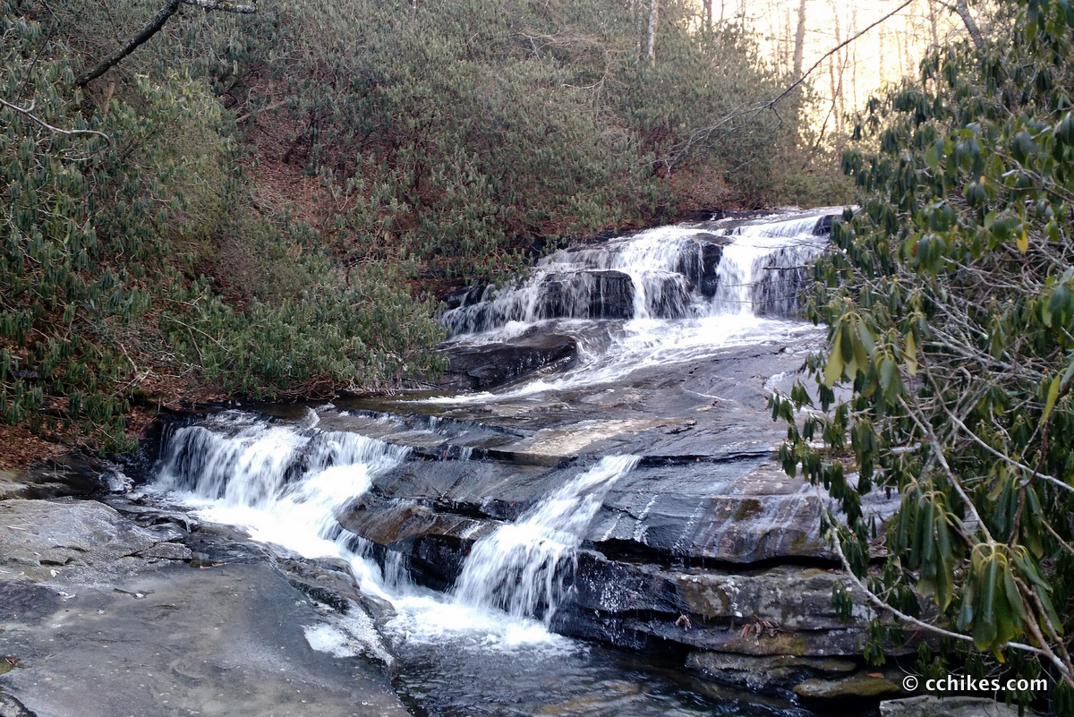
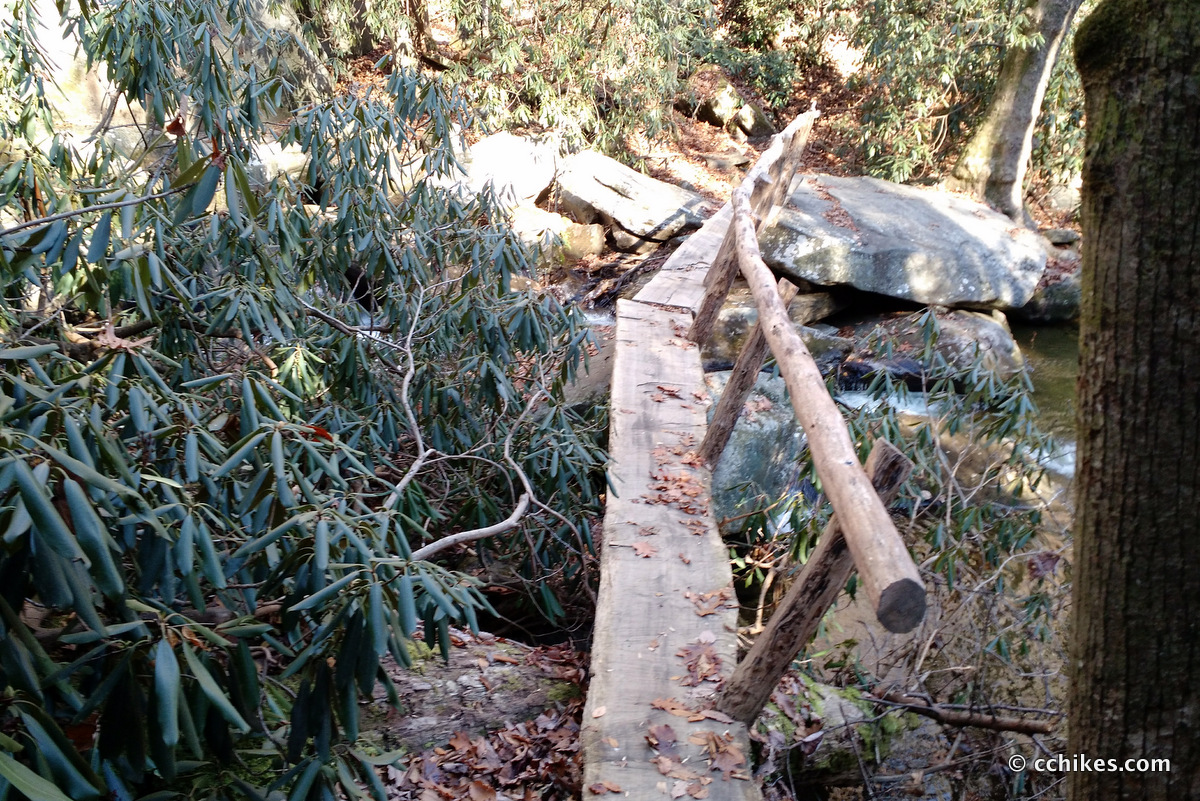
The bridge at Raven Cliff Falls is a worthy spectacle. You have cascades behind you and the drop-off into the gorge in front of you. The distance to the other side of the valley is so far that it’s hard to make out the wooden overlook on the other side.
Here’s a video of the panorama from the bridge.
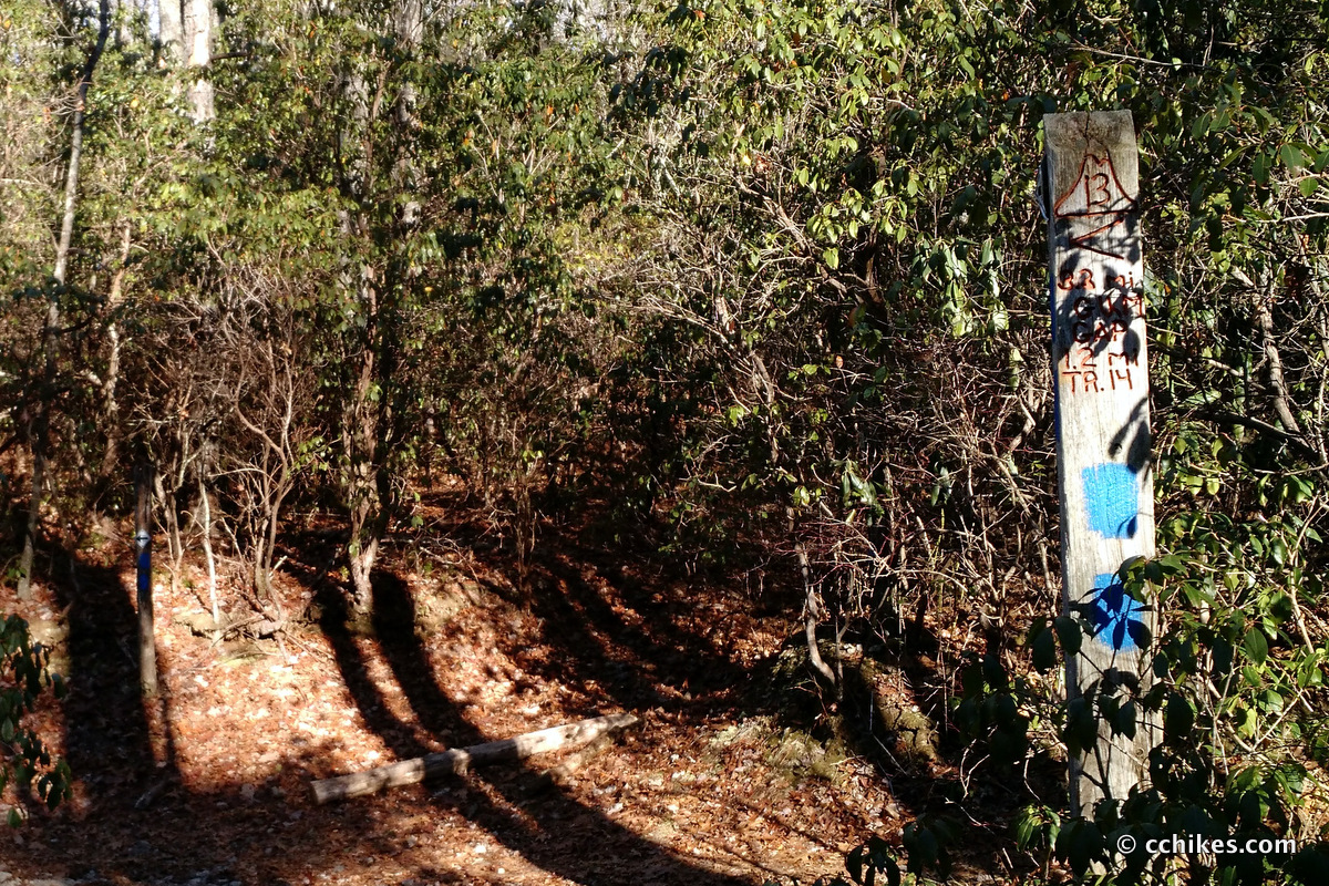
This loop is a tale of two hikes. If you take the red trail (#11) and turn right on the blue trail (#13) to the falls and back, then there is nothing even moderately strenuous about the hike. It’s easy to moderate hiking. The blue trail is an old logging road, so what little elevation you encounter is very mild. The pink trail in single-track, but it’s not steep. Anyone can do this half of the loop if they can do a basic 7-mile walk. It’s the section just on the other side of the bridge that is challenging.
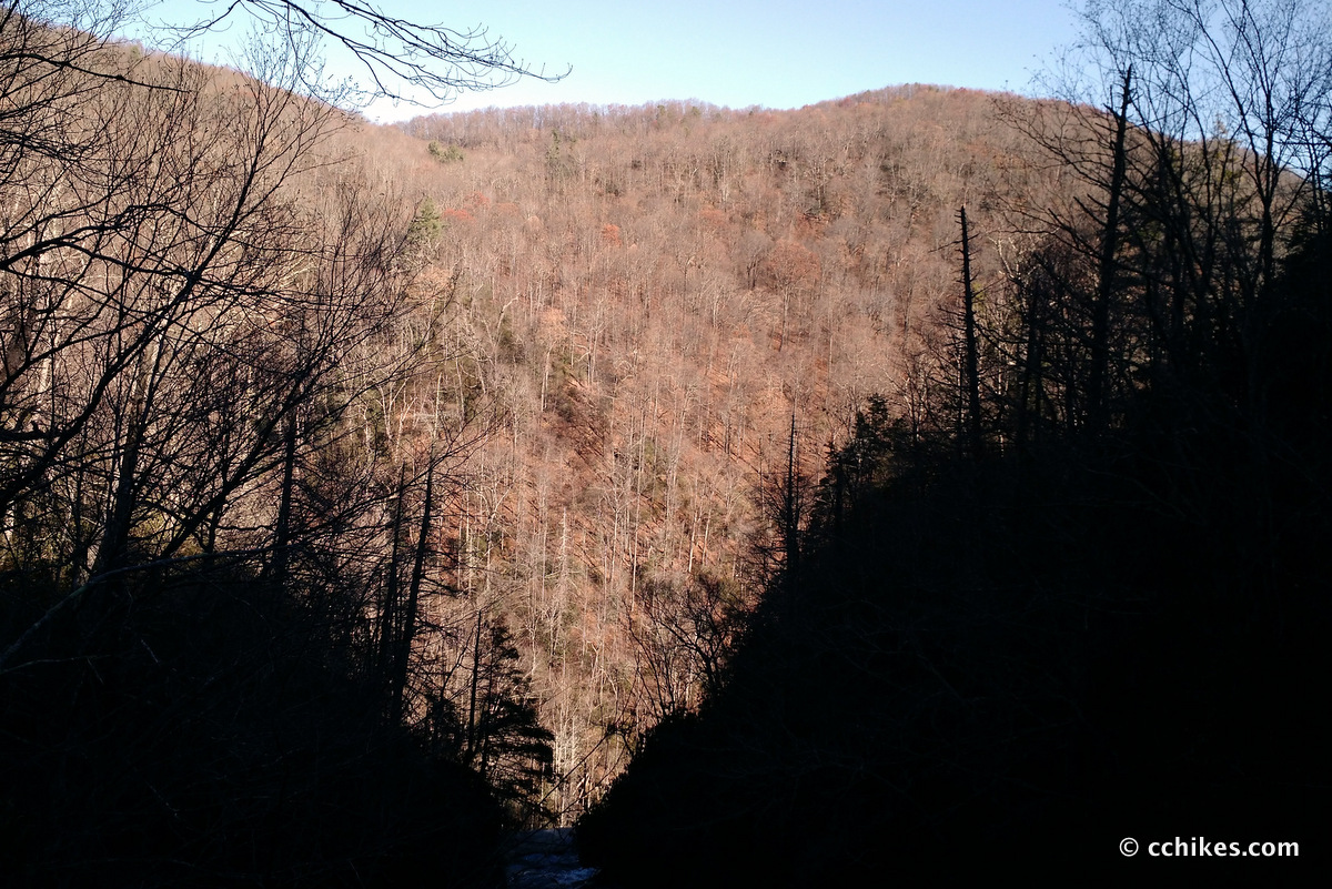
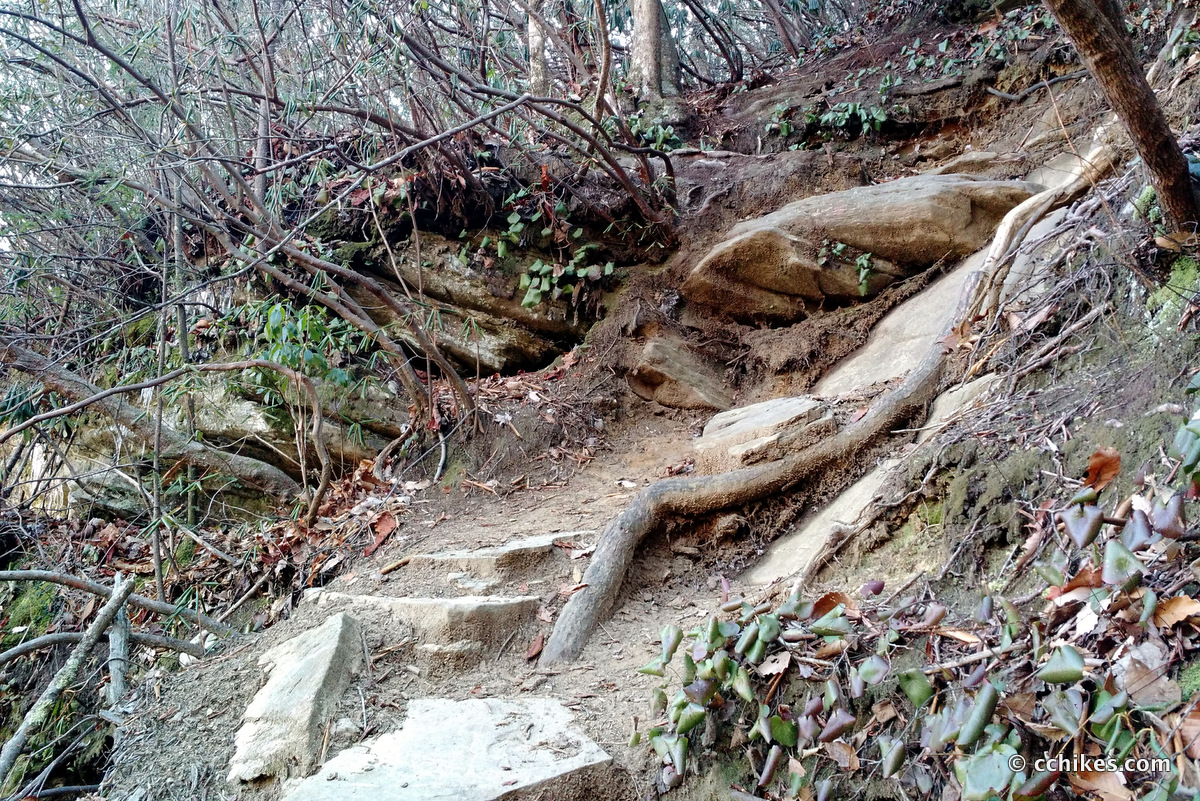
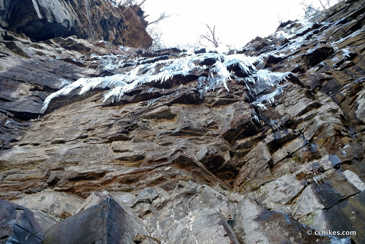
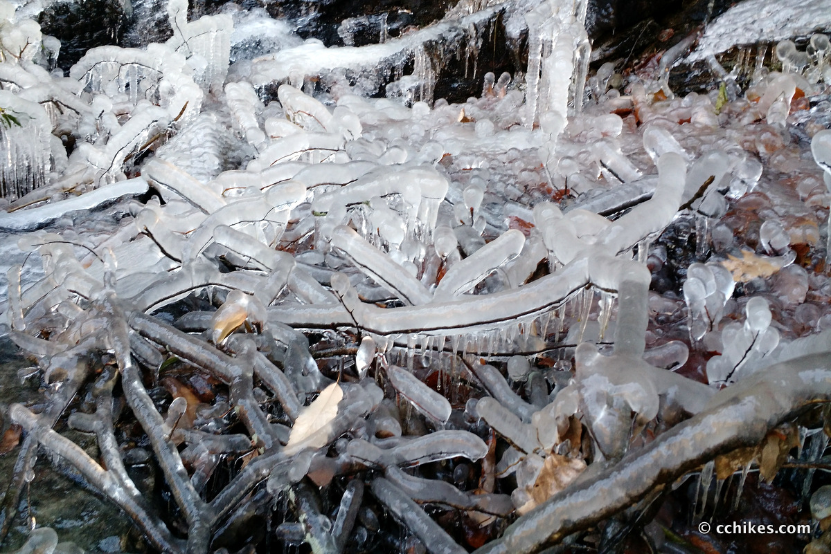
Once you cross the bridge, you are immediately forced to scramble steeply down to the bottom of the gorge. This is the most difficult and dangerous part of the loop and is not for beginners, children, or dogs. There are several wooden ladders you’ll have to climb up and down. Ledges adjacent to the gorge are icy in the cold months from perpetual shade and the trail is very steep in some places. It’s also the most fun part of the hike in my opinion.
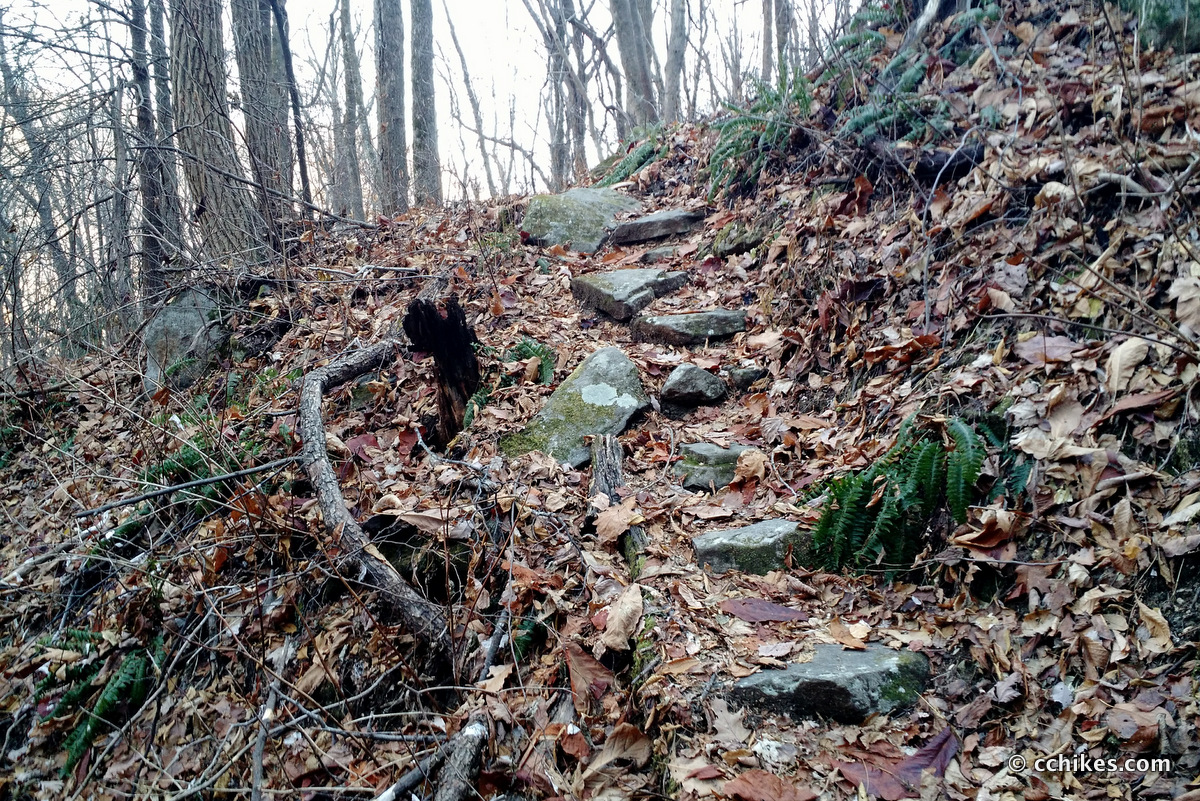
In retrospect, it would be safer to do the loop clockwise so that you’re scrambling up this section during cold weather. But I had fun nonetheless. Once you cross the river, the walk back up the purple trail (#12) is pretty gradual. It features switchbacks when necessary and sometimes follows badly old, badly eroded dirt roads as well.
If you’re in pretty good shape, the climb is not very hard. Then again, my perspective on what’s hard and what’s not has shifted since hiking the very steep Coosa Backcountry Trail. Everything seems easy by comparison.
I wore a knee brace on this hike and it did wonders at keeping my pain in check. It still hurt, especially on descents, but it was bearable. I felt very strong on this hike—so strong that I hiked the 8-mile Pinnacle Pass & Rim Of The Gap Loop the next morning. I knocked that out in around 3 hours as well, and it featured a much more difficult climb than this hike.
I never thought I’d be one of those people who get excited about walking uphill for hours, but I am. I listened to The Atlantis Gene on this hike. It’s a bit campy, but it really passes the time when you’re grinding out the miles on autopilot.
Update
I’ve done this loop many times in all kinds of weather. Like Looking Glass Rock, it’s one of the local hikes I do for exercise more than anything these days. I’ve done it clockwise and counter-clockwise in the rain and in the snow and in the heat of summer.
The vast majority of visitors to this trail system are simply hiking to the overlook and back to the parking lot. But in the warmer months, the right (blue blazed) part of the loop can get crowded too. I highly recommend getting to the parking lot (which is not gated like the ranger station) early so you can have the suspension bridge to yourself. Otherwise, you’ll be walking into a crowd.
The trail has seen a lot of love lately. Blowdowns have been removed, the antiquated metal ladders have been replaced by sturdy wooden structures, and the blazes are finally sufficient for casual day-hikers to follow without confusion. There is also a mounted map encased in plexiglass at each trail junction along the loop. Just take a picture of one display and you’ll have a map on your phone throughout your hike.
I highly recommend hiking the loop counter-clockwise and then visiting the overlook after climbing out of the gorge. It’s fun to do the work and then get to see the monumental scope of your effort at the end. An exception would be in the autumn when freshly fallen leaves make it safer to climb up and out of the gorge (clockwise) than to recklessly slide down into it.
The trail system in the Mountain Bridge Wilderness is not too large but is still pretty impressive. I challenged myself to do every trail in the wilderness in the winter of 2017, and I largely succeeded. If you’re in the area, you should definitely check it out.
Navigate
More
Discover more South Carolina trails.
Discover more loop hikes.
Discover more waterfalls.


Leave a Reply