
I have hiked this area pretty thoroughly. I’ve done the Art Loeb Trail in sections both ways and have thru-hiked it twice. Last time, I day-hiked it in 13 hours. I’ve done Cat Gap and John Rock. So imagine my surprise when someone told me about Gorgon Creek Falls along the Butter Gap Trail.
It’s not a long walk from the Pisgah Center for Wildlife Education to the falls, but I figured it would be more fun to turn this into a 9½-mile loop. I figured I’d do it clockwise so that the waterfalls on Gorgon Creek and Cedar Rock Creek would be near the end. It feels more rewarding that way. Plus, the climb up and over Cedar Rock Mountain is at the start the hike and the rest of the day is mostly downhill or relatively flat.
You can navigate to the large, paved parking lot via the map point below. Get your app up and running early. You’ll lose cell service once you enter Pisgah National Forest. There are restrooms available during daylight hours from April through October. There is no parking permit or fee. This area is very popular and the parking lot fills up quickly. So get there early to secure a spot and beat the crowd.
Orienteering
I relied on my own GPS map ↗ on my smartphone to track my progress on the trail. Many people don’t know this, but you don’t need an internet connection to ping GPS. It even works while your phone is in airplane mode. This GPS map showed me exactly where I was on the trail at all times. Feel free to copy this map or download the location data points and import them into your preferred GPS app. These step-by-step instructions will show you how to do that.
As you know, tech can malfunction, break, or run out of power. It’s prudent to take a contour map and a declination-correcting compass on your backpacking trips as well.
If you shop through any Amazon link on this website, you support me at no cost to yourself. Learn more in my disclosure.
![Pisgah Ranger District Map [Pisgah National Forest] (National Geographic Trails Illustrated Map, 780)](https://m.media-amazon.com/images/I/41tjCRmBDpL._SL160_.jpg)

Directions
If you’re not familiar with this part of Pisgah National Forest, these trails can be a little confusing. You may want to screenshot/print these instructions.
Park at the rear-left corner of the Pisgah Center for Wildlife Education parking lot. You’ll start the trail there by the Davidson River. Follow the orange blazes alongside the river and up the mountain. Make the climb past the John Rock detour and towards Cat Gap.
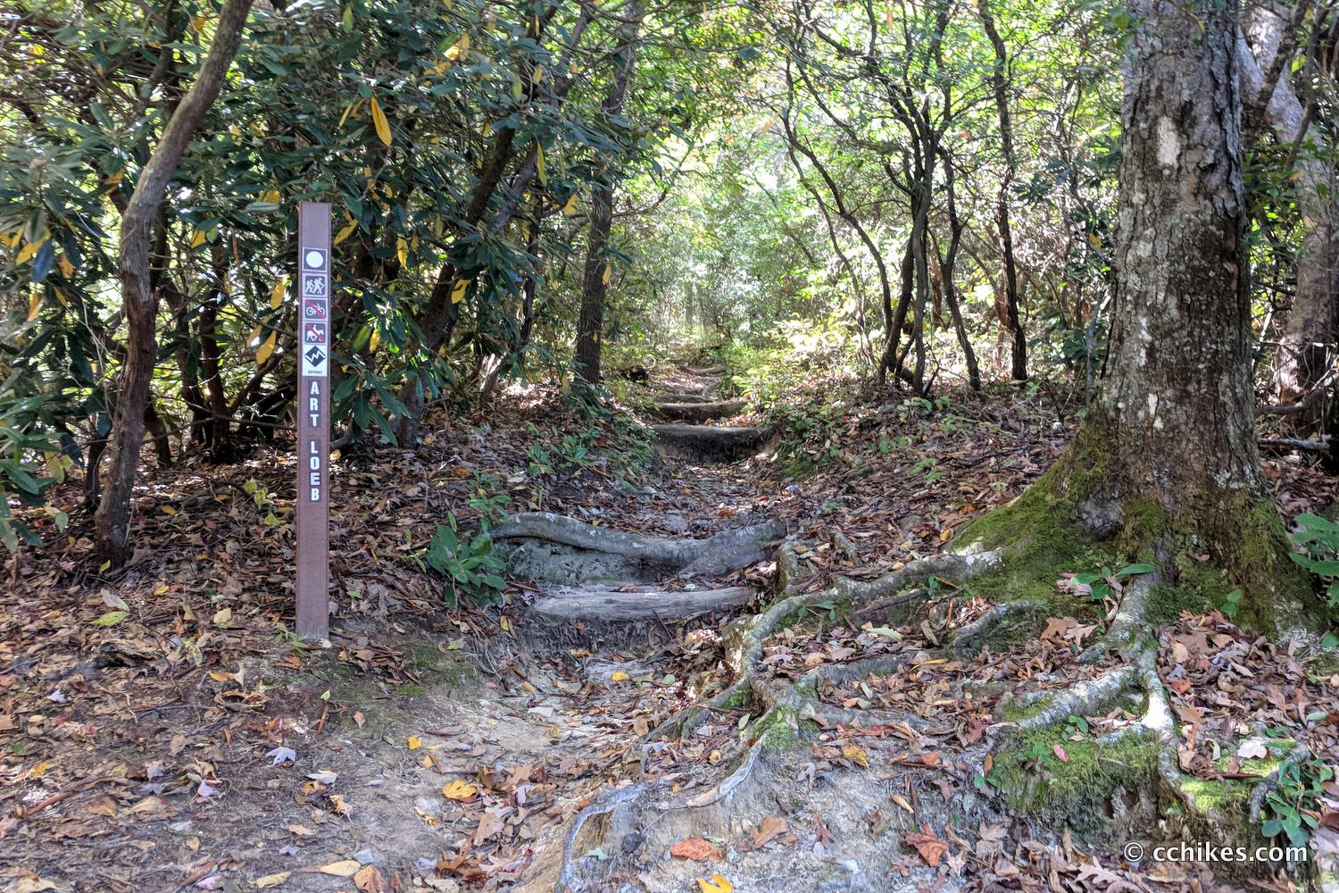
There’s an intersection with the Cat Gap Bypass trail that can be confusing. The bypass exists for people who want to do the Cat Gap loop but don’t want to climb up to Cat Gap. When you hit that intersection, you will veer left and uphill. This climb is the only strenuous section of the hike. Once at Cat Gap, take the white-blazed Art Loeb Trail straight uphill and eventually over Cedar Rock Mountain.
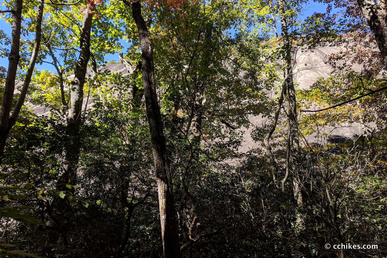
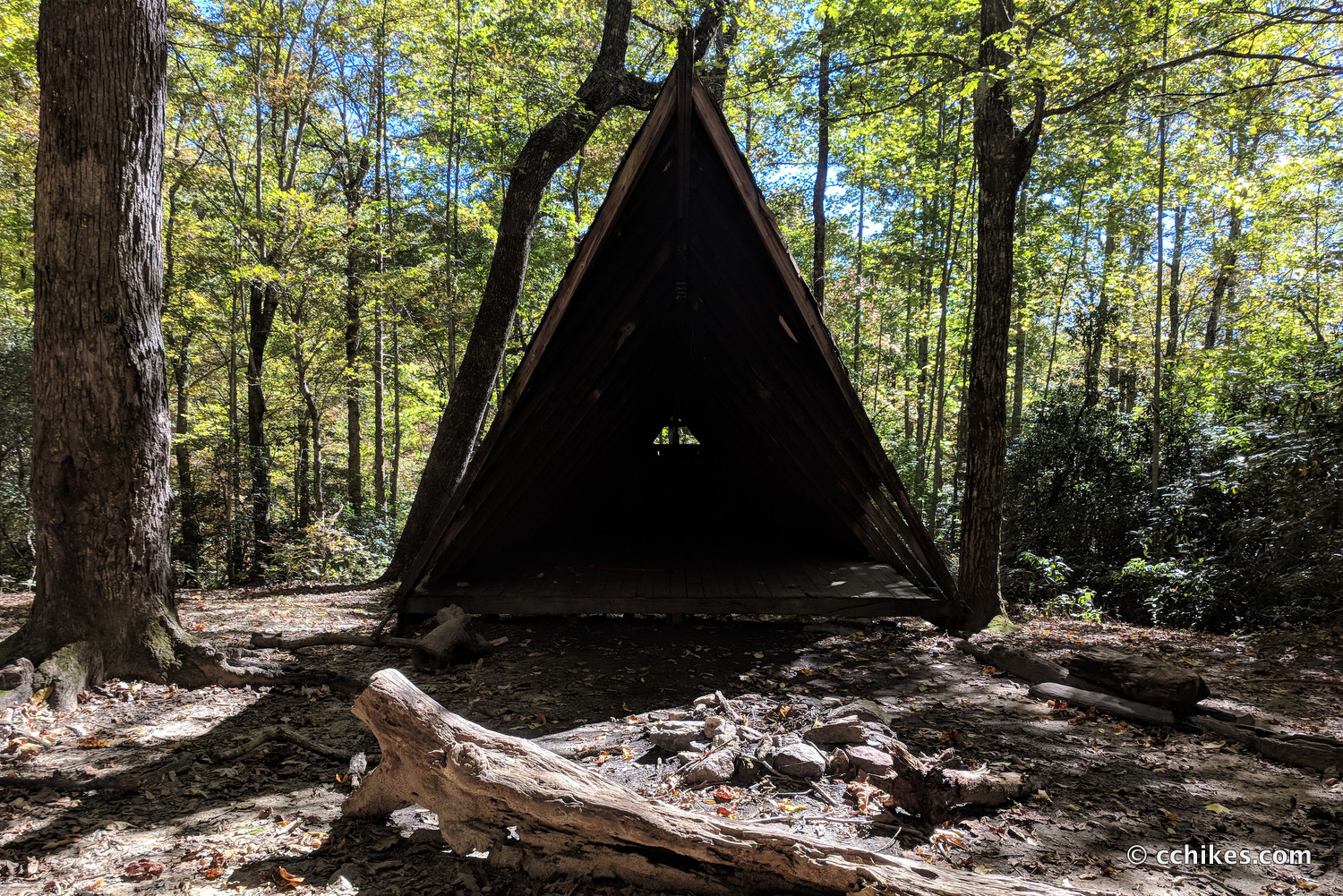
Once over the crest, you’ll walk past the bluffs and water becomes plentiful. You’ll eventually pop out of the woods at Butter Gap. You can’t miss the decrepit shelter. There’s a natural spring here in case the previous water sources were just mudholes, which can happen.
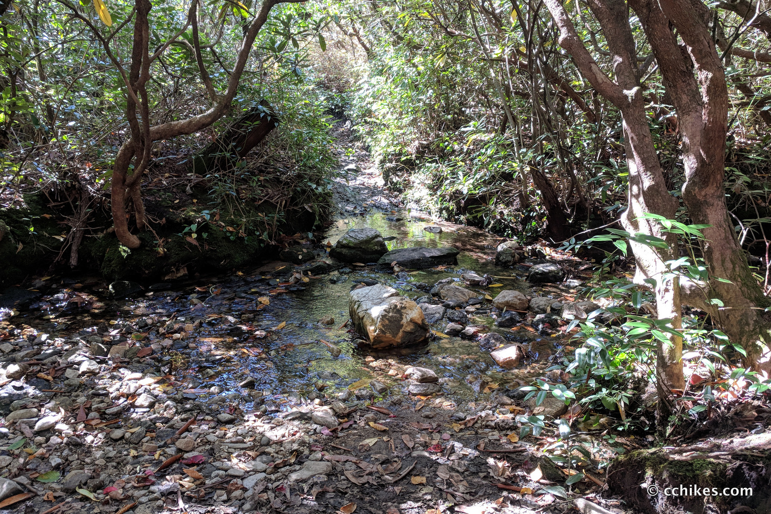
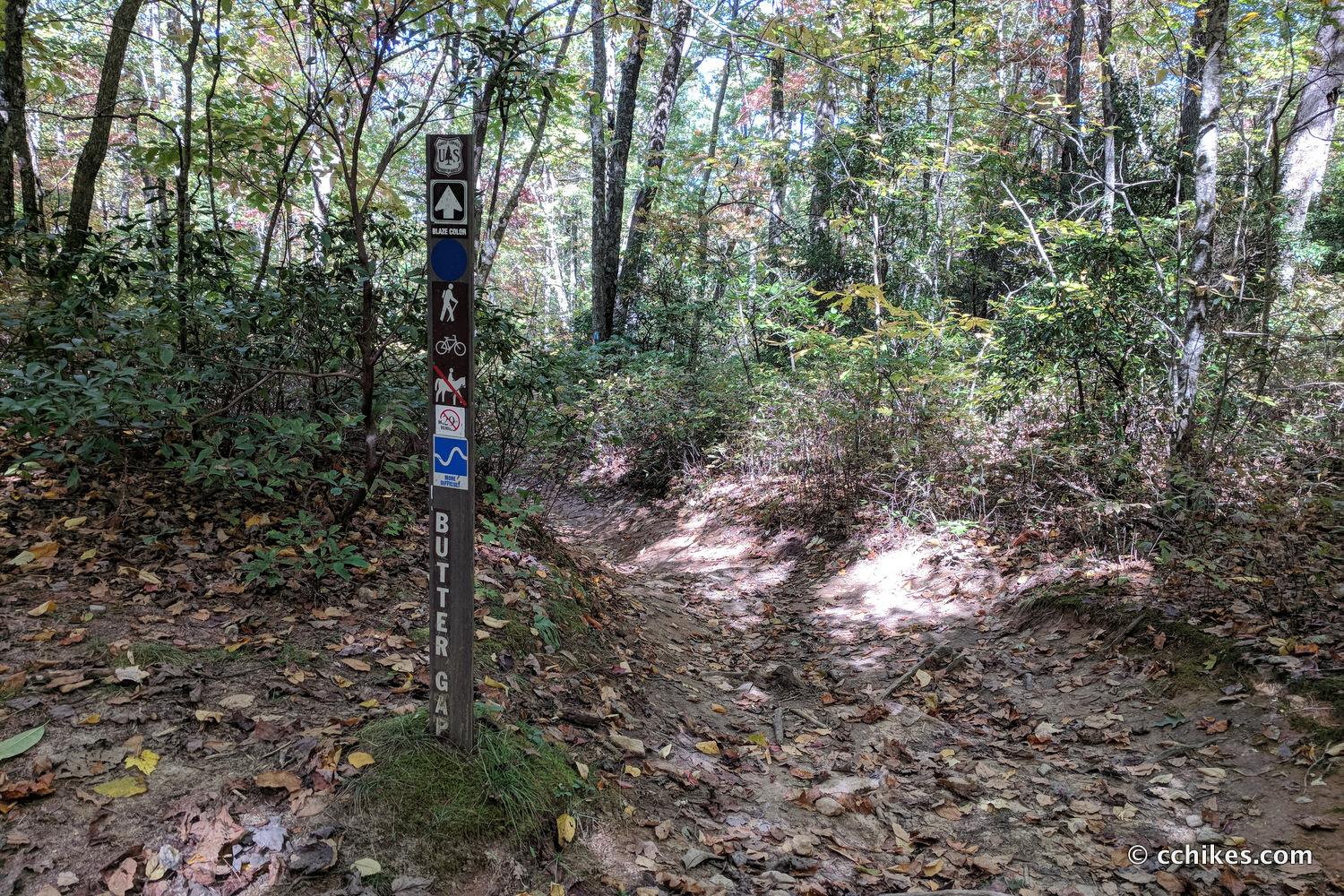
Stay on the Art Loeb Trail until the very confusing intersection with Butter Gap. There are forestry roads here and hiking/mountain biking trails. All of them intersect at this place. You will take the blue-blazed Butter Gap Trail that goes downhill on your right. This is a popular mountain biking trail, so keep an eye (and earphone) out for them. This trail mostly follows the creek and there are lots of great campsites.
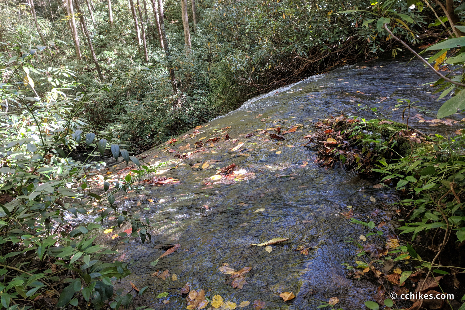
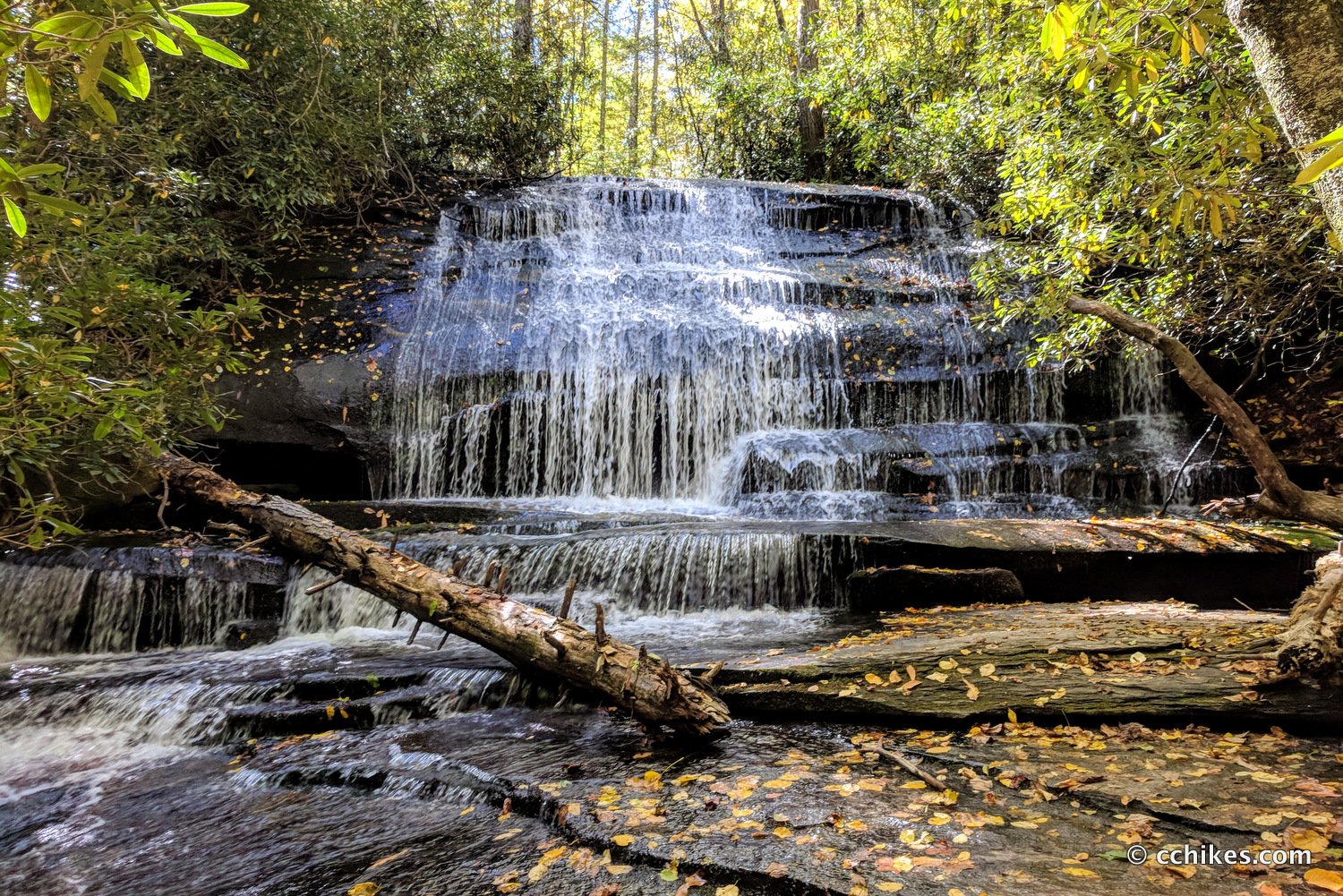
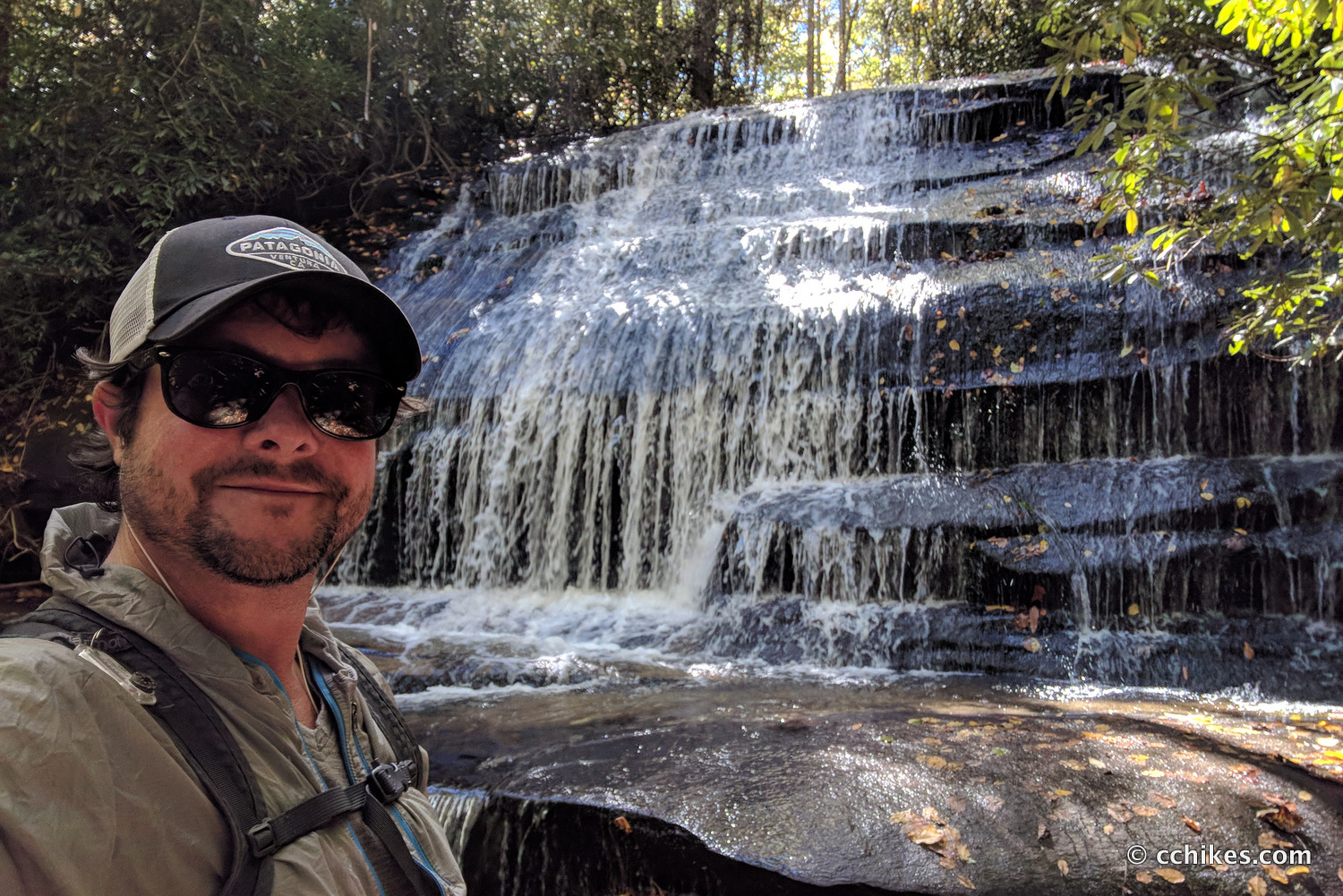
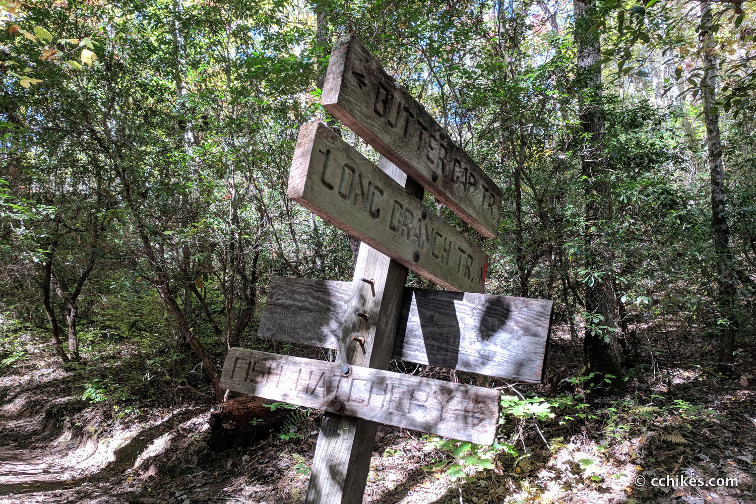
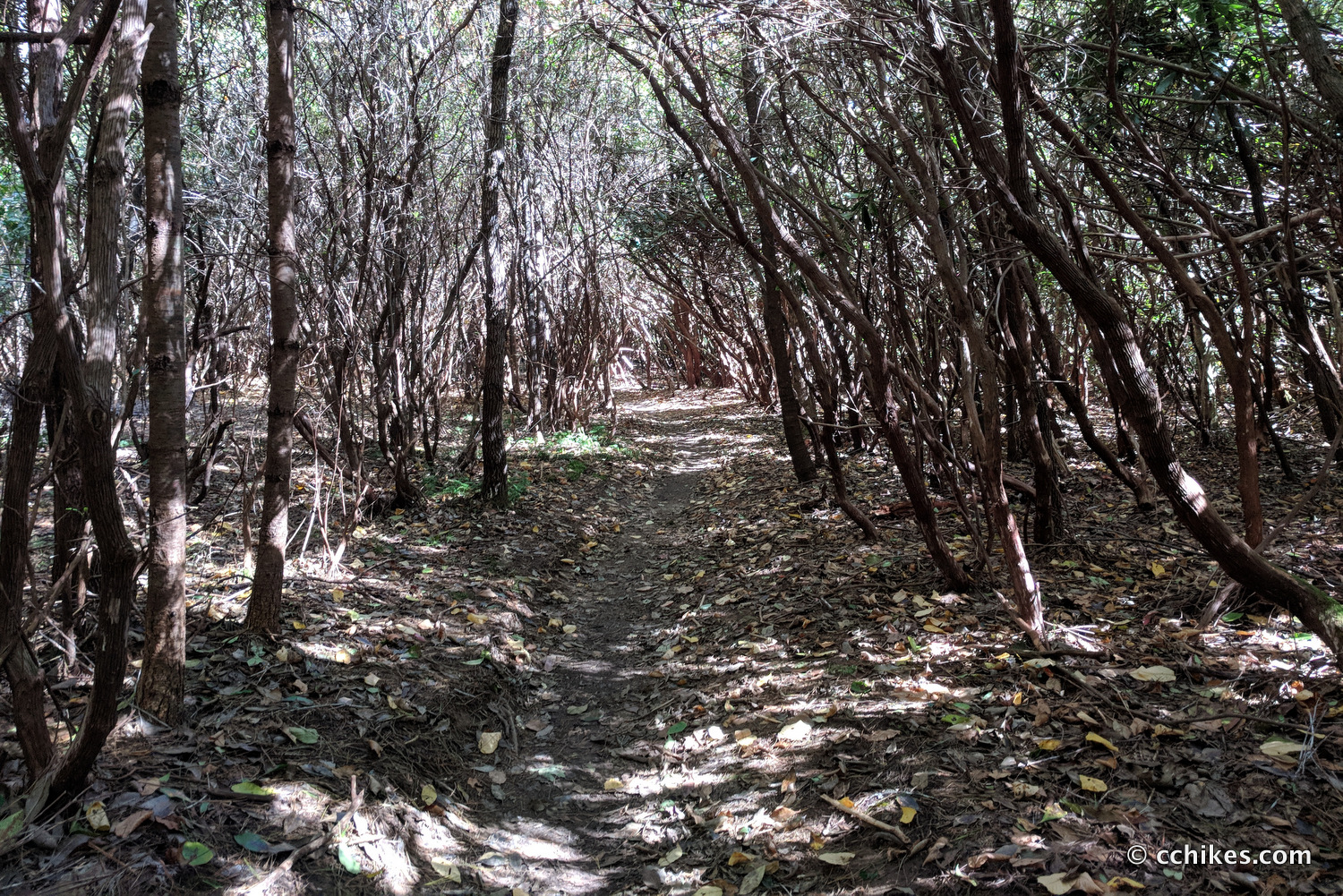
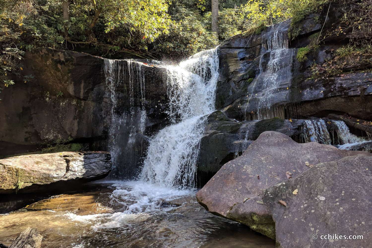
You’ll eventually come to an intersection with the Long Branch Trail. Ignore the sign that advertises the Fish Hatchery to the right. You will continue straight on the Butter Gap Trail. This part of the trail is beautiful with high grass, tunnels of rhododendron, and clear creek waters. You’ll hear Gorgon Creek Falls before you see it. You start at the top of the falls and have to hike down to the bottom of the 20-foot cascade. It’s picturesque.
You eventually intersect back at the Cat Gap Loop, but it’s not a part of the trail you’ve walked before. I know this sounds odd since you’ve been turning right all day, but you turn left here. Do not turn right. Do not cross the creek on the wooden bridge. Turn left.
After a little while, you should hear the upper cascade at Cedar Rock Falls. It’s down a scramble to a large, flat campsite adjacent to the water. The falls here aren’t that impressive, but it’s a fun detour. After that, you’ll hear and then see the 25-foot cascade at Cedar Rock Creek Falls. Keep your eyes open for a side trail on the right that leads down to the falls.
Hike back up to Cat Gap Loop and continue walking downhill. You’ll soon come to a gravel road. Walk straight across the road and follow the orange blazes. You’ll eventually come to yet another gravel road where you’ll turn left and cross the concrete bridge and walk back to your car.
Impressions
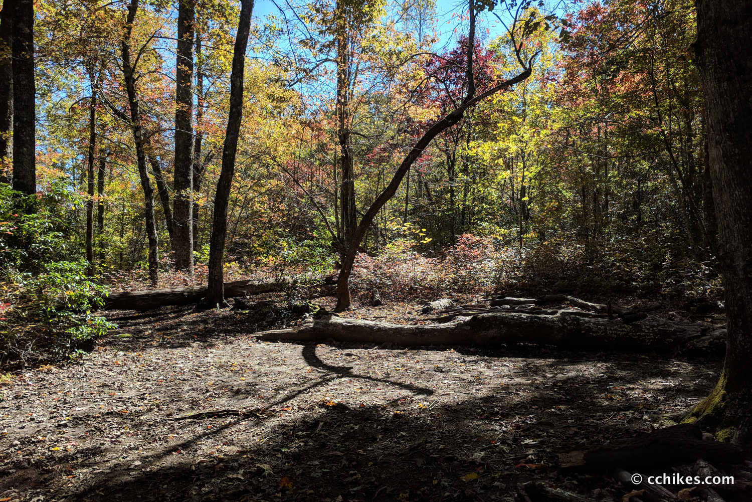
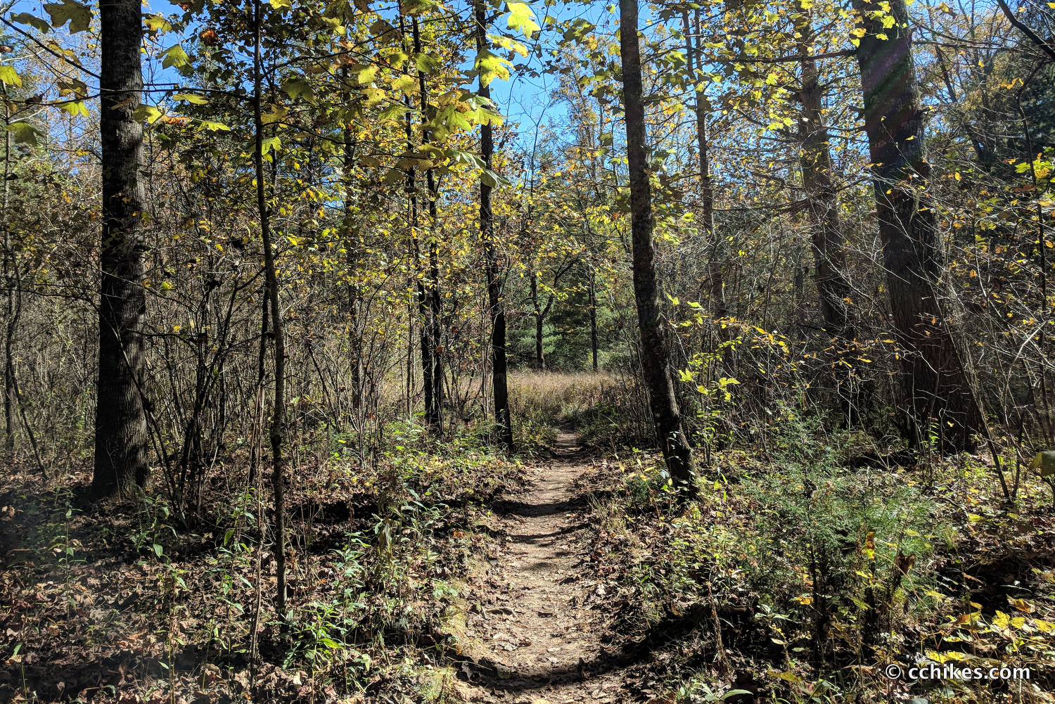
This is a beautiful hike, especially in late fall when the colors are changing. Much of the hike is on the Art Loeb Trail, which is designated for hikers only. So you don’t have to look over your shoulder for mountain bikes. The only reason I would consider doing this loop counter-clockwise would be if I wanted to tack John Rock on at the end. Then it would make sense.
I knocked this out in about 3 hours, but I was going for speed. I would budget a couple additional hours if I was hiking with someone else, or even with a dog.
This loop would make a great overnight trip since there are campsites everywhere. Just walk until you’re tired and find water. There’s bound to be an established campsite nearby.
I highly recommend that you bring some trekking poles on this loop. There’s a lot of downhill hiking where the poles will take the stress off your knees and ankles.
Navigate
More
Discover more loop hikes.
Discover more sections of the Art Loeb Trail.
Discover more North Carolina trails.
Discover more waterfalls.


Leave a Reply