


I spent most of January fighting off head and chest colds, so I wanted to get out in February and grind out some miles. I considered several trails, but the lack of car shuttling tipped the scales in favor of this loop that begins and ends at the Nantahala Outdoor Center (NOC).
People think that because I spend so much time hiking in the southeastern USA, I must be out on the Appalachian Trail (AT). And while I do use sections of the AT to piece together loop hikes in places like the Smoky Mountains, I generally find the AT to be too crowded for my liking. It can be like waiting in line for a ride at Disneyland, except there’s no ride. There’s just a line. If you don’t believe me, head up to Neel’s Gap or Max Patch on a summer Saturday. If I do any backpacking on the AT, I try to go in winter before the NOBO bubble starts to form in mid-March.
About the loop
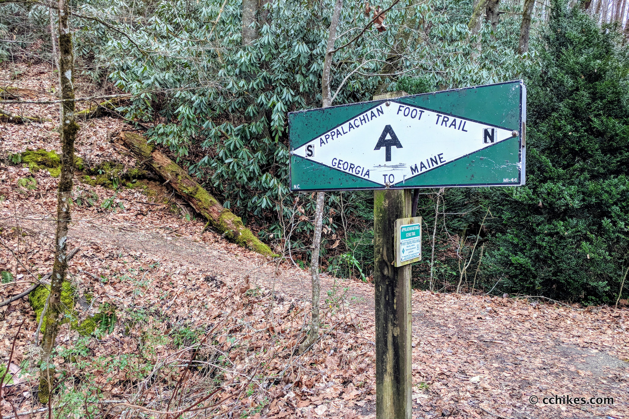
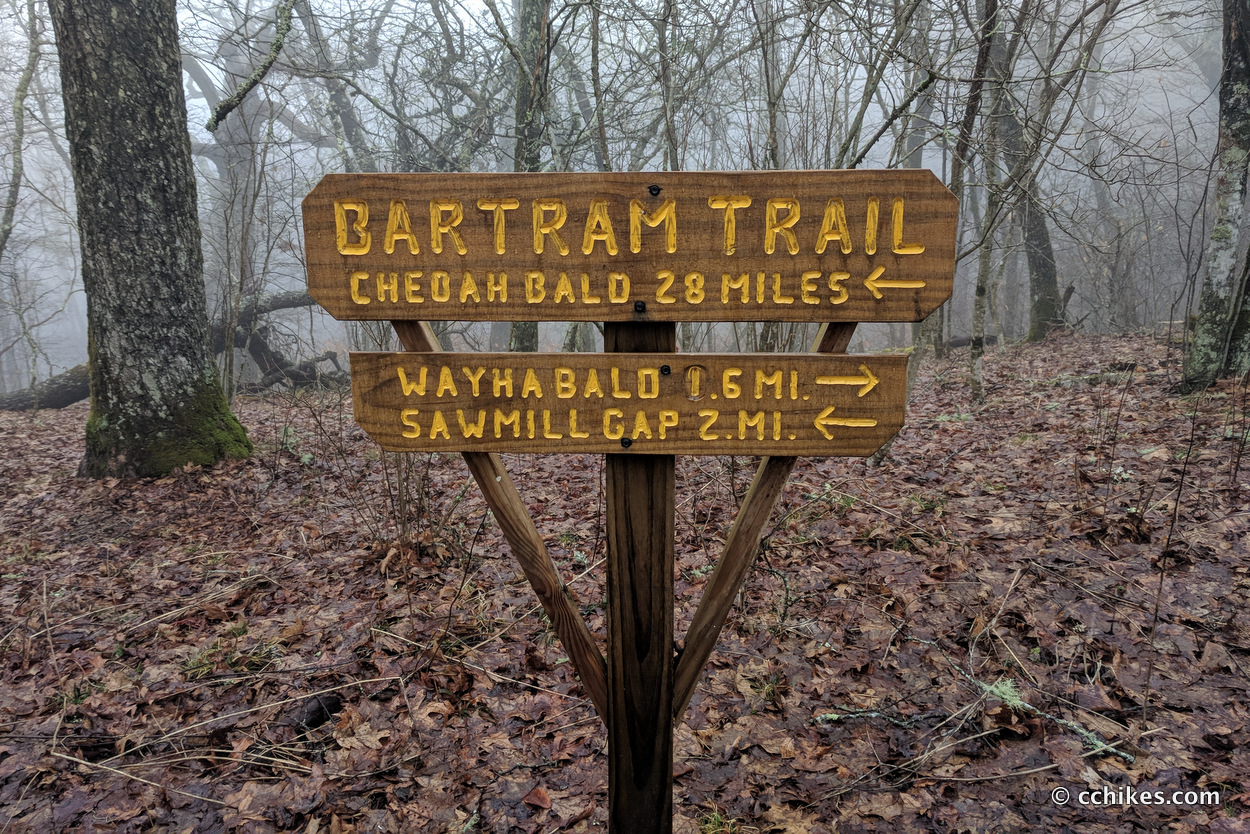
The Appalachian Trail and the Bartram Trail intersect twice—near Cheoah Bald in the north and Wayah Bald in the south—forming a 58-mile loop.
Although there are several places you could start and finish this loop, I think it makes the most sense to park at the NOC near Bryson City, NC. There’s an outfitter on the property as well as a restaurant (and lodging if you need it). Another upside to starting at the NOC is that you make the 3000-foot climb out of the Nantahala Gorge on fresh legs.
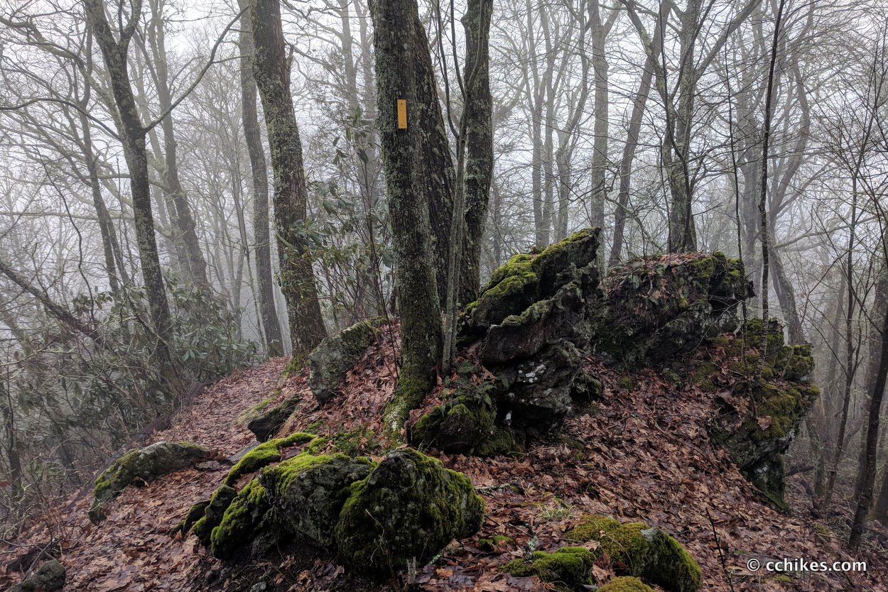
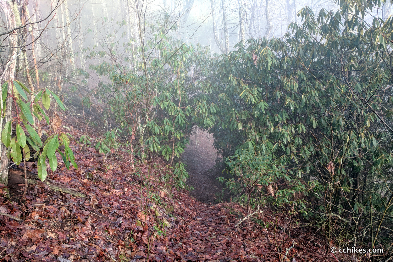
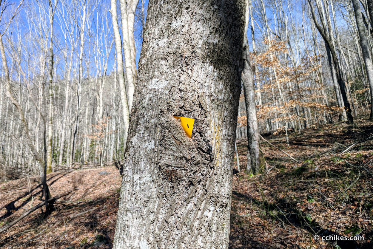
It’s almost impossible to get lost on the white-blazed AT, but the Bartram is another story. The Bartram Trail is little trafficked, overgrown in places, and can be confusing to navigate. Sections of it incorporate paved, gravel, and dirt roads, and it can be hard to find the yellow-blazed trailheads. I carried a paper map of Nantahala National Forest, but I almost exclusively used the GPS map on my smartphone to navigate.
If you’re planning to do this loop, I highly recommend that you download some sort of interactive map to your smartphone that will show you exactly where you are on—or off—the trail.
Orienteering
I relied on my own GPS map ↗ on my smartphone to track my progress on the trail. Many people don’t know this, but you don’t need an internet connection to ping GPS. It even works while your phone is in airplane mode. This GPS map showed me exactly where I was on the trail at all times. Feel free to copy this map or download the location data points and import them into your preferred GPS app. These step-by-step instructions will show you how to do that.
As you know, tech can malfunction, break, or run out of power. It’s prudent to take a contour map and a declination-correcting compass on your backpacking trips as well. This is the map and compass I used. The declination is -8° (west).
If you shop through any Amazon link on this website, you support me at no cost to yourself. Learn more in my disclosure.
![Nantahala and Cullasaja Gorges Map [Nantahala National Forest] (National Geographic Trails Illustrated Map, 785)](https://m.media-amazon.com/images/I/51gWpdEPcNL._SL160_.jpg)

Day 1 (12 miles)
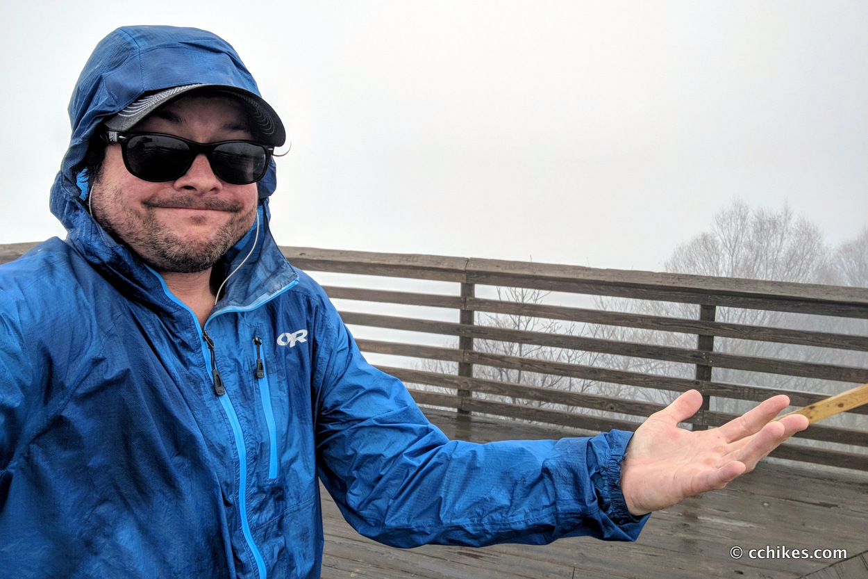
I intended to park at the NOC and start my hike at dawn. That would have given me three days of around 19 miles each. That didn’t work out. I ended up starting my hike SOBO on the AT at 11:30 a.m. The rain held off until I climbed out of the gorge and started walking the ridgeline of the mountains. This climb was not as bad as I thought it would be. Then again, I love walking on the backbone of a range. It reminded me of the Black Mountain Crest Trail in that I could look back and see the series of summits I had just climbed. Seeing your progress is very rewarding.
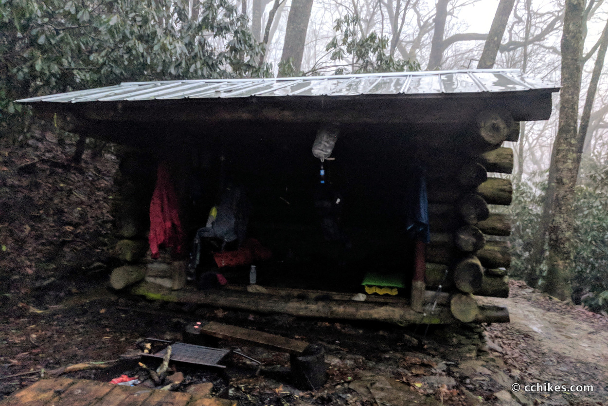
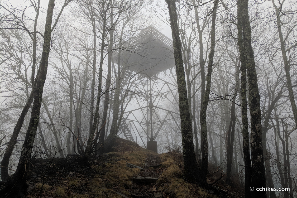
The rain brought a dense fog that ruined my views from the trail and the steel lookout tower. I walked until the sunlight was fading and stopped at Cold Spring Shelter, which is directly adjacent to the trail. The shelter is small and I was pleased to only find one other person there, an AT NOBO thru-hiker, nicknamed Copper Man. I hung my gear to dry, filtered water, and ate dinner. I almost never sleep in shelters because of the rodent problem, but I didn’t feel like pitching a tent in the downpour.
The cold weather forced us into our sleeping bags and we both fell asleep well before hiker midnight. We were joined by another AT NOBO thru-hiker nicknamed Chopsticks around 2:00 a.m. He was night-hiking and was leery of the coyotes that were howling. We made some room and he settled in for the rest of the night. The mice woke me up a few times scrambling against my sleeping pad, but thankfully they didn’t chew through any of my gear.
Day 2 (24 miles)
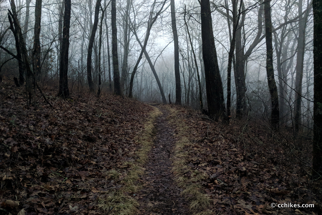
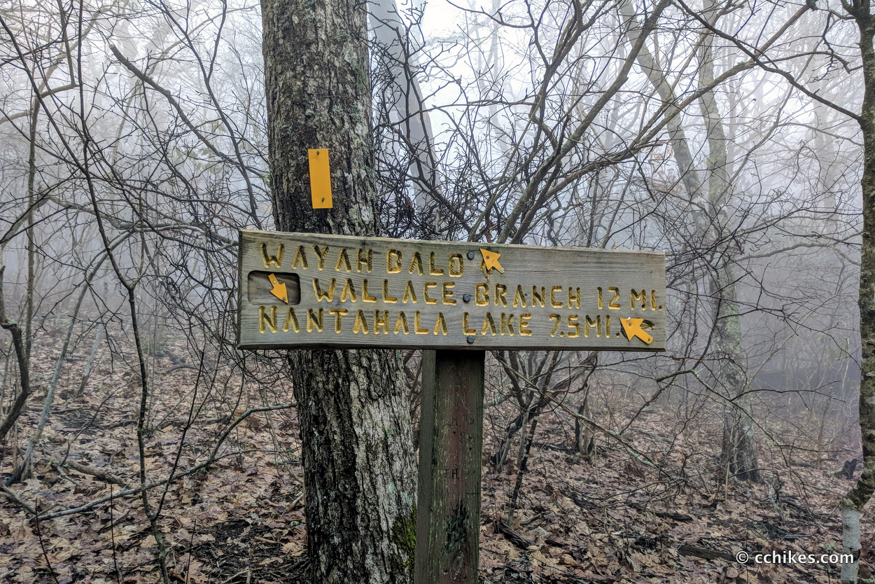
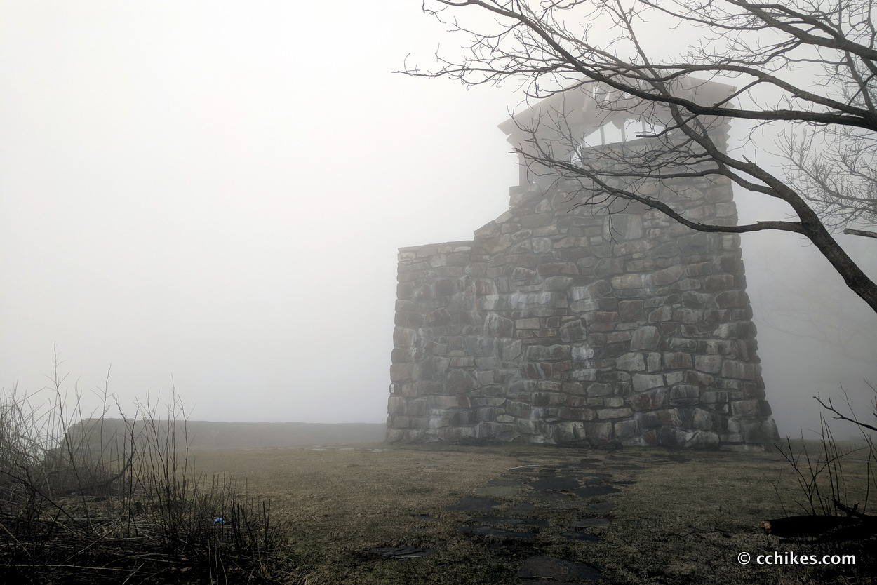
I’m guessing at the mileage here. I woke up at 5:30 a.m. and Chopsticks and I started packing up our gear. He went north and I went south. The walk to Wayah Bald was pretty easy. Again, the rain and fog ruined any views from the stone lookout tower there.
The AT and Bartram Trail line up for a little while on an absolutely unnecessary trail that parallels a paved footpath. If you’re a purist, take the trail. Otherwise, walk the road downhill until a side road on the right takes you to the trail junction. Take the Bartram Trail north and enjoy what I think is the best section of the entire loop.
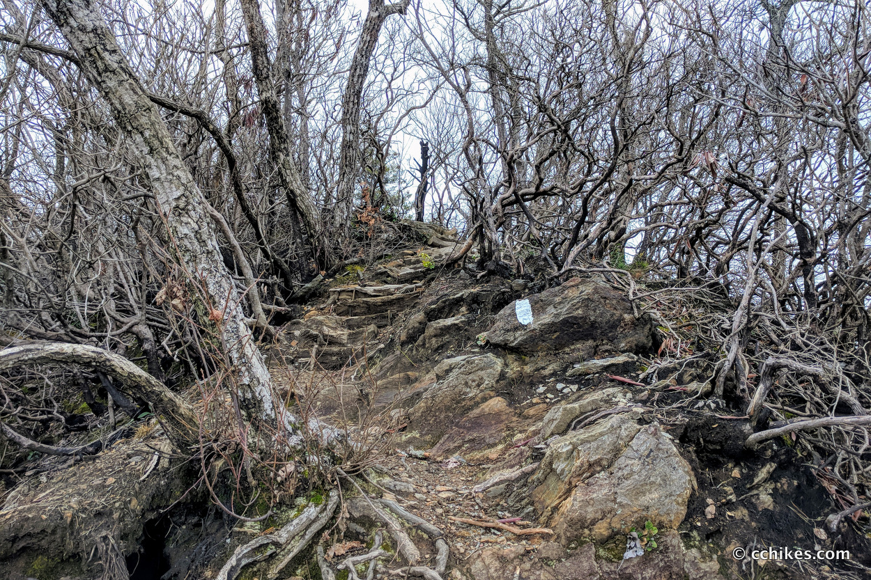
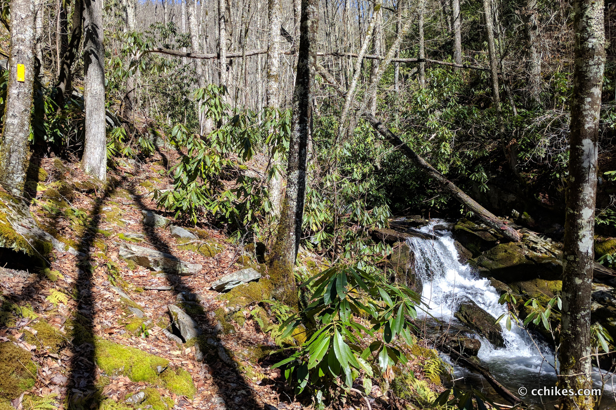
The trail descends over ridges and through unexpected grassy fields. It was challenging at times to stay on the trail, but that was part of the fun. There’s a gun range nearby and you hear a constant rat-a-tat-tat. It’s very banjo music if you know what I mean. Don’t hate; I’ve been to bluegrass festivals. Anyway, the pathway descends and crosses the road at Sawmill Gap and then climbs back up the mountain. The climb back up is on a gravel road and is pretty easy. The 3½-mile climb from the summit down to Fontana Lake was exhilarating. I was surprised at some of the scrambling involved to get down the rocky crags. I’d have no idea where the trail was taking me until I rounded the next turn. It was steep and slippery and so much fun.
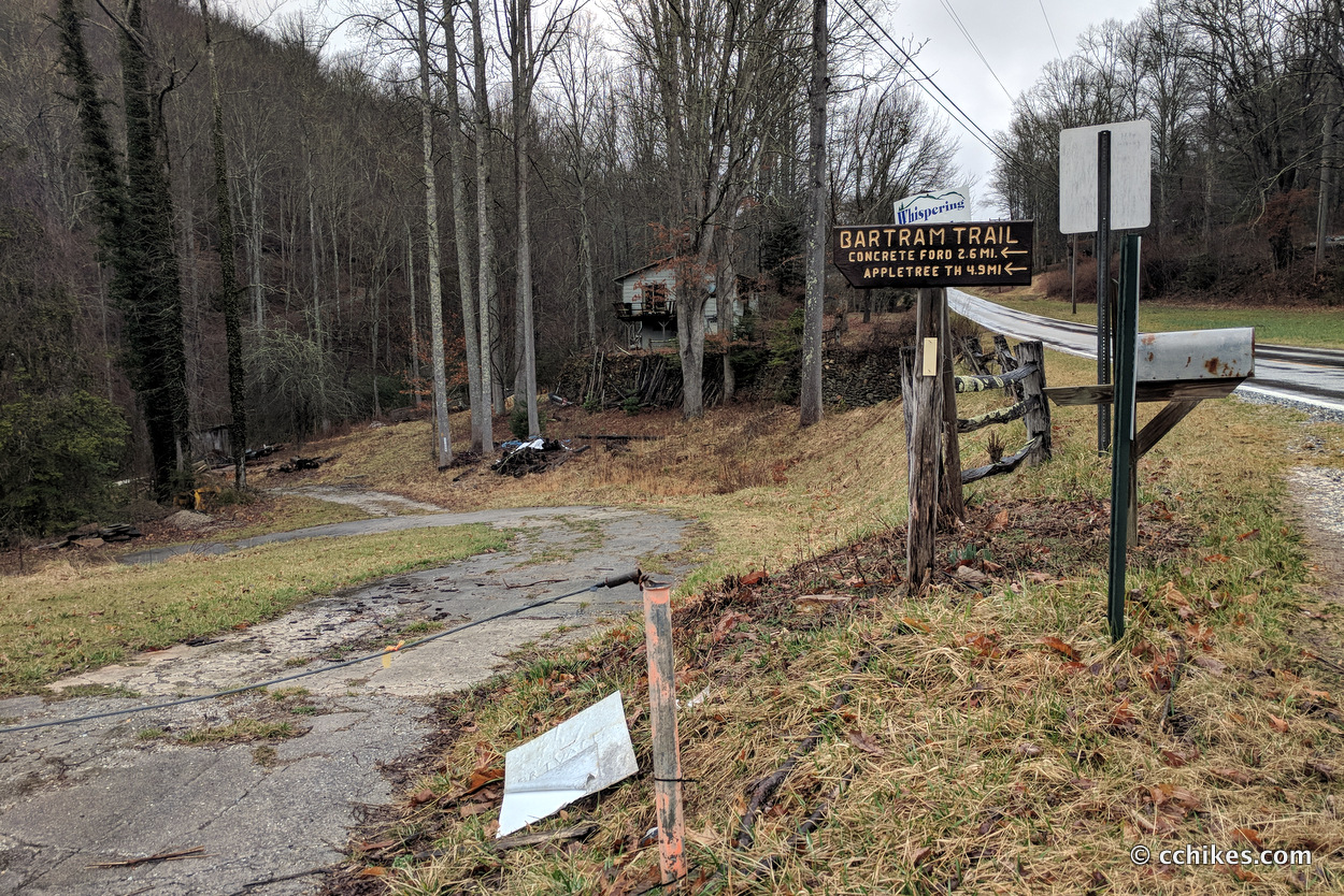
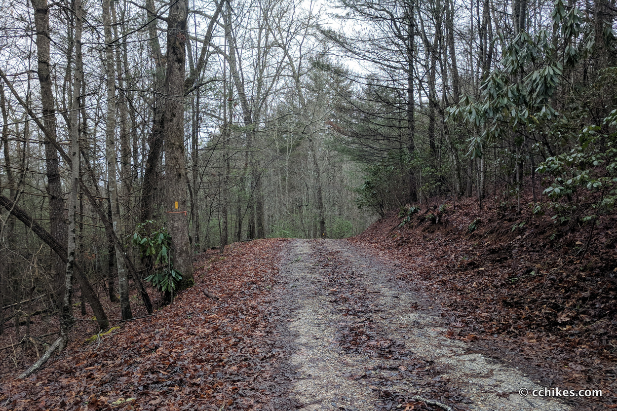
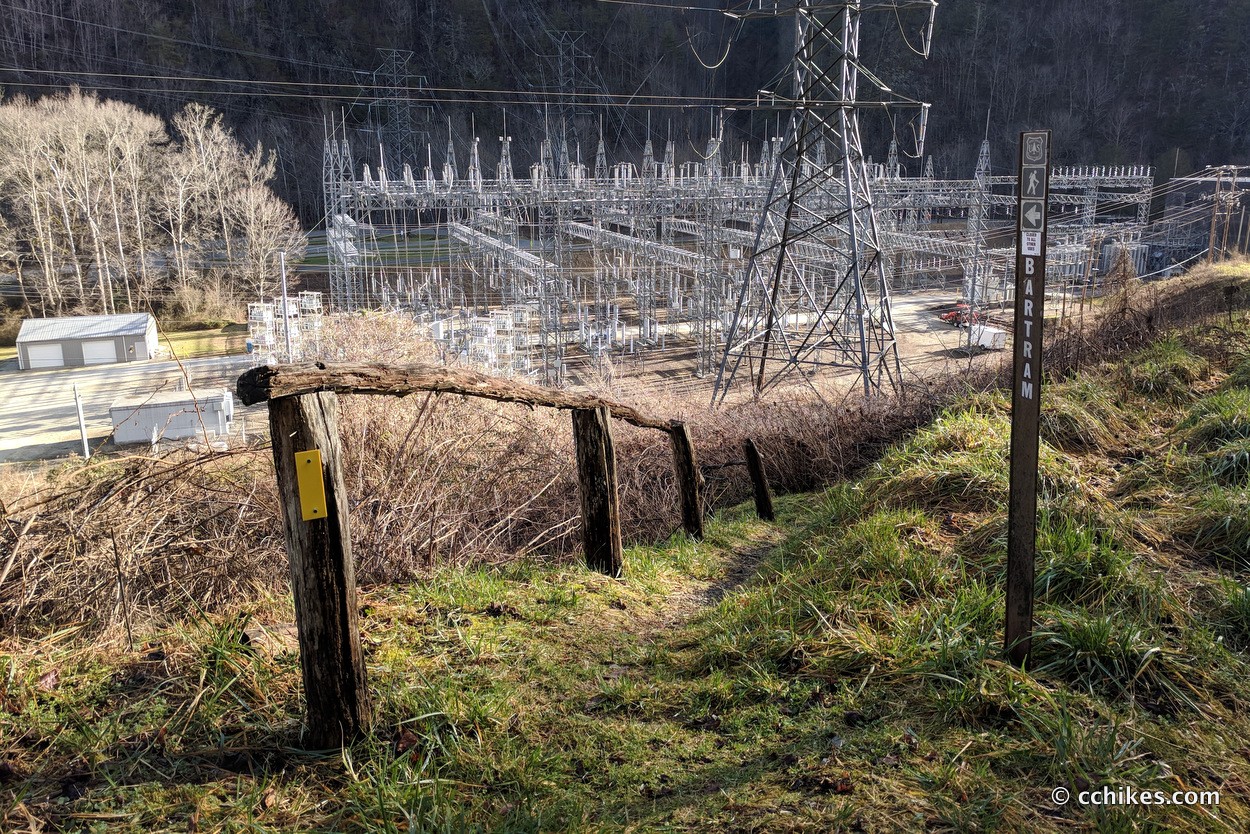
The trail spit me out on a road adjacent to Fontana Lake. I walked to the right and took a series of paved and gravel roads all the way to Appletree Group Camp. It can be hard to follow the trail in this section, but the blazes are there if you look for them. After entering Appletree, the Bartram Trail follows the river on a muddy, hilly footpath that is no fun at all. It’s basically the worst parts of the Chattooga Trail without any of the good parts. In warmer months, this must be swarming with biting insects. Bring bug spray.
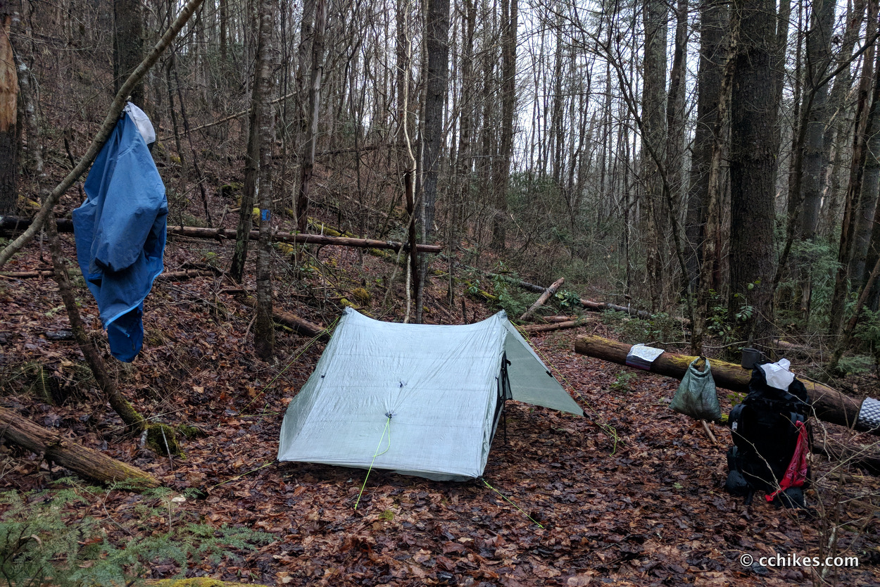
After the camp, the trail follows old forestry roads through the mountains. I should stress that there are no campsites between here and the water tower above the Nantahala River rafting/kayaking put-in on Highway 74. As darkness closed in on me, I managed to find a flat enough spot at the intersection of the Bartram and Piercy Creek Trails. I set up camp during a lull in the rain and managed to eat dinner before the raindrops started to fall again.
I got terrible sleep since I had to wipe away condensation constantly throughout the night to keep my sleeping quilt and other gear from getting wet. That’s a big downside to a single-walled tent. My morale was low at this point. I thought I’d have another day and half of this wet slog. Thankfully, that proved not to be the case.
Day 3 (22 miles)
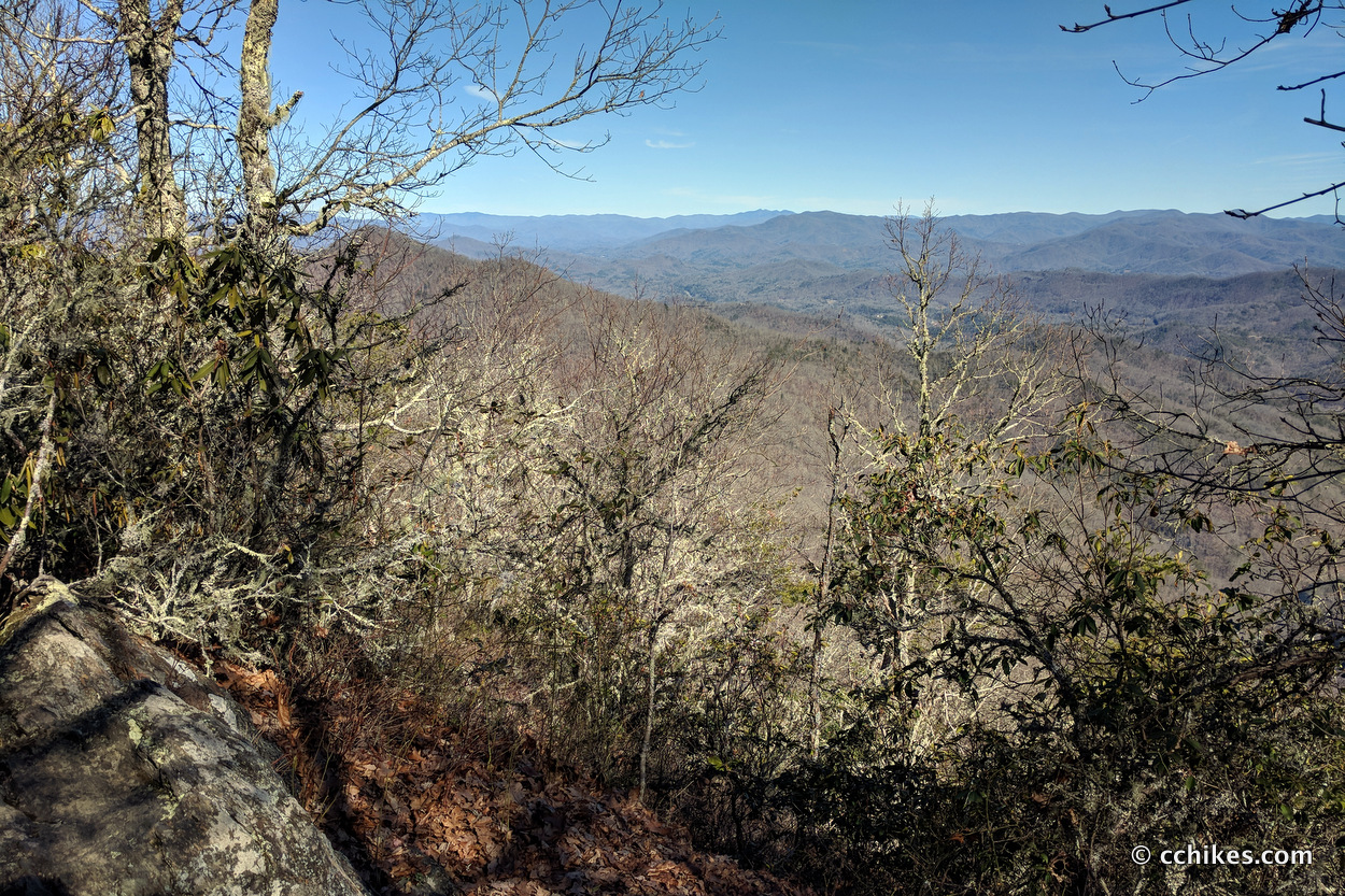
Again, I’m guessing at the mileage here. I woke up and broke camp and started hiking during a lull in the misty rain around 7:00 am. I had to walk up and over the mountain to get to the Nantahala River put-in. This section reminded me of the Pinnacle Pass & Rim Of The Gap Loop in northwest SC. Near the top of the mountain, I saw the sun for the first time in days. It was truly invigorating.
Most of the descent down the mountain was on a gravel road. I was hauling ass. I made it to the river put-in by around 9:30 am. It was at this point that I realized I might be able to finish my hike before sunset and grab a real, non-freeze-dried meal at the NOC. Food is a big motivator for me.
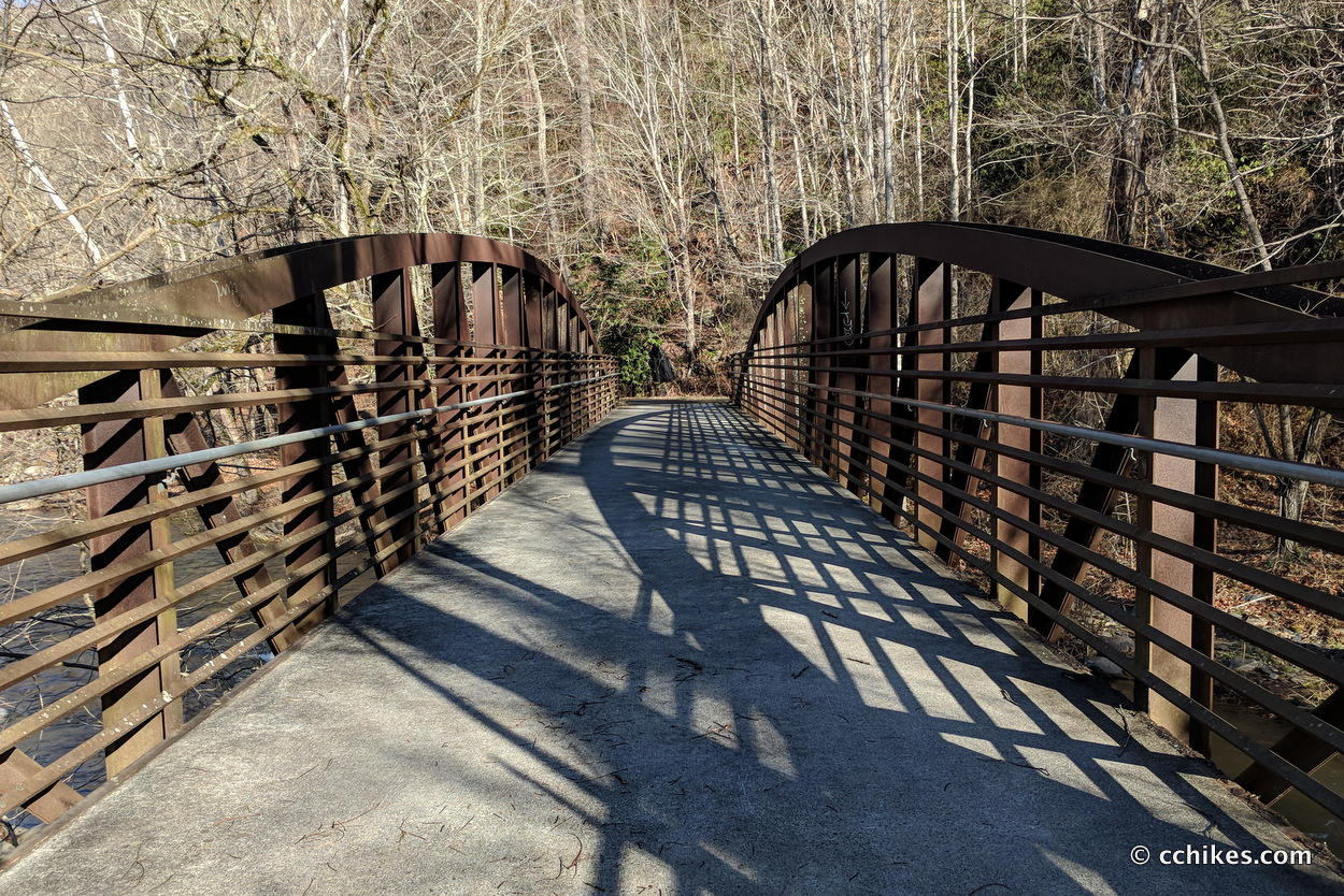
The walk from the put-in to the base of the mountain featured a paved footpath! You can imagine how fast I walked that section. This was the only time I encountered another person on the Bartram Trail and it was a jogger.
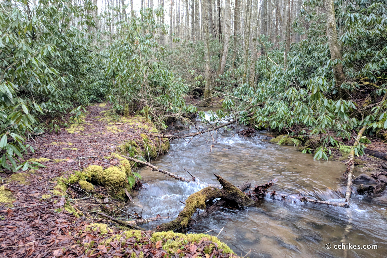
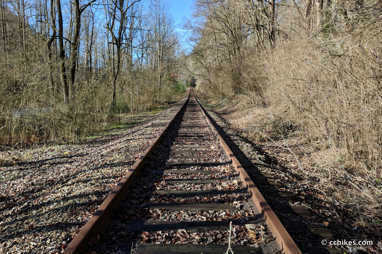
After that, I crossed the highway and the railroad tracks and started to climb the mountain. This section ascends 3000 feet in 5 miles. It is a brutal climb. I probably haven’t done this much climbing in one day since I went over Muir Pass on day 6 of my John Muir Trail thru-hike. The trail follows steep switchbacks up the mountain until it intersects with Ledbetter Creek. After that, it largely follows the creek to the intersection with the AT.
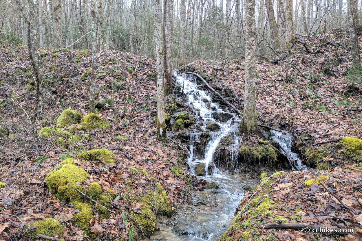
There are many creek crossings. I’m sure most of the crossings can be made atop rocks and logs during a dry season, but not after the steady rain I had just experienced. I resigned myself to having macerated feet for yet another day and just started fording straight through the creek beds. I’m guessing the big waterfall 3/4 of the way up the mountain was Bartram Falls, but I don’t know for sure.
After climbing above the creek, I crossed an old forestry road and was challenged with a still steeper trail to the summit. This was really tough, especially since I had already climbed up and over a mountain earlier in the day. I lost some of every step due to the slickness of the mud. It was like running up an escalator. As usual, I promised myself that I’d stop to eat lunch at the intersection of the Bartram Trail and the AT.
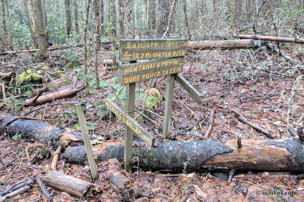
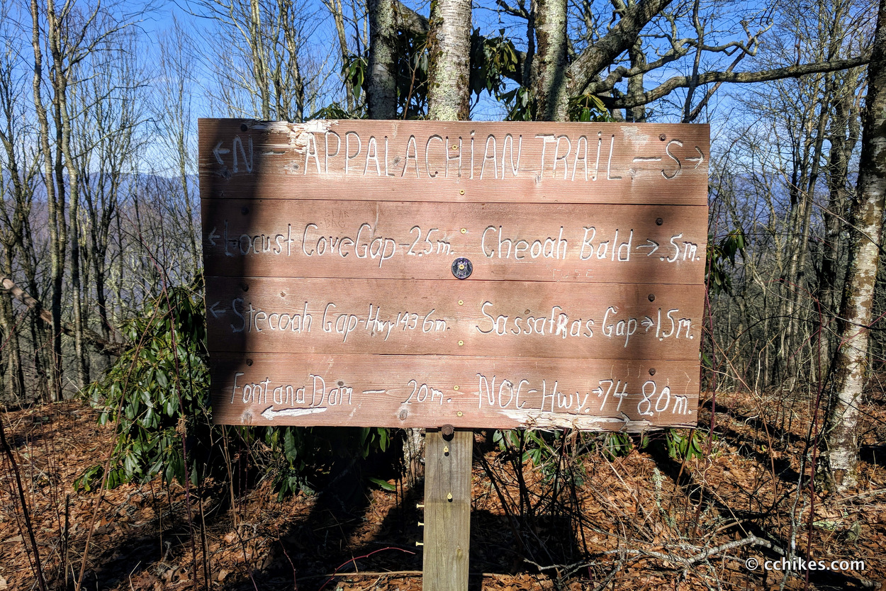
When I finally reached the trail junction, a sign informed me that I was only a half mile from Cheoah Bald. Better yet, I was only 8 miles from the NOC. I didn’t know my exact mileage along the Bartram Trail and thought I might have around 13 miles left. I strolled the half mile to Cheoah Bald and took a well-earned break.
It was 1:30 p.m. and I only had 7½ miles to go. I figured that instead of eating a big lunch of trail pizza I would burn through my snacks I’d packed just in case there was a morning of day 4. I pocketed my remaining jerky and cheese and started the trek down the mountain. I ate whenever there was a relatively flat stretch of trail.
My remaining hike was probably 80% downhill. The section from Cheoah Bald to Wright Gap was almost as brutal as the climb up the mountain had been. Thank goodness for my knee sleeves. As is sadly typical, I rolled my left ankle a few times on my way down the mountain. This is common when I’m descending fast after doing big miles.
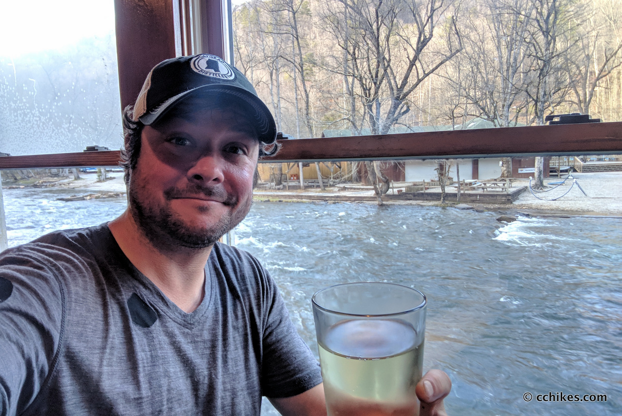
I popped out at the NOC around 4:15 p.m. and was very happy to throw my pack in the back of my car. Wet gear smells bad and I was pleased to part with it. I should note that I smelled pretty bad as well. I walked across the river to the restaurant and ordered a chili-cheeseburger and a beer.
Impressions
This hike was challenging and parts of it were a lot of fun. That said, I wouldn’t do it again. Most of the AT section was the standard, boring, green tunnel. Understand that I have easy access to the AT and have done these sections to death. It’s kind of like when you buy an album because of one song you like. You play that song so much that you eventually get sick of it and learn to appreciate and prefer the other, lesser-known songs. Well, the AT from Neel’s Gap to Clingman’s Dome is that overplayed song for me. I just don’t appreciate the majesty like I used to. The Bartram Trail involved more road walking than I imagined it would. I don’t necessarily dislike that. I’ll take a gentle grade over a steep, muddy trail most of the time. And it was very muddy.
I was soaking wet for the first two days. The fog and rain robbed me of any views and colored my experience in a negative way. I was so thoroughly dismayed by dawn on day three that I actually thought about hitching a ride from the Nantahala River up Highway 74 to the NOC. I’ve never entertained the idea of quitting before and I loathed myself for considering it.
I rotated two pairs of merino wool socks, but my feet were never close to dry. They were macerated and achy. My swollen socks made my trail runners fit tightly and rubbed blisters on the balls of my feet beneath my big toes. Prior to this trip, I hadn’t had a blister in over a year. I was wet and in pain and my efforts seemed to offer no rewards. By and large, I wasn’t having fun. Day 3 brought sunny skies and warmer temperatures. I’m not sure what spurred me more, the sunny weather or the fact that the end was in sight. Maybe a little bit of both.
It’s been a while since I hiked around the Smokies. I had forgotten just how taxing the climbs can be—both physically with the ascents and mentally with the false summits. My climb from the Nantahala River on day 3 was tough thanks to wet ground and achy feet. And the hike from Cheoah Bald down into the Nantahala Gorge was very hard on my knees. It’s the kind of descent that makes you pine for another uphill climb.
Advice
Like I said above, I wouldn’t hike this 58-mile loop again. There were a few sections that would make for a great day-hike or weekend trip. These were the high points, so to speak. The rest of the loop is mostly filler.
- Wayah Bald to Nantahala Lake (BT NOBO)—You could shorten this and start from Sawmill Gap, but I think it would be fun to start at the top of the mountain. Leave another car at Lake’s End Grill & Marina. The hike down the Bartram Trail toward the lake is riveting. Bring trekking poles.
- NOC to Wayah Bald (AT SOBO)—This is a great ridge trail that features lookout towers and shelters for group camping. You ascend and then stay on top of the range. You’d need to park a car at the NOC and another at Wayah Bald.
- NOC to Choeah Bald (AT SOBO) to the Nantahala River Put-In (BT NOBO)—This is absolutely brutal in both directions. You climb 3000 feet to Cheoah Bald. There are many campsites along the way plus more around the bald. Follow the AT NOBO for a half mile until it meets the northern terminus of the Bartram Trail. The climb down the mountain mostly follows Ledbetter Creek and crosses it many times. It’s as picturesque as it is unforgiving. You’d need to park a car at the NOC and another at either the Winding Stairs Trailhead or the Nantahala River put-in. The walk from the Winding Stairs Trailhead to the put-in is on a paved walkway that follows the river and passes an old homestead. You can choose to tag it on the end of your hike or not.
Navigate
Usually, I just include one map point to show you where to park. But since I’ve recommended breaking this loop into a few day or weekend hikes, I’m including several points to help you shuttle cars between the section trailheads. But if you’re planning to hike the loop the way I did, you need to navigate to the Nantahala Outdoor Center (NOC) to park your car.
More
Discover more loop hikes.
Discover more sections of the Appalachian Trail.


NOC Appalachian Trail and Bartram Trail Loop | PMags.com
[…] info: The CC Hikes website has a lot of info for this loop. I’ll just add that we did not find the navigation to be difficult at all on the Bartram […]
Chip
Hey man. I am planning on hit up this loop next week. I have been scouring the internet but for the life of me can not find mileages for the Bartram Trail. You don’t have any resources to help in planning this do you?
Chad Chandler
You can grab the KML points from this map. Use that to estimate the mileage. Import those points into whatever Trail GPS app you use. These step-by-step instructions will show you how to do that. This is very necessary. The Bartram Trail is not as well blazed as the AT and some of the road walking is confusing. If I had to venture a guess, I’d say that about 26 miles of the 58-mile loop are on the Bartram Trail. Best of luck with your hike!
Carol A Blaney
HEllo, any idea how to begin a search and rescue? my adult child chris left bryson city nov 9, 2019 with plans to go to Franklin, no phone. and was going to call me a week later. it’s been over 2 weeks. any ideas helpful. is there an on line network of hikers on the trail like there is for the ap trail?
Chad Chandler
I’m very sorry to hear this. Have you tried calling the Bryson City police non-emergency number? Even if they’re not the ones to help, they should be able to point you to the right authorities.
Bryson City Police Department
200 Main Street
Bryson City, NC 28713
Phone: (828)488-3050
Josh N
Chad, thanks for the write up and the good info on the loop. I just completed this loop in three days on 6/8/2020, but I went the opposite direction. Leaving NOBO from NOC and camping at Cheoah bald the first night made for excellent views in the morning. I think NOBO route has a couple of advantages: 1) less extreme climbs, 2) better spacing of improved campsites. I had a positive experience, but I had no rain either 😉